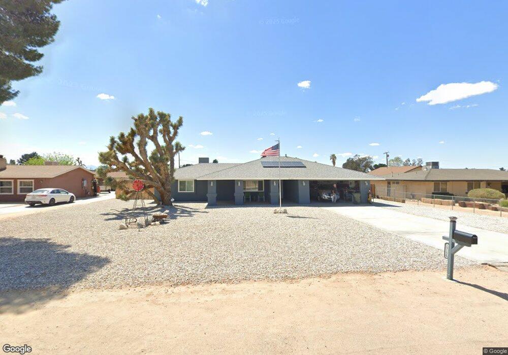
13130 Pocono Rd Apple Valley, CA 92308
High Desert NeighborhoodEstimated Value: $410,000 - $450,000
3
Beds
2
Baths
1,688
Sq Ft
$250/Sq Ft
Est. Value
About This Home
This home is located at 13130 Pocono Rd, Apple Valley, CA 92308 and is currently estimated at $422,640, approximately $250 per square foot. 13130 Pocono Rd is a home located in San Bernardino County with nearby schools including Sitting Bull Academy and Apple Valley High School.
Ownership History
Date
Name
Owned For
Owner Type
Purchase Details
Closed on
Jun 5, 2014
Sold by
Becker Dean O
Bought by
Melanson Robert Edward and Melanson Joyue Elena
Current Estimated Value
Home Financials for this Owner
Home Financials are based on the most recent Mortgage that was taken out on this home.
Original Mortgage
$186,558
Interest Rate
4.25%
Mortgage Type
FHA
Purchase Details
Closed on
Jul 22, 1997
Sold by
Vance Roy J
Bought by
Tatum Margaret P
Create a Home Valuation Report for This Property
The Home Valuation Report is an in-depth analysis detailing your home's value as well as a comparison with similar homes in the area
Home Values in the Area
Average Home Value in this Area
Purchase History
| Date | Buyer | Sale Price | Title Company |
|---|---|---|---|
| Melanson Robert Edward | $190,000 | First American Title Company | |
| Tatum Margaret P | -- | -- |
Source: Public Records
Mortgage History
| Date | Status | Borrower | Loan Amount |
|---|---|---|---|
| Previous Owner | Melanson Robert Edward | $186,558 |
Source: Public Records
Tax History
| Year | Tax Paid | Tax Assessment Tax Assessment Total Assessment is a certain percentage of the fair market value that is determined by local assessors to be the total taxable value of land and additions on the property. | Land | Improvement |
|---|---|---|---|---|
| 2025 | $2,715 | $228,354 | $45,673 | $182,681 |
| 2024 | $2,639 | $223,876 | $44,777 | $179,099 |
| 2023 | $2,615 | $219,486 | $43,899 | $175,587 |
| 2022 | $2,501 | $215,182 | $43,038 | $172,144 |
| 2021 | $2,443 | $210,963 | $42,194 | $168,769 |
| 2020 | $2,412 | $208,799 | $41,761 | $167,038 |
| 2019 | $2,366 | $204,705 | $40,942 | $163,763 |
| 2018 | $3,438 | $200,691 | $40,139 | $160,552 |
| 2017 | $3,364 | $196,756 | $39,352 | $157,404 |
| 2016 | $3,237 | $192,898 | $38,580 | $154,318 |
| 2015 | $3,213 | $190,000 | $38,000 | $152,000 |
| 2014 | $1,743 | $153,806 | $31,232 | $122,574 |
Source: Public Records
Map
Nearby Homes
- 13099 Pocono Rd
- 13206 Winona Rd
- 20357 Ituma Rd
- 20578 Nisqually Rd
- 12902 Casco Rd
- 20726 Nisqually Rd
- 20190 Osseo Rd
- 12790 Patoka Ct
- 20136 Ottawa Rd
- 13564 Seminole Rd
- 0 Matawan Rd
- 0 Shawnee Rd Unit HD25098149
- 21011 Ponca Rd
- 20585 Yucca Loma Rd
- 20276 Itasca Rd
- 12574 Sarsi Ct
- 12850 Lakota Rd
- 2222 Ottawa Rd
- 19978 Eyota Rd
- 12563 Sarsi Ct
- 13146 Pocono Rd
- 13116 Pocono Rd
- 13160 Pocono Rd
- 13143 Quapaw Rd
- 13098 Pocono Rd
- 13123 Pocono Rd
- 13121 Quapaw Rd
- 13163 Quapaw Rd
- 13101 Quapaw Rd
- 13174 Pocono Rd
- 13093 Pocono Rd
- 20565 Winona Rd
- 13084 Pocono Rd
- 13085 Pocono Rd
- 13156 Winona Rd
- 13194 Pocono Rd
- 13185 Quapaw Rd
- 13079 Quapaw Rd
- 13157 Winona Rd
- 20448 Osseo Rd
Your Personal Tour Guide
Ask me questions while you tour the home.