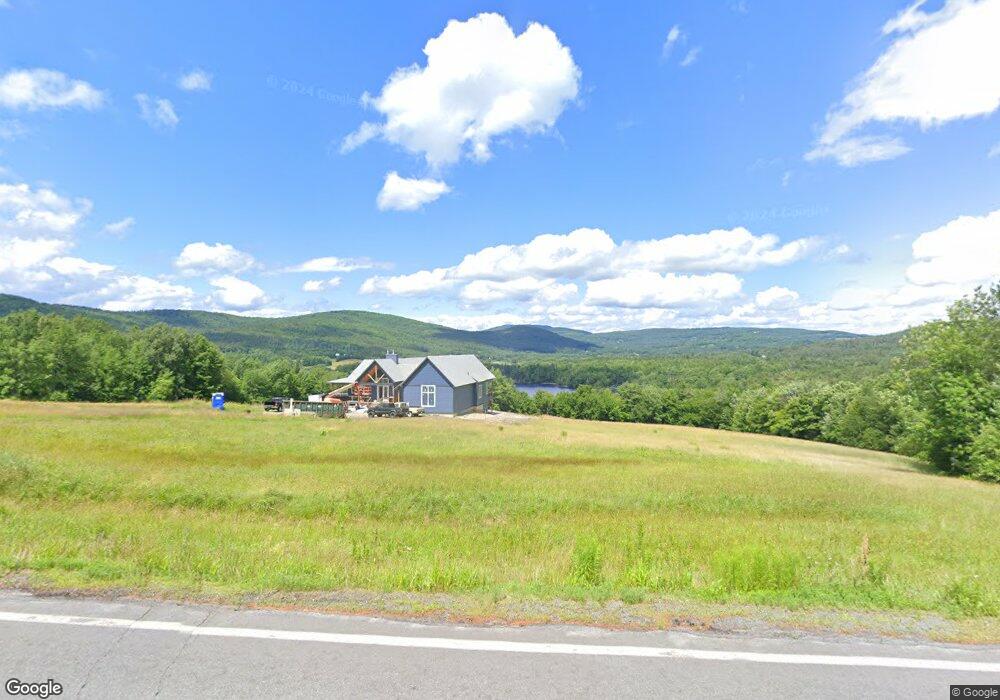
1314 Monroe Rd Littleton, NH 03561
Estimated Value: $680,591 - $796,000
3
Beds
3
Baths
2,912
Sq Ft
$245/Sq Ft
Est. Value
About This Home
This home is located at 1314 Monroe Rd, Littleton, NH 03561 and is currently estimated at $713,398, approximately $244 per square foot. 1314 Monroe Rd is a home located in Grafton County with nearby schools including Mildred C. Lakeway School.
Ownership History
Date
Name
Owned For
Owner Type
Purchase Details
Closed on
May 13, 2010
Sold by
Claussen Michael E and Breen-Classen Beverly
Bought by
Meyer John H and Meyer Martha R
Current Estimated Value
Home Financials for this Owner
Home Financials are based on the most recent Mortgage that was taken out on this home.
Original Mortgage
$320,000
Interest Rate
5.11%
Mortgage Type
Purchase Money Mortgage
Create a Home Valuation Report for This Property
The Home Valuation Report is an in-depth analysis detailing your home's value as well as a comparison with similar homes in the area
Home Values in the Area
Average Home Value in this Area
Purchase History
| Date | Buyer | Sale Price | Title Company |
|---|---|---|---|
| Meyer John H | $400,000 | -- |
Source: Public Records
Mortgage History
| Date | Status | Borrower | Loan Amount |
|---|---|---|---|
| Open | Meyer John H | $320,000 | |
| Closed | Meyer John H | $320,000 | |
| Previous Owner | Meyer John H | $100,000 |
Source: Public Records
Tax History Compared to Growth
Tax History
| Year | Tax Paid | Tax Assessment Tax Assessment Total Assessment is a certain percentage of the fair market value that is determined by local assessors to be the total taxable value of land and additions on the property. | Land | Improvement |
|---|---|---|---|---|
| 2024 | $9,141 | $366,510 | $44,310 | $322,200 |
| 2023 | $8,261 | $366,510 | $44,310 | $322,200 |
| 2022 | $8,462 | $366,960 | $44,760 | $322,200 |
| 2021 | $8,393 | $363,970 | $41,770 | $322,200 |
| 2020 | $7,880 | $363,970 | $41,770 | $322,200 |
| 2019 | $7,941 | $343,770 | $37,870 | $305,900 |
| 2018 | $7,635 | $343,720 | $37,820 | $305,900 |
| 2017 | $7,557 | $292,680 | $32,380 | $260,300 |
| 2016 | $7,413 | $286,110 | $32,610 | $253,500 |
| 2015 | $5,653 | $242,400 | $31,700 | $210,700 |
| 2014 | $5,381 | $242,400 | $31,700 | $210,700 |
| 2013 | $5,458 | $243,000 | $31,800 | $211,200 |
Source: Public Records
Map
Nearby Homes
- 1950-1952 Monroe Rd
- Lot 6 N Skinny Ridge Rd
- 205 Hurd Hill Rd
- 1615 Saint Johnsbury Rd
- 35 Langway Rd
- 1247 High Ridge Rd
- 128 Valley View Rd
- 104 Glebe Rd
- 10 Harvest Ct
- 48 Wetherbee Rd
- 3314 Route 18
- 921 Old Waterford Rd
- 0 Denio Rd Unit 5059200
- 0 Denio Rd Unit 5059211
- 0 Denio Rd Unit 5059215
- 0 Denio Rd Unit 24587948
- 0 Denio Rd
- 0 Denio Rd Unit 5059206
- 0 Denio Rd Unit 24587953
- - Denio Rd
- 1218 Monroe Rd
- 1226 Monroe Rd
- 1411 Monroe Rd
- 1227 Monroe Rd Unit 1229
- 1178 Monroe Rd
- 1317 Monroe Rd
- 1174 Monroe Rd
- 1566 Monroe Rd
- 1172 Monroe Rd
- 1680 Monroe Rd
- 00 Monroe Rd
- 0 Monroe Rd
- Lot 5 Monroe Rd
- 1568 Monroe Rd
- lot 4 & 10 Monroe Rd
- 1579 Monroe Rd
- 1581 Monroe Rd
- 101 N Skinny Ridge Rd
- Route 135 Lot 28-12 & 29-1
- 109 Shana Ln