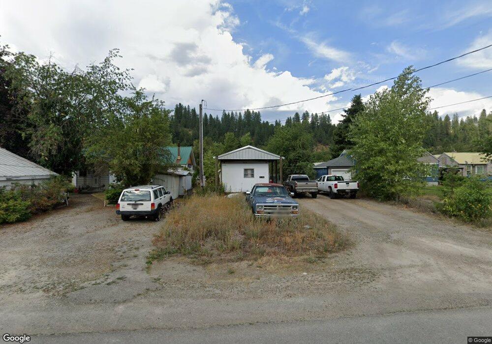
1314 W Polaris Ave Osburn, ID 83849
Estimated Value: $71,581 - $367,000
--
Bed
--
Bath
--
Sq Ft
7,013
Sq Ft Lot
About This Home
This home is located at 1314 W Polaris Ave, Osburn, ID 83849 and is currently estimated at $225,895. 1314 W Polaris Ave is a home with nearby schools including Silver Hills Elementary School and Wallace Junior/Senior High School.
Ownership History
Date
Name
Owned For
Owner Type
Purchase Details
Closed on
Feb 18, 2020
Sold by
Pickolick Kevin
Bought by
Reid Danielle
Current Estimated Value
Purchase Details
Closed on
Jun 11, 2019
Sold by
County Of Shoshone
Bought by
Pickolick Kevin
Purchase Details
Closed on
Jul 24, 2018
Sold by
Kirk Ernest E
Bought by
Shosone County
Purchase Details
Closed on
Dec 17, 2013
Sold by
Kirk Ernest E
Bought by
Sanders Clifford Kirk
Create a Home Valuation Report for This Property
The Home Valuation Report is an in-depth analysis detailing your home's value as well as a comparison with similar homes in the area
Home Values in the Area
Average Home Value in this Area
Purchase History
| Date | Buyer | Sale Price | Title Company |
|---|---|---|---|
| Reid Danielle | -- | None Available | |
| Pickolick Kevin | -- | None Available | |
| Shosone County | -- | None Available | |
| Sanders Clifford Kirk | $2,000 | None Available |
Source: Public Records
Tax History Compared to Growth
Tax History
| Year | Tax Paid | Tax Assessment Tax Assessment Total Assessment is a certain percentage of the fair market value that is determined by local assessors to be the total taxable value of land and additions on the property. | Land | Improvement |
|---|---|---|---|---|
| 2025 | $339 | $39,264 | $27,885 | $11,379 |
| 2024 | $339 | $39,264 | $27,885 | $11,379 |
| 2023 | $339 | $35,013 | $25,190 | $9,823 |
| 2022 | $376 | $33,975 | $24,152 | $9,823 |
| 2021 | $418 | $25,622 | $21,032 | $4,590 |
| 2020 | $406 | $24,082 | $19,492 | $4,590 |
| 2019 | $420 | $21,861 | $18,491 | $3,370 |
| 2018 | $1,164 | $20,190 | $16,810 | $3,380 |
| 2017 | $1,117 | $20,190 | $16,810 | $3,380 |
| 2016 | $1,017 | $20,360 | $16,810 | $3,550 |
| 2015 | -- | $20,070 | $16,810 | $3,260 |
| 2014 | -- | $20,069 | $16,809 | $3,260 |
Source: Public Records
Map
Nearby Homes
- 712 W Yellowstone Ave
- 0 Cameron Dr Unit 25-1685
- 225 Rio Vista St
- 235 Rio Vista St
- Lot 2B Upper Dr
- 905 Terror Gulch Rd
- 315 W Yellowstone Ave
- 511 E Idaho Ave
- 807 E Garden Ave
- 3 Polaris Peak Rd
- 1 Polaris Peak Rd
- 2 Polaris Peak Rd
- 1154 E Larch Ave
- 67 Nuchols Gulch Rd
- NNA County Club Rd
- 86 E Circle Dr
- 930 Moon Gulch Rd
- 1068 Moon Gulch Rd
- 104 Ninth St
- 99 Sather Field Rd
- 1316 Polaris Ave
- 1310 Polaris Ave
- 1321 Frontage Rd
- 1306 Polaris Ave
- 1307 Frontage
- 1307 Frontage Unit 3
- 1307 Frontage
- 1320 W Yellowstone Ave
- 1320 W Yellowstone Ave
- 1402 Polaris Ave
- 108 Buchanan St
- 12686 N Sunflower Loop
- NKA Polaris Ave
- 1314 W Yellowstone Ave
- 208 Buchanan St
- 1302 Polaris
- 1402 Yellowstone Ave
- 1216 Polaris Ave
- 1410 W Yellowstone Ave
- 1224 W Yellowstone Ave