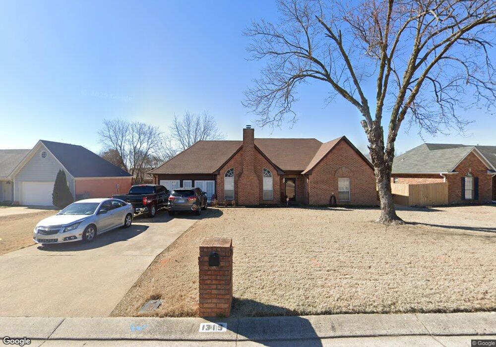
1315 Custer Dr E Southaven, MS 38671
Estimated Value: $190,661 - $246,000
3
Beds
--
Bath
1,822
Sq Ft
$125/Sq Ft
Est. Value
About This Home
This home is located at 1315 Custer Dr E, Southaven, MS 38671 and is currently estimated at $228,165, approximately $125 per square foot. 1315 Custer Dr E is a home located in DeSoto County with nearby schools including Southaven Elementary School, Southaven Middle School, and Southaven High School.
Ownership History
Date
Name
Owned For
Owner Type
Purchase Details
Closed on
Jan 18, 2019
Sold by
Patrick William
Bought by
Webb Stanfort and Webb Elizabeth
Current Estimated Value
Purchase Details
Closed on
Feb 27, 2009
Sold by
Roberts Kenneth G
Bought by
Webb Stanfort and Webb Elizabeth W
Home Financials for this Owner
Home Financials are based on the most recent Mortgage that was taken out on this home.
Original Mortgage
$111,000
Interest Rate
5.1%
Mortgage Type
Seller Take Back
Create a Home Valuation Report for This Property
The Home Valuation Report is an in-depth analysis detailing your home's value as well as a comparison with similar homes in the area
Home Values in the Area
Average Home Value in this Area
Purchase History
| Date | Buyer | Sale Price | Title Company |
|---|---|---|---|
| Webb Stanfort | -- | None Available | |
| Patrick William | $1,200 | None Available | |
| Webb Stanfort | -- | None Available |
Source: Public Records
Mortgage History
| Date | Status | Borrower | Loan Amount |
|---|---|---|---|
| Previous Owner | Webb Stanfort | $111,000 |
Source: Public Records
Tax History
| Year | Tax Paid | Tax Assessment Tax Assessment Total Assessment is a certain percentage of the fair market value that is determined by local assessors to be the total taxable value of land and additions on the property. | Land | Improvement |
|---|---|---|---|---|
| 2025 | $617 | $10,056 | $1,750 | $8,306 |
| 2024 | $736 | $10,056 | $1,750 | $8,306 |
| 2023 | $736 | $10,056 | $0 | $0 |
| 2022 | $720 | $10,056 | $1,750 | $8,306 |
| 2021 | $720 | $10,056 | $1,750 | $8,306 |
| 2020 | $370 | $10,056 | $1,750 | $8,306 |
| 2019 | $720 | $10,056 | $1,750 | $8,306 |
| 2017 | $1,100 | $17,794 | $9,772 | $8,022 |
| 2016 | $1,100 | $9,911 | $1,750 | $8,161 |
| 2015 | $1,412 | $18,072 | $9,911 | $8,161 |
| 2014 | $1,119 | $9,911 | $0 | $0 |
| 2013 | $2,125 | $14,866 | $0 | $0 |
Source: Public Records
Map
Nearby Homes
- 1366 Carriage View Ln
- 7881 Chesterfield Dr S
- 1099 Rasco Rd W
- 7764 Auburn Cove
- 1591 Brookhaven Dr
- 1596 Hickory Dr
- 1645 Hickory Dr
- 7594 Cherry Valley Blvd
- 718 Cumberland Cove
- 1687 Whitehead Dr
- 1884 Conerly Dr S
- 2097 Custer Dr
- 7984 Charleston Dr
- 1818 Whitehead Dr
- 1242 Brandywine Dr
- 1383 Ranger Dr
- 2081 Carrolton Dr
- 8131 Oakbrook Dr
- 7752 Charleston Dr
- 8718 Carriage Cove
- 1301 Custer Dr E
- 1331 Custer Dr E
- 1336 Annesdale Dr
- 1287 Custer Dr E
- 1322 Annesdale Dr
- 1345 Custer Dr E
- 1350 Annesdale Dr
- 1308 Custer Dr E
- 1322 Custer Dr E
- 7746 Annesdale Dr
- 1275 Custer Dr E
- 1361 Custer Dr E
- 7808 Idlebrook Cove
- 1332 Custer Dr E
- 1364 Annesdale Dr
- 1344 Custer Dr E
- 7835 Idlebrook Cove
- 1265 Custer Dr E
- 1352 Custer Dr E
- 7738 Annesdale Dr
Your Personal Tour Guide
Ask me questions while you tour the home.