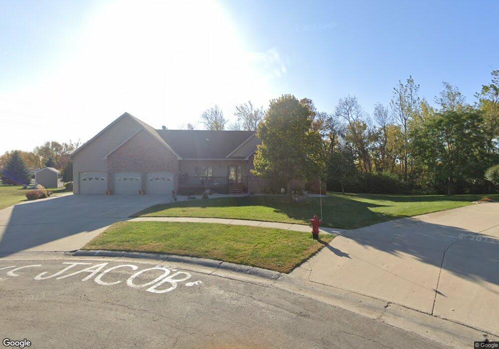
1315 Pheasant Run Cir Brookings, SD 57006
Estimated Value: $480,000 - $653,000
4
Beds
3
Baths
4,048
Sq Ft
$148/Sq Ft
Est. Value
About This Home
This home is located at 1315 Pheasant Run Cir, Brookings, SD 57006 and is currently estimated at $597,546, approximately $147 per square foot. 1315 Pheasant Run Cir is a home located in Brookings County with nearby schools including Brookings High School and St Thomas More Catholic School.
Ownership History
Date
Name
Owned For
Owner Type
Purchase Details
Closed on
Aug 22, 2012
Sold by
Cochrane Mark A and Cochrane Claudia V
Bought by
York Kelly R and York Kari Jo
Current Estimated Value
Home Financials for this Owner
Home Financials are based on the most recent Mortgage that was taken out on this home.
Original Mortgage
$248,000
Outstanding Balance
$170,260
Interest Rate
3.48%
Estimated Equity
$427,286
Create a Home Valuation Report for This Property
The Home Valuation Report is an in-depth analysis detailing your home's value as well as a comparison with similar homes in the area
Home Values in the Area
Average Home Value in this Area
Purchase History
| Date | Buyer | Sale Price | Title Company |
|---|---|---|---|
| York Kelly R | -- | -- |
Source: Public Records
Mortgage History
| Date | Status | Borrower | Loan Amount |
|---|---|---|---|
| Open | York Kelly R | $248,000 |
Source: Public Records
Tax History
| Year | Tax Paid | Tax Assessment Tax Assessment Total Assessment is a certain percentage of the fair market value that is determined by local assessors to be the total taxable value of land and additions on the property. | Land | Improvement |
|---|---|---|---|---|
| 2025 | $7,466 | $557,400 | $52,400 | $505,000 |
| 2024 | $7,426 | $518,900 | $52,400 | $466,500 |
| 2023 | $6,983 | $482,200 | $52,400 | $429,800 |
| 2022 | $6,595 | $442,300 | $52,400 | $389,900 |
| 2021 | $6,461 | $442,300 | $52,400 | $389,900 |
| 2020 | $5,583 | $368,200 | $52,400 | $315,800 |
| 2019 | $5,449 | $368,200 | $52,400 | $315,800 |
| 2018 | $5,480 | $368,200 | $52,400 | $315,800 |
| 2017 | $5,373 | $357,600 | $41,800 | $315,800 |
| 2016 | $5,251 | $343,300 | $41,800 | $301,500 |
| 2010 | -- | $327,200 | $0 | $0 |
Source: Public Records
Map
Nearby Homes
- 1023 16th St S
- 1008 16th St S
- 808 Sunflower Rd
- 723 Leprechaun Cir
- 521 12th St S Unit 75
- 1401 Windermere Way
- 1407 Sheridan Cir
- 1507 Sequoia Ct
- L3, B7 Prairie Hills Addition
- 821 Goldenrod Trail
- 725 Sunflower Rd
- TBD,TBD Hunter's Ridge Addition
- 720 Sunflower Rd
- 722 Sunflower Rd
- 1311 Sawgrass Dr
- 1529 Steamboat Trail
- 2323 Sweetgrass Dr
- 300 Medary Ave S Unit 90
- 1907 Council Ridge Rd
- 1804 Half Moon Rd S
- 1311 Pheasant Run Cir
- 1316 Pheasant Run Cir
- 901 15th St S Unit 1011
- 901 15th St S Unit 1010
- 901 15th St S Unit 1009
- 901 15th St S Unit 1007
- 901 15th St S Unit 1006
- 901 15th St S Unit 1005
- 901 15th St S Unit 1004
- 901 15th St S Unit 1003
- 901 15th St S Unit 1002
- 901 15th St S Unit 1001
- 1418 Pheasant Run Rd
- 1331 Medary Ave S
- 1310 Pheasant Run Cir
- 1008 Yorktown Dr
- 1400 Pheasant Run Rd
- 1405 Medary Ave S
- 1014 Yorktown Dr
- 1417 Pheasant Run Rd
Your Personal Tour Guide
Ask me questions while you tour the home.