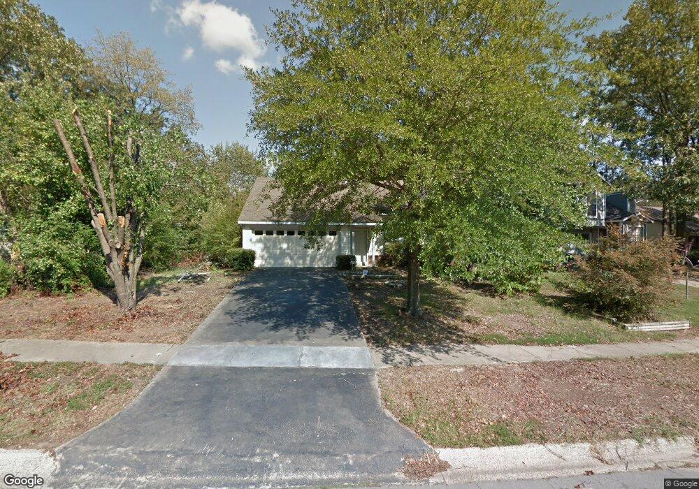
1315 Point West Dr Little Rock, AR 72211
Western Little Rock NeighborhoodEstimated Value: $188,587 - $226,000
--
Bed
2
Baths
1,197
Sq Ft
$175/Sq Ft
Est. Value
About This Home
This home is located at 1315 Point West Dr, Little Rock, AR 72211 and is currently estimated at $209,147, approximately $174 per square foot. 1315 Point West Dr is a home located in Pulaski County with nearby schools including Terry Elementary School, Pinnacle View Middle School, and LISA Academy West Elementary School.
Ownership History
Date
Name
Owned For
Owner Type
Purchase Details
Closed on
Nov 5, 2012
Sold by
Lewis Kevin Laurens Kelley Raymond and Lewis Kelley R
Bought by
Lewis Kevin Laurens Kelley Raymond
Current Estimated Value
Home Financials for this Owner
Home Financials are based on the most recent Mortgage that was taken out on this home.
Original Mortgage
$112,500
Outstanding Balance
$77,387
Interest Rate
3.37%
Mortgage Type
VA
Estimated Equity
$131,760
Purchase Details
Closed on
Aug 30, 2002
Sold by
Caldwell Karen R
Bought by
Lewis Kelley R
Create a Home Valuation Report for This Property
The Home Valuation Report is an in-depth analysis detailing your home's value as well as a comparison with similar homes in the area
Home Values in the Area
Average Home Value in this Area
Purchase History
| Date | Buyer | Sale Price | Title Company |
|---|---|---|---|
| Lewis Kevin Laurens Kelley Raymond | -- | American Abstract & Title Co | |
| Lewis Kelley R | $103,000 | American Abstract & Title Co |
Source: Public Records
Mortgage History
| Date | Status | Borrower | Loan Amount |
|---|---|---|---|
| Open | Lewis Kevin Laurens Kelley Raymond | $112,500 | |
| Closed | Lewis Kelley R | $0 |
Source: Public Records
Tax History Compared to Growth
Tax History
| Year | Tax Paid | Tax Assessment Tax Assessment Total Assessment is a certain percentage of the fair market value that is determined by local assessors to be the total taxable value of land and additions on the property. | Land | Improvement |
|---|---|---|---|---|
| 2025 | $2,011 | $28,732 | $4,600 | $24,132 |
| 2024 | $1,901 | $28,732 | $4,600 | $24,132 |
| 2023 | $1,901 | $28,732 | $4,600 | $24,132 |
| 2022 | $1,742 | $28,732 | $4,600 | $24,132 |
| 2021 | $1,595 | $22,630 | $5,300 | $17,330 |
| 2020 | $1,584 | $22,630 | $5,300 | $17,330 |
| 2019 | $1,584 | $22,630 | $5,300 | $17,330 |
| 2018 | $1,584 | $22,630 | $5,300 | $17,330 |
| 2017 | $1,584 | $22,630 | $5,300 | $17,330 |
| 2016 | $1,693 | $24,180 | $5,000 | $19,180 |
| 2015 | $1,695 | $24,180 | $5,000 | $19,180 |
| 2014 | $1,695 | $24,180 | $5,000 | $19,180 |
Source: Public Records
Map
Nearby Homes
- 23 Wagon Wheel Ct
- 1505 Point Dr W
- 28 Elkrun Cove
- 12825 Westglen Dr
- 1707 Point Dr W
- 1509 Gamble Rd
- 714 Atkins Rd
- 13100 Kanis Rd
- 12400 Cherry Laurel Dr
- 1115 Nix Rd
- 1105 Nix Rd
- 1109 Nix Rd
- 1408 S Bowman Rd
- 000 Coleman Ave
- 2 Timber Ridge Ct
- 13408 Teton Dr
- 624 Gamble Rd
- 12601 Misty Creek Dr
- 2001 Brookford Dr
- 1409 Mesquite Dr
- 1319 Point West Dr
- 1 Pinto Point
- 3 Whipple Ct
- 3 Pinto Point
- 1401 Point West Dr
- 5 Pinto Point
- 4 Elkrun Cove
- 7 Pinto Point
- 1318 Point West Dr
- 1318 Point Dr W
- 1320 Point West Dr
- 1 Spur Cove
- 0 Point Dr W Unit 15015654
- 0 Point Dr W Unit 16023152
- 0 Point Dr W Unit 16029758
- 0 Point Dr W Unit 16030337
- 0 Point Dr W Unit 20039239
- 0 Point Dr W Unit 17010361
- 0 Point Dr W Unit 17020609
- 0 Point Dr W Unit 17029125