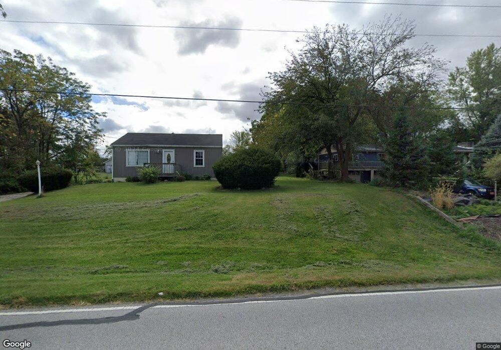
1315 W 129th Ave Crown Point, IN 46307
Estimated Value: $206,600 - $356,000
2
Beds
1
Bath
1,560
Sq Ft
$170/Sq Ft
Est. Value
About This Home
This home is located at 1315 W 129th Ave, Crown Point, IN 46307 and is currently estimated at $264,650, approximately $169 per square foot. 1315 W 129th Ave is a home located in Lake County with nearby schools including Dwight D. Eisenhower Elementary School, Colonel John Wheeler Middle School, and Crown Point High School.
Ownership History
Date
Name
Owned For
Owner Type
Purchase Details
Closed on
Mar 14, 2007
Sold by
Eckhart Corina D
Bought by
Eckhart Matthew J
Current Estimated Value
Home Financials for this Owner
Home Financials are based on the most recent Mortgage that was taken out on this home.
Original Mortgage
$127,281
Outstanding Balance
$75,930
Interest Rate
6.27%
Mortgage Type
FHA
Estimated Equity
$188,720
Purchase Details
Closed on
Dec 28, 2004
Sold by
Eckhart Corina D
Bought by
Eckhart Matthew J and Eckhart Corina D
Home Financials for this Owner
Home Financials are based on the most recent Mortgage that was taken out on this home.
Original Mortgage
$15,833
Interest Rate
5.9%
Mortgage Type
Purchase Money Mortgage
Create a Home Valuation Report for This Property
The Home Valuation Report is an in-depth analysis detailing your home's value as well as a comparison with similar homes in the area
Home Values in the Area
Average Home Value in this Area
Purchase History
| Date | Buyer | Sale Price | Title Company |
|---|---|---|---|
| Eckhart Matthew J | -- | Ticor So | |
| Eckhart Matthew J | -- | Chicago Title Insurance Comp |
Source: Public Records
Mortgage History
| Date | Status | Borrower | Loan Amount |
|---|---|---|---|
| Open | Eckhart Matthew J | $127,281 | |
| Previous Owner | Eckhart Matthew J | $15,833 |
Source: Public Records
Tax History
| Year | Tax Paid | Tax Assessment Tax Assessment Total Assessment is a certain percentage of the fair market value that is determined by local assessors to be the total taxable value of land and additions on the property. | Land | Improvement |
|---|---|---|---|---|
| 2025 | $1,282 | $170,600 | $52,200 | $118,400 |
| 2024 | $3,190 | $154,200 | $52,200 | $102,000 |
| 2023 | $1,197 | $150,100 | $52,200 | $97,900 |
| 2022 | $1,270 | $147,300 | $52,200 | $95,100 |
| 2021 | $848 | $122,100 | $41,800 | $80,300 |
| 2020 | $864 | $119,500 | $41,800 | $77,700 |
| 2019 | $930 | $117,700 | $41,800 | $75,900 |
| 2018 | $958 | $116,000 | $41,800 | $74,200 |
| 2017 | $973 | $116,000 | $41,800 | $74,200 |
| 2016 | $2,496 | $118,300 | $41,800 | $76,500 |
| 2014 | $2,232 | $114,500 | $42,100 | $72,400 |
| 2013 | $788 | $110,700 | $42,100 | $68,600 |
Source: Public Records
Map
Nearby Homes
- 12819 Grant St
- 1051 W 129th Ave
- 12938 Hayes St
- 253 W 129th Ave Unit 1
- 809 W 126th Ct
- 2184 W 129th Place
- 13209 Roosevelt Place
- 13181 Taft St
- 1790 W 134th Ct
- 12728 Ellsworth St
- 255 Nomo Place
- 283 Nomo Place
- 2725 W 127th Ln
- 244 Sawgrass Dr
- 246 Sawgrass Dr
- 248 Sawgrass Dr
- 13378 Taney St
- 1426 Rainy Brook Way
- 12492 Washington St
- 323 E 129th Place
- 1403 W 129th Ave
- 1339 W 129th Ave
- 1413 W 129th Ave
- 1211 W 129th Ave
- 1444 W 129th Ave
- 1203 W 129th Ave
- 12821 Lincoln Ct
- 12828 Lincoln Ct
- 12844 Lincoln Ct
- 12968 Pierce Ct
- 12919 Grant St
- 12940 Pierce Ct
- 12843 Lincoln Ct
- 12996 Pierce Ct
- 12851 Lincoln Ct
- 12866 Lincoln Ct
- 12815-12817 Grant (Approx) St
- 12817 Grant (Approx) St
- 12815 Grant (Approx) St
- 12865 Lincoln Ct
Your Personal Tour Guide
Ask me questions while you tour the home.