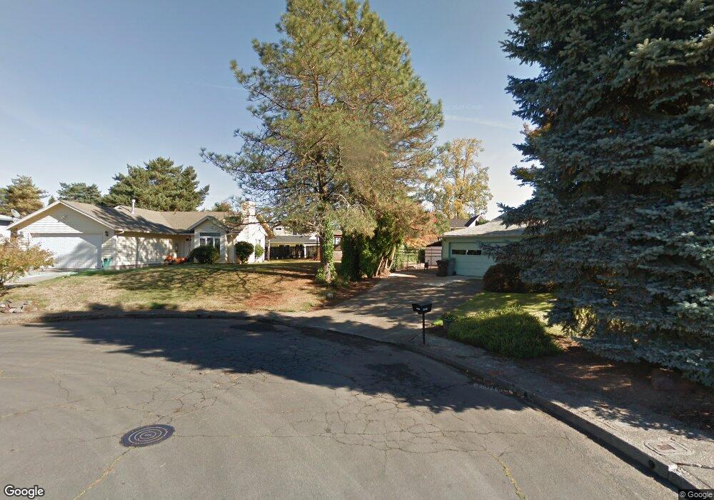
1316 Sherri Ct West Linn, OR 97068
Willamette NeighborhoodEstimated Value: $581,000 - $735,000
3
Beds
2
Baths
1,306
Sq Ft
$480/Sq Ft
Est. Value
About This Home
This home is located at 1316 Sherri Ct, West Linn, OR 97068 and is currently estimated at $626,977, approximately $480 per square foot. 1316 Sherri Ct is a home located in Clackamas County with nearby schools including Willamette Primary School, Athey Creek Middle School, and West Linn High School.
Ownership History
Date
Name
Owned For
Owner Type
Purchase Details
Closed on
Oct 26, 1998
Sold by
Crouch Sandra K
Bought by
Younger John C and Younger Mary M
Current Estimated Value
Home Financials for this Owner
Home Financials are based on the most recent Mortgage that was taken out on this home.
Original Mortgage
$132,000
Interest Rate
6.71%
Mortgage Type
Purchase Money Mortgage
Create a Home Valuation Report for This Property
The Home Valuation Report is an in-depth analysis detailing your home's value as well as a comparison with similar homes in the area
Home Values in the Area
Average Home Value in this Area
Purchase History
| Date | Buyer | Sale Price | Title Company |
|---|---|---|---|
| Younger John C | $165,000 | First American Title Ins Co | |
| Crouch Sandra K | -- | First American Title Ins Co |
Source: Public Records
Mortgage History
| Date | Status | Borrower | Loan Amount |
|---|---|---|---|
| Closed | Younger John C | $132,000 |
Source: Public Records
Tax History Compared to Growth
Tax History
| Year | Tax Paid | Tax Assessment Tax Assessment Total Assessment is a certain percentage of the fair market value that is determined by local assessors to be the total taxable value of land and additions on the property. | Land | Improvement |
|---|---|---|---|---|
| 2025 | $7,202 | $373,714 | -- | -- |
| 2024 | $6,933 | $362,830 | -- | -- |
| 2023 | $6,933 | $352,263 | $0 | $0 |
| 2022 | $6,543 | $342,003 | $0 | $0 |
| 2021 | $6,211 | $332,042 | $0 | $0 |
| 2020 | $4,945 | $256,750 | $0 | $0 |
| 2019 | $4,680 | $249,272 | $0 | $0 |
| 2018 | $4,395 | $242,012 | $0 | $0 |
| 2017 | $4,192 | $234,963 | $0 | $0 |
| 2016 | $4,070 | $228,119 | $0 | $0 |
| 2015 | $3,767 | $221,475 | $0 | $0 |
| 2014 | $3,598 | $215,024 | $0 | $0 |
Source: Public Records
Map
Nearby Homes
- 1733 Jamie Cir
- 1721 Dollar St Unit 1721
- 1694 16th St
- 1690 16th St
- 1765 Ostman Rd
- 1931 13th St
- 1160 Blankenship Rd
- 25545 Katherine Ct
- 1075 Epperly Way
- 975 Springtree Ln
- 880 Springtree Ln Unit 880
- 850 Springtree Ln Unit 850
- 640 Springtree Ln
- 3565 Summerlinn Dr Unit 64
- 812 Wendy Ct
- 3850 Summerlinn Dr Unit 58
- 4650 Summerlinn Way
- 1101 Ryan Ct
- 3395 Summerlinn Dr Unit 24
- 2077 5th Ave
- 1314 Sherri Ct
- 1318 Sherri Ct
- 1936 Hillhouse Dr
- 1942 Hillhouse Dr
- 1928 Hillhouse Dr
- 1309 Sherri Ct
- 1312 Sherri Ct
- 1305 Sherri Ct
- 1307 Sherri Ct
- 1340 Dollar St
- 1310 Sherri Ct
- 1918 Hillhouse Dr
- 1303 Sherri Ct
- 1306 Sherri Ct
- 1966 Hillhouse Dr
- 1324 Dollar St
- 1935 Hillhouse Dr
- 1945 Hillhouse Dr
- 1304 Sherri Ct
- 1912 Hillhouse Dr