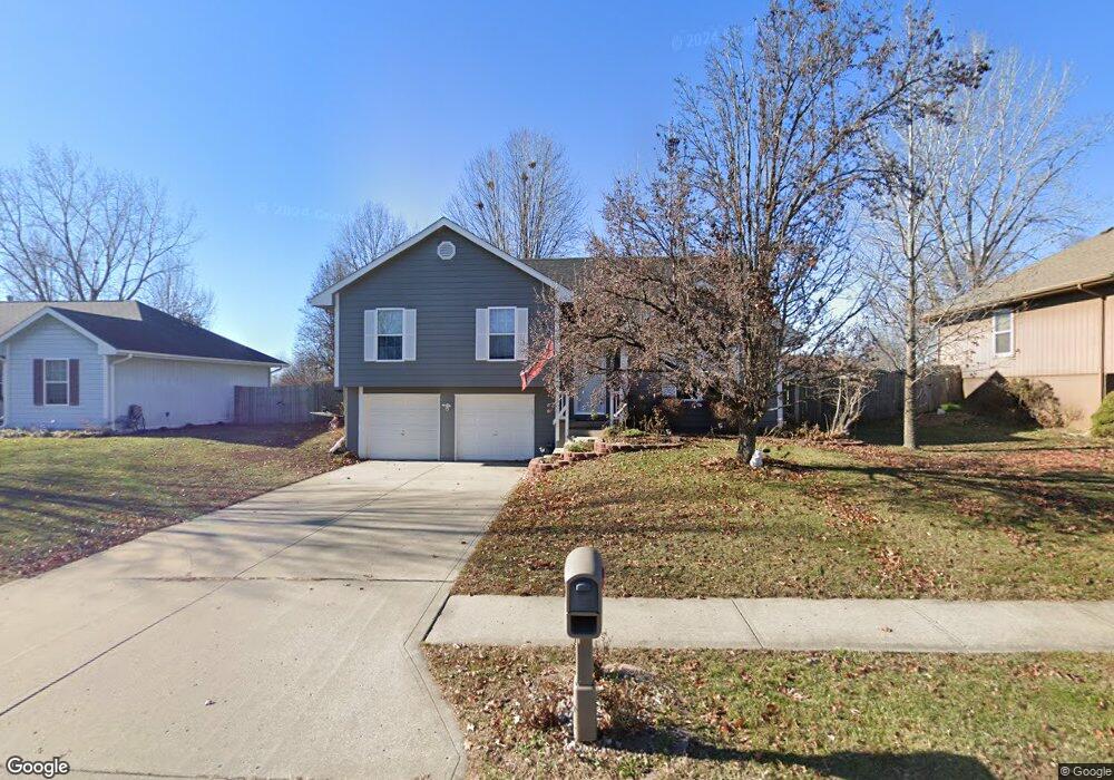
1316 Stonecrest Dr Kearney, MO 64060
Estimated Value: $304,248 - $312,000
3
Beds
3
Baths
1,232
Sq Ft
$250/Sq Ft
Est. Value
About This Home
This home is located at 1316 Stonecrest Dr, Kearney, MO 64060 and is currently estimated at $308,312, approximately $250 per square foot. 1316 Stonecrest Dr is a home located in Clay County with nearby schools including Kearney Junior High School and Kearney High School.
Ownership History
Date
Name
Owned For
Owner Type
Purchase Details
Closed on
Jun 10, 2010
Sold by
Rhoades Gary R and Rhoades Diana L
Bought by
Shields Martin and Shields Nicole
Current Estimated Value
Purchase Details
Closed on
Feb 5, 2010
Sold by
Matrix Financial Services Corp
Bought by
Rhoades Gary R
Purchase Details
Closed on
Sep 23, 2009
Sold by
Brown Danny E
Bought by
Matrix Financial Services Corp
Purchase Details
Closed on
Jan 10, 2008
Sold by
Brown Marina
Bought by
Brown Danny E
Purchase Details
Closed on
Oct 19, 1998
Sold by
Aartech Investments Inc
Bought by
Brown Danny E
Home Financials for this Owner
Home Financials are based on the most recent Mortgage that was taken out on this home.
Original Mortgage
$103,225
Interest Rate
6.73%
Create a Home Valuation Report for This Property
The Home Valuation Report is an in-depth analysis detailing your home's value as well as a comparison with similar homes in the area
Home Values in the Area
Average Home Value in this Area
Purchase History
| Date | Buyer | Sale Price | Title Company |
|---|---|---|---|
| Shields Martin | -- | Stewart Title Company | |
| Rhoades Gary R | -- | Stewart Title Company | |
| Matrix Financial Services Corp | $90,681 | None Available | |
| Brown Danny E | -- | None Available | |
| Brown Danny E | -- | -- |
Source: Public Records
Mortgage History
| Date | Status | Borrower | Loan Amount |
|---|---|---|---|
| Previous Owner | Brown Danny E | $103,225 |
Source: Public Records
Tax History
| Year | Tax Paid | Tax Assessment Tax Assessment Total Assessment is a certain percentage of the fair market value that is determined by local assessors to be the total taxable value of land and additions on the property. | Land | Improvement |
|---|---|---|---|---|
| 2025 | $2,416 | $43,300 | -- | -- |
| 2024 | $2,416 | $35,260 | -- | -- |
| 2023 | $2,408 | $35,260 | $0 | $0 |
| 2022 | $2,158 | $30,550 | $0 | $0 |
| 2021 | $2,115 | $30,552 | $4,750 | $25,802 |
| 2020 | $2,093 | $27,490 | $0 | $0 |
| 2019 | $2,081 | $27,493 | $4,750 | $22,743 |
Source: Public Records
Map
Nearby Homes
- 1307 Stonecrest Dr
- 623 E 13th St
- 1209 Noah's Ln
- 1204 Noah's Ln
- 1202 Noah's Ln
- 1102 Susan St
- 1300 Robin Cir
- 808 E 16th St
- 1300 Melissa Ct
- 905 Susan St
- 1710 Rockwater Ln
- 402 E 14th St
- 704 Feldspar St
- 709 Feldspar St
- 1210 E 15th St
- 1003 Madelyn Dr
- 1304 S Jefferson St
- 1102 Melody Ct
- 1105 Melody Ct
- 1818 Lauren Ln
- 1314 Stonecrest Dr
- 1318 Stonecrest Dr
- 1311 Susan St
- Lot 74 Stonecrest Dr
- Lot 73 Stonecrest Dr
- 1309 Susan St
- 1313 Susan St
- 1312 Stonecrest Dr
- 1320 Stonecrest Dr
- 1319 Stonecrest Dr
- 1307 Susan St
- 1315 Susan St
- 1321 Stonecrest Dr
- 1315 Stonecrest Dr
- 1322 Stonecrest Dr
- 1401 Susan St
- 1323 Stonecrest Dr
- 1313 Stonecrest Dr
- 1310 Susan St
- 716 E 13th Terrace
Your Personal Tour Guide
Ask me questions while you tour the home.