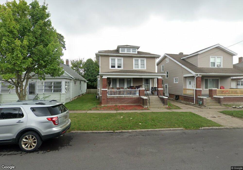
1316 Tyler St Sandusky, OH 44870
Estimated Value: $101,981 - $125,000
3
Beds
2
Baths
1,303
Sq Ft
$86/Sq Ft
Est. Value
About This Home
This home is located at 1316 Tyler St, Sandusky, OH 44870 and is currently estimated at $111,745, approximately $85 per square foot. 1316 Tyler St is a home located in Erie County with nearby schools including Sandusky High School, Monroe Preparatory Academy, and Sandusky Central Catholic School.
Ownership History
Date
Name
Owned For
Owner Type
Purchase Details
Closed on
Jul 30, 2008
Sold by
The Bank Of New York Mellon Trust Co N A
Bought by
Howard Ronald Steven and Howard Sharleen S
Current Estimated Value
Purchase Details
Closed on
Jul 29, 2008
Sold by
New York Mellon Trust Company N A
Bought by
The Bank Of New York Mellon Trust Co N A and The Bank Of New York Trust Co N A
Purchase Details
Closed on
Apr 17, 2008
Sold by
Bledsoe Don
Bought by
Bank Of New York Trust Co
Purchase Details
Closed on
Sep 8, 1995
Sold by
Estella O Funni Est
Bought by
Bledsoe Dale E and Bledsoe Kerry L
Home Financials for this Owner
Home Financials are based on the most recent Mortgage that was taken out on this home.
Original Mortgage
$40,000
Interest Rate
7.76%
Mortgage Type
New Conventional
Create a Home Valuation Report for This Property
The Home Valuation Report is an in-depth analysis detailing your home's value as well as a comparison with similar homes in the area
Home Values in the Area
Average Home Value in this Area
Purchase History
| Date | Buyer | Sale Price | Title Company |
|---|---|---|---|
| Howard Ronald Steven | $29,900 | Landcastle Title Llc | |
| The Bank Of New York Mellon Trust Co N A | -- | Landcastle Title Llc | |
| Bank Of New York Trust Co | $45,000 | Hartung Title | |
| Bledsoe Dale E | $47,500 | -- |
Source: Public Records
Mortgage History
| Date | Status | Borrower | Loan Amount |
|---|---|---|---|
| Previous Owner | Bledsoe Dale E | $40,000 |
Source: Public Records
Tax History
| Year | Tax Paid | Tax Assessment Tax Assessment Total Assessment is a certain percentage of the fair market value that is determined by local assessors to be the total taxable value of land and additions on the property. | Land | Improvement |
|---|---|---|---|---|
| 2024 | $976 | $25,032 | $1,792 | $23,240 |
| 2023 | $986 | $17,552 | $1,431 | $16,121 |
| 2022 | $890 | $17,548 | $1,431 | $16,117 |
| 2021 | $898 | $17,550 | $1,430 | $16,120 |
| 2020 | $930 | $16,710 | $1,430 | $15,280 |
| 2019 | $956 | $16,710 | $1,430 | $15,280 |
| 2018 | $957 | $16,710 | $1,430 | $15,280 |
| 2017 | $1,039 | $18,080 | $1,540 | $16,540 |
| 2016 | $1,039 | $18,080 | $1,540 | $16,540 |
| 2015 | $941 | $18,080 | $1,540 | $16,540 |
| 2014 | $1,030 | $19,920 | $1,540 | $18,380 |
| 2013 | $1,020 | $19,920 | $1,540 | $18,380 |
Source: Public Records
Map
Nearby Homes
- 1318 Tyler St
- 1329 Carr St
- 1330 Carr St
- 911 A St
- 1330 Clinton St
- 1333 Shelby St
- 1308 W Madison St
- 1204 W Monroe St
- 1510 Pearl St
- 1308 Vine St
- 932 W Madison St
- 17 Tyler Way
- 1523 Central Ave
- 1618 Mcdonough St
- 1105 W Adams St
- 1311 Filmore St
- 1604 Central Ave
- 325 Mcdonough St
- 808 Fulton St
- 1319 Tiffin Ave
Your Personal Tour Guide
Ask me questions while you tour the home.