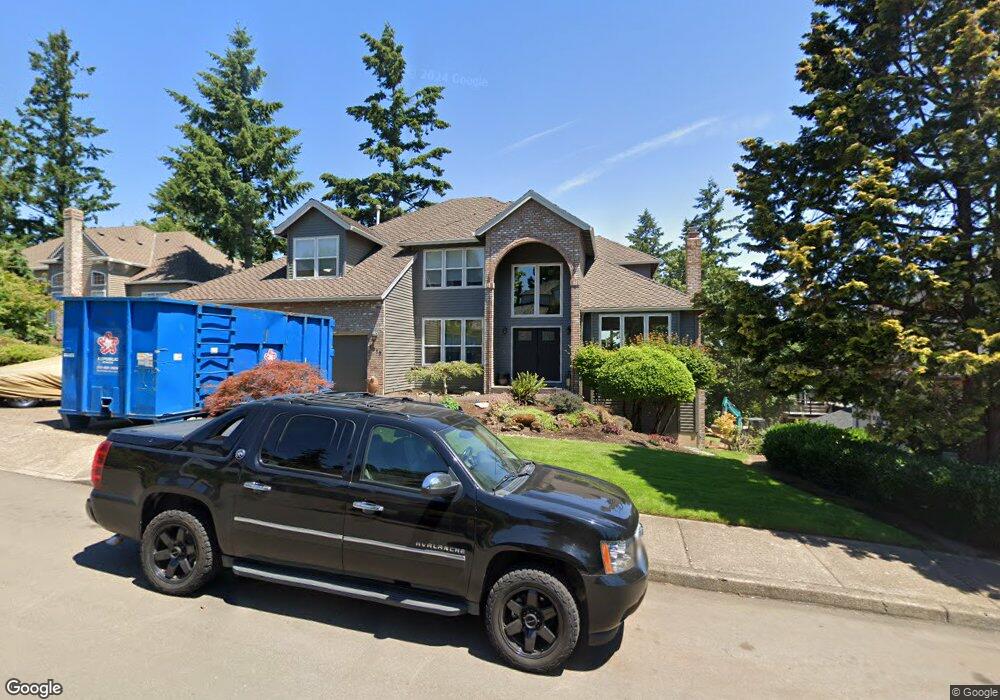
1317 Stonehaven Dr West Linn, OR 97068
Marylhurst NeighborhoodEstimated Value: $1,138,000 - $1,224,057
4
Beds
3
Baths
3,100
Sq Ft
$379/Sq Ft
Est. Value
About This Home
This home is located at 1317 Stonehaven Dr, West Linn, OR 97068 and is currently estimated at $1,175,764, approximately $379 per square foot. 1317 Stonehaven Dr is a home located in Clackamas County with nearby schools including Stafford Primary School, West Linn High School, and Harmony Academy.
Ownership History
Date
Name
Owned For
Owner Type
Purchase Details
Closed on
Feb 8, 2021
Sold by
Kawasaki Edwin J and Kawasaki Pamela T
Bought by
Kawasaki Edwin J and Kawasaki Pamela T
Current Estimated Value
Purchase Details
Closed on
Jun 1, 1998
Sold by
Murrieta David and Murrieta Jill W
Bought by
Kawasaki Edwin J and Kawasaki Pamela T
Home Financials for this Owner
Home Financials are based on the most recent Mortgage that was taken out on this home.
Original Mortgage
$272,000
Outstanding Balance
$50,936
Interest Rate
6.62%
Estimated Equity
$1,124,828
Create a Home Valuation Report for This Property
The Home Valuation Report is an in-depth analysis detailing your home's value as well as a comparison with similar homes in the area
Home Values in the Area
Average Home Value in this Area
Purchase History
| Date | Buyer | Sale Price | Title Company |
|---|---|---|---|
| Kawasaki Edwin J | -- | None Available | |
| Kawasaki Edwin J | $340,000 | Pacific Nw Title |
Source: Public Records
Mortgage History
| Date | Status | Borrower | Loan Amount |
|---|---|---|---|
| Open | Kawasaki Edwin J | $272,000 |
Source: Public Records
Tax History Compared to Growth
Tax History
| Year | Tax Paid | Tax Assessment Tax Assessment Total Assessment is a certain percentage of the fair market value that is determined by local assessors to be the total taxable value of land and additions on the property. | Land | Improvement |
|---|---|---|---|---|
| 2025 | $14,149 | $734,193 | -- | -- |
| 2024 | $13,620 | $712,809 | -- | -- |
| 2023 | $13,620 | $692,048 | $0 | $0 |
| 2022 | $12,855 | $671,892 | $0 | $0 |
| 2021 | $12,166 | $652,323 | $0 | $0 |
| 2020 | $12,043 | $633,324 | $0 | $0 |
| 2019 | $11,547 | $614,878 | $0 | $0 |
| 2018 | $11,027 | $596,969 | $0 | $0 |
| 2017 | $10,387 | $579,582 | $0 | $0 |
| 2016 | $9,969 | $562,701 | $0 | $0 |
| 2015 | $9,556 | $546,312 | $0 | $0 |
| 2014 | $9,016 | $530,400 | $0 | $0 |
Source: Public Records
Map
Nearby Homes
- 1611 Arran Ct
- 1321 Troon Dr
- 1397 Skye Pkwy
- 1384 Celtic Ct
- 2167 Marylwood Ct
- 19640 Kapteyns St
- 1354 Skye Pkwy
- 655 Rosemont Rd
- 2041 Marylhurst Dr
- 1777 Skyland Dr
- 19661 Sun Cir
- 18300 S Whitten Ln
- 2455 College Hill Place
- 17900 Crestline Dr
- 17833 Marylcreek Dr
- 451 S Wilda Rd
- 17514 Brookhurst Dr
- 2005 Carriage Way
- 17623 Brookhurst Dr
- 17634 Brookhurst Dr
- 1319 Stonehaven Dr
- 1315 Stonehaven Dr
- 1316 Stonehaven Dr
- 1313 Stonehaven Dr
- 1321 Stonehaven Dr
- 1610 Arran Ct
- 1314 Stonehaven Dr
- 1318 Stonehaven Dr
- 1312 Stonehaven Dr
- 1320 Stonehaven Dr
- 1333 Stonehaven Dr
- 1335 Stonehaven Dr
- 1323 Stonehaven Dr
- 1608 Arran Ct
- 1337 Stonehaven Dr
- 1310 Stonehaven Dr
- 1322 Stonehaven Dr
- 655 Marylhurst Dr
- 635 Marylhurst Dr
- 1309 Stonehaven Dr