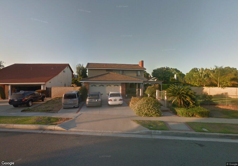
13171 Sutton St Cerritos, CA 90703
Estimated Value: $1,267,160 - $1,346,000
4
Beds
3
Baths
2,460
Sq Ft
$527/Sq Ft
Est. Value
About This Home
This home is located at 13171 Sutton St, Cerritos, CA 90703 and is currently estimated at $1,296,290, approximately $526 per square foot. 13171 Sutton St is a home located in Los Angeles County with nearby schools including Cecil B. Stowers Elementary School, Carmenita Middle School, and Cerritos High School.
Ownership History
Date
Name
Owned For
Owner Type
Purchase Details
Closed on
Dec 14, 2018
Sold by
Long Dennis and Long Joanne
Bought by
Long Dennis and Long Joanne
Current Estimated Value
Purchase Details
Closed on
Dec 23, 2002
Sold by
Long Dennis and Long Joanne
Bought by
Long Dennis
Home Financials for this Owner
Home Financials are based on the most recent Mortgage that was taken out on this home.
Original Mortgage
$222,000
Interest Rate
5.86%
Mortgage Type
Stand Alone First
Create a Home Valuation Report for This Property
The Home Valuation Report is an in-depth analysis detailing your home's value as well as a comparison with similar homes in the area
Home Values in the Area
Average Home Value in this Area
Purchase History
| Date | Buyer | Sale Price | Title Company |
|---|---|---|---|
| Long Dennis | -- | None Available | |
| Long Dennis | -- | Gateway |
Source: Public Records
Mortgage History
| Date | Status | Borrower | Loan Amount |
|---|---|---|---|
| Closed | Long Dennis | $222,000 |
Source: Public Records
Tax History
| Year | Tax Paid | Tax Assessment Tax Assessment Total Assessment is a certain percentage of the fair market value that is determined by local assessors to be the total taxable value of land and additions on the property. | Land | Improvement |
|---|---|---|---|---|
| 2025 | $2,042 | $136,323 | $24,728 | $111,595 |
| 2024 | $2,042 | $133,651 | $24,244 | $109,407 |
| 2023 | $1,987 | $131,031 | $23,769 | $107,262 |
| 2022 | $1,954 | $128,462 | $23,303 | $105,159 |
| 2021 | $1,899 | $125,945 | $22,847 | $103,098 |
| 2019 | $1,856 | $122,211 | $22,170 | $100,041 |
| 2018 | $1,673 | $119,816 | $21,736 | $98,080 |
| 2016 | $1,576 | $115,165 | $20,893 | $94,272 |
| 2015 | $1,557 | $113,436 | $20,580 | $92,856 |
| 2014 | $1,538 | $111,215 | $20,177 | $91,038 |
Source: Public Records
Map
Nearby Homes
- 13202 Carolyn St
- 13010 Artesia Blvd
- 18622 Kamstra Ave
- 18727 Holmes Ave
- 13506 Darvalle St
- 13011 Hart Place
- 17105 Holmes Cir
- 13626 Aclare Ln
- 17405 Jasmine Way
- 12524 Bryce Cir
- 12525 Semora St
- 13026 San Salvador Place
- 18704 Stefani Ave
- 16602 Yvette Way
- 12703 Park St
- 16604 Cobblestone Ct
- 12711 Castleford Ln
- 19335 Derbyshire Ln
- 5271 Niguel Dr
- 16918 Chaparral Ave Unit 27
- 13165 Sutton St
- 18005 Pires Ave
- 18001 Pires Ave
- 17912 Kay Ct
- 18013 Pires Ave
- 17917 Pires Ave
- 13172 Sutton St
- 17913 Pires Ave
- 13166 Sutton St
- 13178 Sutton St
- 17908 Kay Ct
- 13162 Sutton St
- 13182 Sutton St
- 17907 Pires Ave
- 13149 Sutton St
- 13158 Sutton St
- 17902 Kay Ct
- 13204 Sutton St
- 18006 Pires Ave
- 18002 Pires Ave
Your Personal Tour Guide
Ask me questions while you tour the home.