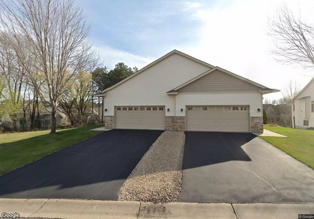
13179 Crane St NW Coon Rapids, MN 55448
Estimated Value: $401,859 - $416,000
4
Beds
3
Baths
1,576
Sq Ft
$259/Sq Ft
Est. Value
About This Home
This home is located at 13179 Crane St NW, Coon Rapids, MN 55448 and is currently estimated at $408,215, approximately $259 per square foot. 13179 Crane St NW is a home located in Anoka County with nearby schools including Sand Creek Elementary School, Coon Rapids Middle School, and Coon Rapids Senior High School.
Ownership History
Date
Name
Owned For
Owner Type
Purchase Details
Closed on
Mar 26, 2009
Sold by
Builders Mortgage Co Llc
Bought by
Blount Nancy Ann
Current Estimated Value
Home Financials for this Owner
Home Financials are based on the most recent Mortgage that was taken out on this home.
Original Mortgage
$157,000
Outstanding Balance
$102,555
Interest Rate
5.11%
Mortgage Type
Construction
Estimated Equity
$305,660
Create a Home Valuation Report for This Property
The Home Valuation Report is an in-depth analysis detailing your home's value as well as a comparison with similar homes in the area
Home Values in the Area
Average Home Value in this Area
Purchase History
| Date | Buyer | Sale Price | Title Company |
|---|---|---|---|
| Blount Nancy Ann | $150,000 | -- |
Source: Public Records
Mortgage History
| Date | Status | Borrower | Loan Amount |
|---|---|---|---|
| Open | Blount Nancy Ann | $157,000 |
Source: Public Records
Tax History Compared to Growth
Tax History
| Year | Tax Paid | Tax Assessment Tax Assessment Total Assessment is a certain percentage of the fair market value that is determined by local assessors to be the total taxable value of land and additions on the property. | Land | Improvement |
|---|---|---|---|---|
| 2025 | $3,597 | $359,900 | $75,000 | $284,900 |
| 2024 | $3,597 | $343,900 | $70,000 | $273,900 |
| 2023 | $3,804 | $384,400 | $65,000 | $319,400 |
| 2022 | $3,627 | $385,300 | $56,000 | $329,300 |
| 2021 | $3,550 | $327,900 | $38,000 | $289,900 |
| 2020 | $3,517 | $314,200 | $35,000 | $279,200 |
| 2019 | $3,284 | $299,100 | $35,000 | $264,100 |
| 2018 | $3,280 | $273,000 | $0 | $0 |
| 2017 | $3,324 | $264,400 | $0 | $0 |
| 2016 | $3,381 | $261,000 | $0 | $0 |
| 2015 | $3,124 | $261,000 | $36,000 | $225,000 |
| 2014 | -- | $216,700 | $20,000 | $196,700 |
Source: Public Records
Map
Nearby Homes
- 1687 131st Ln NW
- 12859 Grouse St NW
- 1776 133rd Ave NW
- 1520 129th Ave NW
- 12796 Bluebird St NW
- 1234 128th Cir NW
- 1593 126th Ln NW
- 12554 Grouse St NW
- 1930 127th Cir NW
- 13519 Partridge Cir NW
- 12463 Drake St NW
- 13416 Swallow St NW
- 1625 124th Ave NW
- 12365 Jay St NW
- 12760 Raven St NW
- 12488 Unity St NW
- 2147 125th Ln NW
- 1568 140th Ln NW
- 2270 137th Ln NW
- 2201 139th Ave NW
- 13179 Crane St NW Unit 14
- 13175 Crane St NW
- 13159 Crane St NW
- 13155 Crane St NW
- 1484 132nd Ave NW
- 1492 132nd Ave NW
- 13176 Crane St NW
- 13168 Crane St NW
- 13149 Crane St NW
- 1468 132nd Ave NW
- 13186 Crane St NW
- 13152 Crane St NW
- 1460 132nd Ave NW
- 13145 Crane St NW
- 13146 Crane St NW
- 1514 132nd Ave NW
- 1452 132nd Ave NW
- 13190 Avocet St NW
- 13139 Crane St NW
- 13178 Avocet St NW