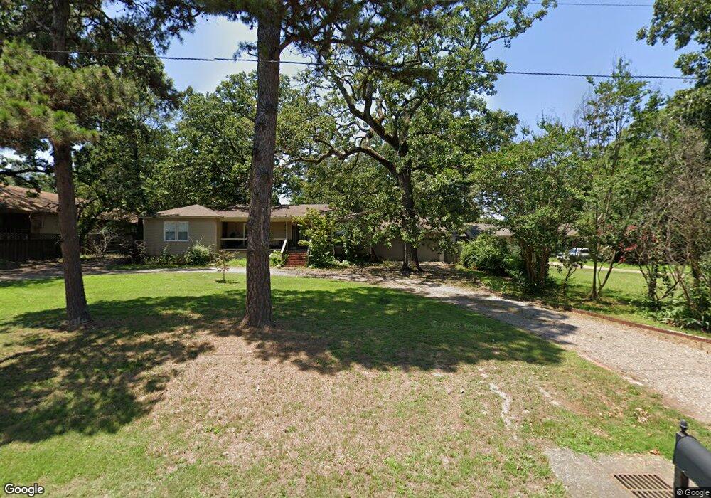
1318 Burnham Rd Fort Smith, AR 72903
Estimated Value: $229,000 - $271,000
Studio
1
Bath
2,347
Sq Ft
$105/Sq Ft
Est. Value
About This Home
This home is located at 1318 Burnham Rd, Fort Smith, AR 72903 and is currently estimated at $246,818, approximately $105 per square foot. 1318 Burnham Rd is a home located in Sebastian County with nearby schools including Euper Lane Elementary School, L.A. Chaffin Junior High School, and Southside High School.
Ownership History
Date
Name
Owned For
Owner Type
Purchase Details
Closed on
Aug 31, 2012
Sold by
White Vernon L
Bought by
Johnson David Charles and Johnson Barbara Smith
Current Estimated Value
Home Financials for this Owner
Home Financials are based on the most recent Mortgage that was taken out on this home.
Original Mortgage
$110,000
Interest Rate
3.49%
Mortgage Type
Construction
Purchase Details
Closed on
Feb 21, 2012
Sold by
Riser Eleanor M
Bought by
Riser Robert P
Create a Home Valuation Report for This Property
The Home Valuation Report is an in-depth analysis detailing your home's value as well as a comparison with similar homes in the area
Home Values in the Area
Average Home Value in this Area
Purchase History
| Date | Buyer | Sale Price | Title Company |
|---|---|---|---|
| Johnson David Charles | $230,000 | Guaranty Abstract | |
| Riser Robert P | -- | None Available |
Source: Public Records
Mortgage History
| Date | Status | Borrower | Loan Amount |
|---|---|---|---|
| Closed | Johnson David Charles | $110,000 |
Source: Public Records
Tax History
| Year | Tax Paid | Tax Assessment Tax Assessment Total Assessment is a certain percentage of the fair market value that is determined by local assessors to be the total taxable value of land and additions on the property. | Land | Improvement |
|---|---|---|---|---|
| 2025 | $1,906 | $41,854 | $5,280 | $36,574 |
| 2024 | $1,641 | $31,260 | $3,840 | $27,420 |
| 2023 | $1,390 | $31,260 | $3,840 | $27,420 |
| 2022 | $1,440 | $31,260 | $3,840 | $27,420 |
| 2021 | $1,440 | $31,260 | $3,840 | $27,420 |
| 2020 | $1,362 | $31,260 | $3,840 | $27,420 |
| 2019 | $1,280 | $28,500 | $3,840 | $24,660 |
| 2018 | $1,305 | $28,500 | $3,840 | $24,660 |
| 2017 | $993 | $25,580 | $3,840 | $21,740 |
| 2016 | $1,343 | $25,580 | $3,840 | $21,740 |
| 2015 | $1,343 | $25,580 | $3,840 | $21,740 |
| 2014 | $1,090 | $27,420 | $5,280 | $22,140 |
Source: Public Records
Map
Nearby Homes
- 6209 Duncan Rd
- 6001 Bolton Rd
- 6221 Duncan Rd
- 5600 Elmwood Place
- 1713 Craftwoods Cir
- 5701 Free Ferry Rd Unit 34
- 5701 Free Ferry Rd Unit 29
- 5701 Free Ferry Rd Unit 12
- 6212 Free Ferry Rd
- 6501 Bolton Rd
- 5420 Free Ferry Rd
- 5306 Labelle Ct
- 5421 Free Ferry Rd
- 6104 Park Ave
- 6712 Fern St
- 5325 Free Ferry Rd
- 901 S 68th Ln
- 6700 S S St
- 2415 S 64th St
- 7105 S R St
- 1401 Burnham Ct
- 1310 Burnham Rd
- 1400 Burnham Ct
- 1405 Burnham Ct
- 1300 Burnham Rd
- 1404 Burnham Ct
- 5920 Gordon Ln
- 1409 Burnham Ct
- 5824 Gordon Ln
- 1317 Burnham Rd
- 1408 Burnham Ct
- 5822 Gordon Ln
- 1309 Burnham Rd
- 1421 Burnham Rd
- 1413 Burnham Ct
- 5820 Gordon Ln
- 0 Gordon Ln
- 1301 Burnham Rd
- 1412 Burnham Ct
- 5823 Duncan Rd
Your Personal Tour Guide
Ask me questions while you tour the home.