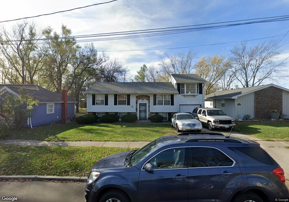
1318 Ewing St Bloomington, IL 61701
Estimated Value: $131,000 - $170,000
Studio
1
Bath
1,132
Sq Ft
$131/Sq Ft
Est. Value
About This Home
This home is located at 1318 Ewing St, Bloomington, IL 61701 and is currently estimated at $148,008, approximately $130 per square foot. 1318 Ewing St is a home located in McLean County with nearby schools including Sheridan Elementary School, Bloomington Junior High School, and Bloomington High School.
Ownership History
Date
Name
Owned For
Owner Type
Purchase Details
Closed on
Nov 15, 2024
Sold by
Ray Andre
Bought by
Davis Ray
Current Estimated Value
Home Financials for this Owner
Home Financials are based on the most recent Mortgage that was taken out on this home.
Original Mortgage
$109,350
Outstanding Balance
$107,847
Interest Rate
6.63%
Mortgage Type
New Conventional
Estimated Equity
$40,161
Purchase Details
Closed on
Nov 20, 2020
Sold by
Henderson Archie and Estate Of Archie Henderson
Bought by
Ray Andre
Create a Home Valuation Report for This Property
The Home Valuation Report is an in-depth analysis detailing your home's value as well as a comparison with similar homes in the area
Purchase History
| Date | Buyer | Sale Price | Title Company |
|---|---|---|---|
| Davis Ray | $135,000 | None Listed On Document | |
| Davis Ray | $135,000 | None Listed On Document | |
| Ray Andre | -- | None Listed On Document |
Source: Public Records
Mortgage History
| Date | Status | Borrower | Loan Amount |
|---|---|---|---|
| Open | Davis Ray | $109,350 | |
| Closed | Davis Ray | $109,350 |
Source: Public Records
Tax History
| Year | Tax Paid | Tax Assessment Tax Assessment Total Assessment is a certain percentage of the fair market value that is determined by local assessors to be the total taxable value of land and additions on the property. | Land | Improvement |
|---|---|---|---|---|
| 2024 | $3,042 | $49,858 | $9,610 | $40,248 |
| 2022 | $3,042 | $41,794 | $8,055 | $33,739 |
| 2021 | $2,742 | $38,260 | $7,374 | $30,886 |
| 2020 | $2,311 | $38,260 | $7,374 | $30,886 |
| 2019 | $2,249 | $37,610 | $7,249 | $30,361 |
| 2018 | $2,147 | $36,515 | $7,038 | $29,477 |
| 2017 | $2,070 | $35,590 | $6,860 | $28,730 |
| 2016 | $1,591 | $35,590 | $6,860 | $28,730 |
| 2015 | $1,587 | $35,119 | $6,769 | $28,350 |
| 2014 | $1,957 | $35,119 | $6,769 | $28,350 |
| 2013 | -- | $36,393 | $7,015 | $29,378 |
Source: Public Records
Map
Nearby Homes
- 1215 Wall St
- Lot 8 Emeline St
- 407 W Emerson St
- 1015 Primrose Ln
- 9 Parkshores Dr
- 212 W Division St
- 1212 N Madison St
- 910 N Mason St
- 805 N Morris Ave
- 919 N Lee St
- 107 E Division St
- 1406 W Walnut St
- 1108 Hovey Ave
- 910 N Center St
- 1004 Hovey Ave
- 39 Oak Park Rd
- 1607 Hovey Ave
- 708 N Lee St
- 813 Highpoint Rd
- 2112 Parker Ave
- 1320 Ewing St
- 1316 Ewing St
- 1322 Ewing St
- 1314 Ewing St
- 1319 Ewing St
- 1315 1/2 Ewing St
- 1317 Ewing St
- 1321 Ewing St
- 1315 Ewing St
- 1308 Ewing St
- 1318 Sherman St
- 1320 Sherman St
- 1316 Sherman St
- 1322 Sherman St
- 1312 Sherman St
- 1519 Calhoun St
- 1309 Ewing St
- 1324 Sherman St
- 1601 Calhoun St
- 1310 Sherman St
Your Personal Tour Guide
Ask me questions while you tour the home.