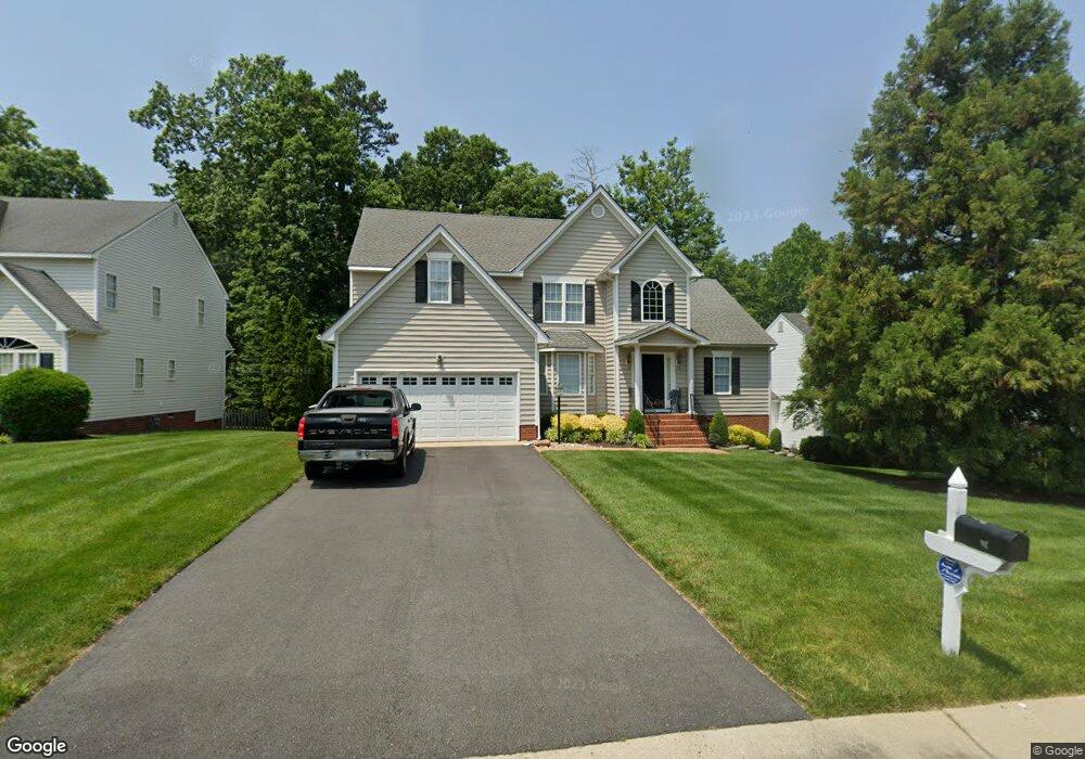
1318 Lomond Dr Midlothian, VA 23114
Estimated Value: $516,000 - $550,000
4
Beds
3
Baths
2,648
Sq Ft
$202/Sq Ft
Est. Value
About This Home
This home is located at 1318 Lomond Dr, Midlothian, VA 23114 and is currently estimated at $534,557, approximately $201 per square foot. 1318 Lomond Dr is a home located in Chesterfield County with nearby schools including W W Gordon Elementary School, Midlothian Middle School, and Monacan High School.
Ownership History
Date
Name
Owned For
Owner Type
Purchase Details
Closed on
May 23, 2022
Sold by
Marks Warren C and Marks Sue W
Bought by
Marks Warren C and Marks Sue W
Current Estimated Value
Purchase Details
Closed on
Jul 17, 2002
Sold by
Main Street Homes
Bought by
Marks Warren C and Marks Sue W
Home Financials for this Owner
Home Financials are based on the most recent Mortgage that was taken out on this home.
Original Mortgage
$87,000
Interest Rate
6.73%
Mortgage Type
New Conventional
Create a Home Valuation Report for This Property
The Home Valuation Report is an in-depth analysis detailing your home's value as well as a comparison with similar homes in the area
Home Values in the Area
Average Home Value in this Area
Purchase History
| Date | Buyer | Sale Price | Title Company |
|---|---|---|---|
| Marks Warren C | -- | None Listed On Document | |
| Marks Warren C | $229,700 | -- |
Source: Public Records
Mortgage History
| Date | Status | Borrower | Loan Amount |
|---|---|---|---|
| Previous Owner | Marks Warren C | $87,000 |
Source: Public Records
Tax History Compared to Growth
Tax History
| Year | Tax Paid | Tax Assessment Tax Assessment Total Assessment is a certain percentage of the fair market value that is determined by local assessors to be the total taxable value of land and additions on the property. | Land | Improvement |
|---|---|---|---|---|
| 2025 | $4,397 | $491,200 | $72,000 | $419,200 |
| 2024 | $4,397 | $457,600 | $67,000 | $390,600 |
| 2023 | $3,984 | $437,800 | $65,000 | $372,800 |
| 2022 | $3,608 | $392,200 | $62,000 | $330,200 |
| 2021 | $3,319 | $346,700 | $60,000 | $286,700 |
| 2020 | $3,294 | $346,700 | $60,000 | $286,700 |
| 2019 | $3,166 | $333,300 | $60,000 | $273,300 |
| 2018 | $3,069 | $323,000 | $60,000 | $263,000 |
| 2017 | $2,883 | $300,300 | $60,000 | $240,300 |
| 2016 | $2,820 | $293,800 | $60,000 | $233,800 |
| 2015 | $2,685 | $279,700 | $60,000 | $219,700 |
| 2014 | $2,675 | $278,600 | $60,000 | $218,600 |
Source: Public Records
Map
Nearby Homes
- 11625 Nevis Dr
- 1418 Crawford Wood Place
- 1526 Crawford Wood Dr
- 1009 Woodlet Meadow Ln
- 1002 Wedgemont Place
- 1606 Bantry Loop
- 11907 Exbury Ct
- 11301 Mansfield Crossing Ct
- 11933 Exbury Terrace
- 11950 Lucks Ln
- 11960 Lucks Ln
- 1937 Bantry Dr
- 11970 Lucks Ln
- 11120 Pennway Dr
- 1712 Porters Mill Ln
- 11101 Pennway Dr
- 11205 Lantern Way Unit B
- 1331 Burlington Rd
- 914 Spirea Rd
- 11312 McCauliff Ct