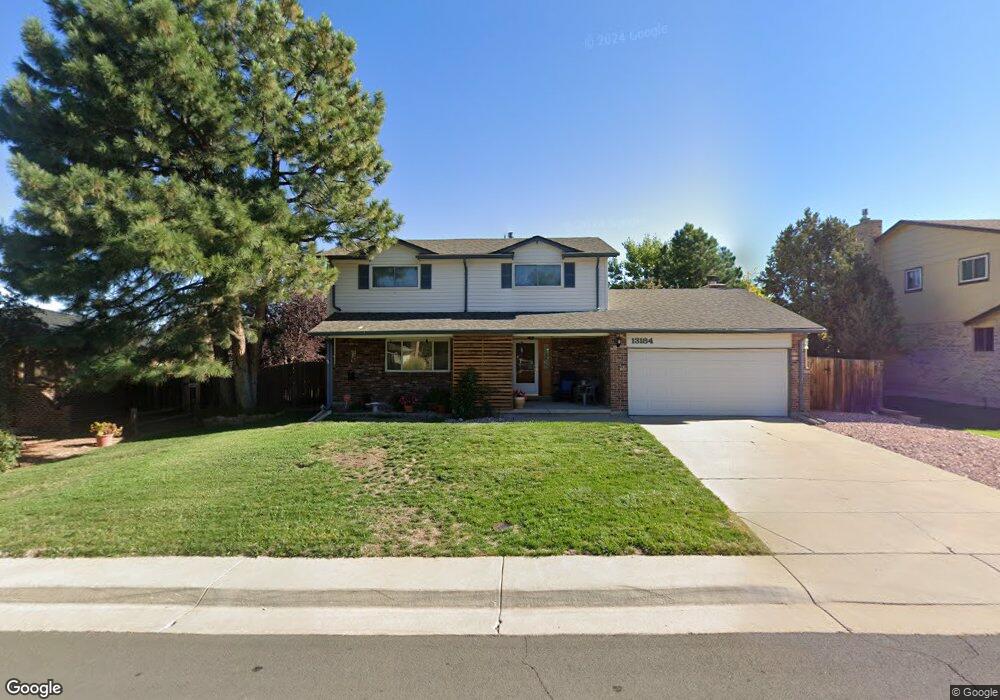
13184 Canopus Dr Lone Tree, CO 80124
Estimated Value: $581,000 - $590,800
4
Beds
3
Baths
1,981
Sq Ft
$296/Sq Ft
Est. Value
About This Home
This home is located at 13184 Canopus Dr, Lone Tree, CO 80124 and is currently estimated at $585,900, approximately $295 per square foot. 13184 Canopus Dr is a home located in Douglas County with nearby schools including Acres Green Elementary School, Cresthill Middle School, and Highlands Ranch High School.
Ownership History
Date
Name
Owned For
Owner Type
Purchase Details
Closed on
May 12, 1989
Sold by
Garrett John Harvey and Garrett Freda Sue
Bought by
Duguid John E and Duguid Linda S
Current Estimated Value
Purchase Details
Closed on
May 16, 1986
Sold by
Gibbons Gregory B and Gibbons Denise A
Bought by
Garrett John Harvey and Garrett Freda Sue
Purchase Details
Closed on
Jul 20, 1979
Sold by
Unavailable
Bought by
Unavailable
Create a Home Valuation Report for This Property
The Home Valuation Report is an in-depth analysis detailing your home's value as well as a comparison with similar homes in the area
Home Values in the Area
Average Home Value in this Area
Purchase History
| Date | Buyer | Sale Price | Title Company |
|---|---|---|---|
| Duguid John E | $88,500 | -- | |
| Garrett John Harvey | $102,000 | -- | |
| Unavailable | $71,500 | -- |
Source: Public Records
Tax History Compared to Growth
Tax History
| Year | Tax Paid | Tax Assessment Tax Assessment Total Assessment is a certain percentage of the fair market value that is determined by local assessors to be the total taxable value of land and additions on the property. | Land | Improvement |
|---|---|---|---|---|
| 2024 | $2,774 | $40,610 | $8,400 | $32,210 |
| 2023 | $2,803 | $40,610 | $8,400 | $32,210 |
| 2022 | $1,979 | $29,170 | $7,130 | $22,040 |
| 2021 | $2,058 | $29,170 | $7,130 | $22,040 |
| 2020 | $1,933 | $28,530 | $6,770 | $21,760 |
| 2019 | $1,940 | $28,530 | $6,770 | $21,760 |
| 2018 | $1,448 | $24,290 | $5,880 | $18,410 |
| 2017 | $1,472 | $24,290 | $5,880 | $18,410 |
| 2016 | $1,182 | $21,410 | $4,370 | $17,040 |
| 2015 | $1,209 | $21,410 | $4,370 | $17,040 |
| 2014 | $972 | $18,090 | $3,980 | $14,110 |
Source: Public Records
Map
Nearby Homes
- 789 Hamal Dr
- 979 Mercury Cir
- 7057 Chestnut Hill St
- 13134 Deneb Dr
- 202 Helena Cir
- 7971 Arrowhead Ct
- 7041 Chestnut Hill Trail
- 9275 Erminedale Dr
- 426 Jupiter Dr
- 8049 Sweet Water Rd
- 7804 Silverweed Way
- 13678 Omega Cir
- 8159 Lodgepole Trail
- 9416 Kemper Dr
- 7107 Mountain Brush Cir
- 9412 La Quinta Way
- 7151 Palisade Dr
- 250 Jupiter Dr
- 336 Aquarius Ct
- 7404 La Quinta Ln
- 13174 Canopus Dr
- 13194 Canopus Dr
- 13225 Peacock Dr
- 13235 Peacock Dr
- 13164 Canopus Dr
- 13226 Canopus Dr
- 13193 Peacock Dr
- 13183 Canopus Dr
- 13173 Canopus Dr
- 13245 Peacock Dr
- 13163 Canopus Dr
- 13193 Canopus Dr
- 13183 Peacock Dr
- 13154 Canopus Dr
- 13226 Peacock Dr
- 13236 Canopus Dr
- 13236 Peacock Dr
- 13255 Peacock Dr
- 13216 Peacock Dr
- 13154 Hadar Dr