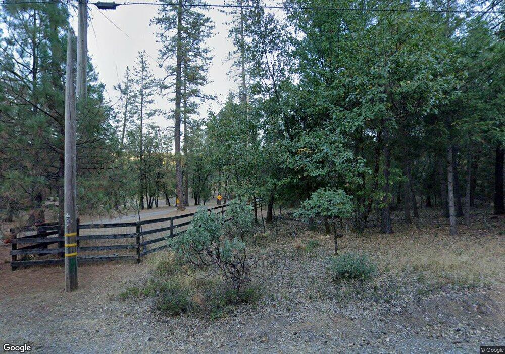
13189 Capitol Dr Grass Valley, CA 95945
Estimated Value: $679,000 - $1,034,000
3
Beds
2
Baths
2,650
Sq Ft
$307/Sq Ft
Est. Value
About This Home
This home is located at 13189 Capitol Dr, Grass Valley, CA 95945 and is currently estimated at $813,881, approximately $307 per square foot. 13189 Capitol Dr is a home located in Nevada County with nearby schools including Bell Hill Academy, Margaret G. Scotten Elementary School, and Lyman Gilmore Middle School.
Ownership History
Date
Name
Owned For
Owner Type
Purchase Details
Closed on
May 25, 2021
Sold by
Hedberg Mark Paul
Bought by
Hedberg Mark P and Mark P Hedberg Living Trust
Current Estimated Value
Purchase Details
Closed on
Jul 9, 2001
Sold by
Guthrie Martha M and Guthrie Richard A
Bought by
Hedberg Mark Paul
Purchase Details
Closed on
May 22, 1997
Sold by
Mackenzie Martha G and Mackenzie Martha G
Bought by
Guthrie Martha M and Guthrie Richard A
Create a Home Valuation Report for This Property
The Home Valuation Report is an in-depth analysis detailing your home's value as well as a comparison with similar homes in the area
Home Values in the Area
Average Home Value in this Area
Purchase History
| Date | Buyer | Sale Price | Title Company |
|---|---|---|---|
| Hedberg Mark P | -- | None Available | |
| Hedberg Mark Paul | $530,000 | California Land Title Co | |
| Guthrie Martha M | -- | Inter County Title Co |
Source: Public Records
Tax History Compared to Growth
Tax History
| Year | Tax Paid | Tax Assessment Tax Assessment Total Assessment is a certain percentage of the fair market value that is determined by local assessors to be the total taxable value of land and additions on the property. | Land | Improvement |
|---|---|---|---|---|
| 2025 | $8,437 | $782,800 | $279,937 | $502,863 |
| 2024 | $8,242 | $767,452 | $274,449 | $493,003 |
| 2023 | $8,242 | $752,405 | $269,068 | $483,337 |
| 2022 | $7,934 | $737,653 | $263,793 | $473,860 |
| 2021 | $7,744 | $723,190 | $258,621 | $464,569 |
| 2020 | $7,739 | $715,776 | $255,970 | $459,806 |
| 2019 | $7,418 | $701,742 | $250,951 | $450,791 |
| 2018 | $7,390 | $687,983 | $246,031 | $441,952 |
| 2017 | $7,095 | $674,494 | $241,207 | $433,287 |
| 2016 | $6,834 | $661,270 | $236,478 | $424,792 |
| 2015 | $6,739 | $651,338 | $232,926 | $418,412 |
| 2014 | $6,739 | $638,580 | $228,364 | $410,216 |
Source: Public Records
Map
Nearby Homes
- 14652 Carman Ct
- 14708 You Bet Rd
- 16621 Greenhorn Rd
- 14008 Sontag Hill Rd
- 12765 Rodriguez Ct
- 17631 Greenhorn Rd
- 12595 Blackberry Trail
- 14833 Quail Pointe Ln
- 16303 Jewett Ln
- 14115 Tahoe View Dr
- 17721 Knoll Top Dr
- 14173 Tahoe View Dr
- 13859 Peardale Ln
- 0 Belle Star Rd
- 13928 Manion Canyon Rd
- 13139 N Meadow View Dr
- 19344 Louis Rd
- 13787 Manion Canyon Rd
- 14295 Arrowhead Mine Rd
- 15397 Flying Cloud Dr
- 15051 Sure Bet Rd
- 13157 Capitol Dr
- 15100 Sure Bet Rd
- 13227 Capitol Dr
- 12999 Capitol Dr
- 15250 Sure Bet Rd
- 13218 Side Bet Dr
- 0 Rough & Ready Hwy Unit 6032796-11724106
- 13267 Osborne Hill Rd
- 0 N Auburn St Unit 222048235
- 0 Rough & Ready Hwy Unit 222046233
- 0 Rough & Ready Hwy Unit 222044826
- 14044 Belle Starr Rd
- 20710 Chalk Bluff Rd
- 420 No Name Dr
- 13326 Side Bet Dr
- 13022 Side Bet Dr
- 13287 Capitol Dr
