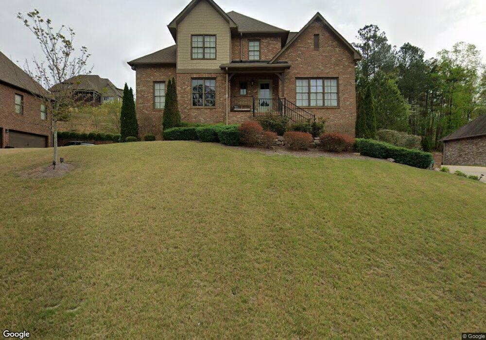
1319 Haddon Trail Unit H69 Birmingham, AL 35226
Ross Bridge NeighborhoodEstimated Value: $673,026 - $783,000
4
Beds
4
Baths
2,725
Sq Ft
$263/Sq Ft
Est. Value
About This Home
This home is located at 1319 Haddon Trail Unit H69, Birmingham, AL 35226 and is currently estimated at $717,507, approximately $263 per square foot. 1319 Haddon Trail Unit H69 is a home located in Jefferson County with nearby schools including Deer Valley Elementary School, Robert F. Bumpus Middle School, and Hoover High School.
Ownership History
Date
Name
Owned For
Owner Type
Purchase Details
Closed on
Oct 15, 2021
Sold by
Collins Paul A
Bought by
Furlong Robert Daniel and Furlong Jill D
Current Estimated Value
Home Financials for this Owner
Home Financials are based on the most recent Mortgage that was taken out on this home.
Original Mortgage
$460,000
Outstanding Balance
$419,477
Interest Rate
2.8%
Mortgage Type
New Conventional
Estimated Equity
$298,030
Purchase Details
Closed on
Oct 14, 2016
Sold by
Newcastle Construction Inc
Bought by
Collins Paul A and Collins Ashley
Home Financials for this Owner
Home Financials are based on the most recent Mortgage that was taken out on this home.
Original Mortgage
$316,000
Interest Rate
3.5%
Mortgage Type
New Conventional
Purchase Details
Closed on
Feb 5, 2013
Sold by
Ross Bridge Land Holdings
Bought by
Newcastle Construction Inc
Create a Home Valuation Report for This Property
The Home Valuation Report is an in-depth analysis detailing your home's value as well as a comparison with similar homes in the area
Home Values in the Area
Average Home Value in this Area
Purchase History
| Date | Buyer | Sale Price | Title Company |
|---|---|---|---|
| Furlong Robert Daniel | $575,000 | -- | |
| Collins Paul A | $395,000 | -- | |
| Newcastle Construction Inc | $337,500 | -- |
Source: Public Records
Mortgage History
| Date | Status | Borrower | Loan Amount |
|---|---|---|---|
| Open | Furlong Robert Daniel | $460,000 | |
| Previous Owner | Collins Paul A | $316,000 |
Source: Public Records
Tax History Compared to Growth
Tax History
| Year | Tax Paid | Tax Assessment Tax Assessment Total Assessment is a certain percentage of the fair market value that is determined by local assessors to be the total taxable value of land and additions on the property. | Land | Improvement |
|---|---|---|---|---|
| 2024 | $4,129 | $60,840 | -- | -- |
| 2022 | $3,759 | $52,490 | $14,410 | $38,080 |
| 2021 | $3,638 | $50,840 | $12,760 | $38,080 |
| 2020 | $3,520 | $49,080 | $11,000 | $38,080 |
| 2019 | $3,510 | $49,080 | $0 | $0 |
| 2018 | $3,314 | $46,380 | $0 | $0 |
| 2017 | $6,416 | $88,380 | $0 | $0 |
| 2016 | $6,059 | $83,460 | $0 | $0 |
| 2015 | $3,370 | $83,460 | $0 | $0 |
| 2014 | $272 | $7,500 | $0 | $0 |
| 2013 | $272 | $7,500 | $0 | $0 |
Source: Public Records
Map
Nearby Homes
- 1401 Haddon Place
- 1455 Haddon Cove
- 312 Shades Crest Rd
- 289 Shades Crest Rd
- 3686 James Hill Terrace
- 1776 Glasscott Trail
- 1791 Glasscott Trail
- 6189 Tilsley Ln Unit 6189
- 6177 Tilsley Ln Unit 6177
- 3930 James Hill Cir
- 3902 James Hill Cir
- 4297 Glasscott Crossing
- 1516 James Hill Way
- 1559 Olivewood Dr
- 1600 Timberview Rd
- 1636 Timberview Rd
- 2233 Farley Rd
- 4501 Mcgill Terrace Unit 25
- 2016 Chapel Rd
- 6188 Tilsley Ln Unit 6188
- 1319 Haddon Trail
- 1315 Haddon Trail
- 1323 Haddon Trail
- 1323 Haddon Trail Unit H68
- 1362 Haddon Place
- 1362 Haddon Place Unit H57
- 1366 Haddon Place
- 1366 Haddon Place Unit H58
- 1318 Haddon Trail Unit H118
- 1322 Haddon Trail
- 1322 Haddon Trail Unit H90
- 1318 Haddon Trail
- 1318 Haddon Trail Unit H118
- 1318 Haddon Trail Unit H89
- 1327 Haddon Trail
- 1327 Haddon Trail Unit H67
- 1311 Haddon Trail
- 1311 Haddon Trail Unit H71
- 1370 Haddon Place
- 1370 Haddon Place Unit H59