Estimated Value: $175,000 - $196,000
3
Beds
1
Bath
1,072
Sq Ft
$170/Sq Ft
Est. Value
About This Home
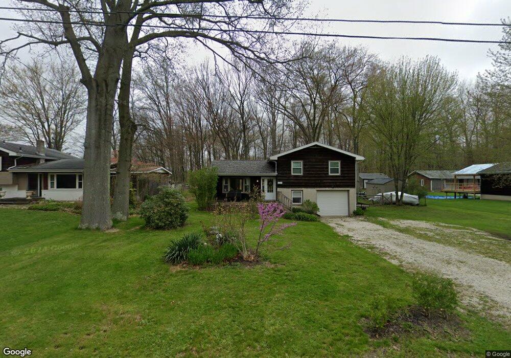
This home is located at 1319 Howe Rd, Kent, OH 44240 and is currently estimated at $182,240, approximately $170 per square foot. 1319 Howe Rd is a home located in Portage County with nearby schools including Brimfield Elementary School, Field Middle School, and Field High School.
Ownership History
Date
Name
Owned For
Owner Type
Purchase Details
Closed on
Oct 27, 2009
Sold by
Us Bank National Association
Bought by
Ruggles Richard G and Ruggles Robin B
Current Estimated Value
Purchase Details
Closed on
Oct 13, 2009
Sold by
Dick Philip J and Case #2007 Cv 01039
Bought by
Us Bank National Association
Purchase Details
Closed on
Aug 13, 2004
Sold by
Shaffer William R and Shaffer Roseanne E
Bought by
Dick Philip J
Home Financials for this Owner
Home Financials are based on the most recent Mortgage that was taken out on this home.
Original Mortgage
$132,421
Interest Rate
6.1%
Mortgage Type
FHA
Purchase Details
Closed on
Jun 2, 1989
Bought by
Shaffer William R
Create a Home Valuation Report for This Property
The Home Valuation Report is an in-depth analysis detailing your home's value as well as a comparison with similar homes in the area
Home Values in the Area
Average Home Value in this Area
Purchase History
| Date | Buyer | Sale Price | Title Company |
|---|---|---|---|
| Ruggles Richard G | $60,000 | Resource Title Agency Inc | |
| Us Bank National Association | $86,667 | None Available | |
| Dick Philip J | $134,625 | Buckeye Reserve Title Agency | |
| Shaffer William R | -- | -- |
Source: Public Records
Mortgage History
| Date | Status | Borrower | Loan Amount |
|---|---|---|---|
| Previous Owner | Dick Philip J | $132,421 |
Source: Public Records
Tax History Compared to Growth
Tax History
| Year | Tax Paid | Tax Assessment Tax Assessment Total Assessment is a certain percentage of the fair market value that is determined by local assessors to be the total taxable value of land and additions on the property. | Land | Improvement |
|---|---|---|---|---|
| 2024 | $2,762 | $56,560 | $10,850 | $45,710 |
| 2023 | $2,705 | $44,590 | $6,790 | $37,800 |
| 2022 | $2,712 | $44,590 | $6,790 | $37,800 |
| 2021 | $2,642 | $44,590 | $6,790 | $37,800 |
| 2020 | $2,293 | $35,000 | $6,790 | $28,210 |
| 2019 | $2,268 | $35,000 | $6,790 | $28,210 |
| 2018 | $1,659 | $30,170 | $6,790 | $23,380 |
| 2017 | $1,659 | $30,170 | $6,790 | $23,380 |
| 2016 | $1,654 | $30,170 | $6,790 | $23,380 |
| 2015 | $1,602 | $30,170 | $6,790 | $23,380 |
| 2014 | $1,548 | $30,170 | $6,790 | $23,380 |
| 2013 | $1,513 | $30,170 | $6,790 | $23,380 |
Source: Public Records
Map
Nearby Homes
- 4682 State Route 43
- 1354 Brimfield Dr
- Poplar Plan at Woodland Reserve
- Nassau Cove Plan at Woodland Reserve
- V/L Sherman Rd
- 4837 King Meadow Trail
- 847 Lakeview Ct
- 0 Meloy Rd Unit 5162435
- 1224 Cedar Ridge Rd
- 1236 Cedar Ridge Rd
- 1755 Honeychuck Ln
- 4649 Creekside Dr Unit 4649
- 4891 Edson Rd
- 1625 S Lincoln St
- 720 Ivan Dr
- 1587 Chadwick Rd
- 1024E Cedar Ridge Dr
- 1024A Cedar Ridge Dr
- 2092 Sugar Maple Dr
- 5123 Troyer Dr
- 1329 Howe Rd
- 1309 Howe Rd
- 1295 Howe Rd
- 1295 1297 Howe Rd
- .635 AC Howe Rd
- 0 Howe Rd Unit 4030772
- 0 Howe Rd Unit 4000914
- 0 Howe Rd Unit 5017764
- 0 Howe Rd Unit 4476294
- 0 Howe Rd Unit 4458234
- 0 Howe Rd Unit 4458229
- 0 Howe Rd Unit 4458227
- 0 Howe Rd Unit 4458225
- 0 Howe Rd Unit 4254181
- 0 Howe Rd Unit 4237788
- .57 AC Howe Rd
- 0 State Route 43 Unit 3689740
- 1324 Howe Rd
- 1354 Howe Rd
- 1367 Howe Rd