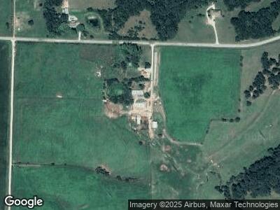
13193 F Hwy Bunceton, MO 65237
Estimated Value: $242,000 - $282,862
3
Beds
2
Baths
1,583
Sq Ft
$166/Sq Ft
Est. Value
About This Home
This home is located at 13193 F Hwy, Bunceton, MO 65237 and is currently estimated at $262,431, approximately $165 per square foot. 13193 F Hwy is a home located in Cooper County with nearby schools including Bunceton Elementary School and Bunceton High School.
Ownership History
Date
Name
Owned For
Owner Type
Purchase Details
Closed on
Nov 12, 2013
Sold by
Comegys Jason S and Comegys Logan L
Bought by
Garrison Mark W and Garrison Stacy
Current Estimated Value
Home Financials for this Owner
Home Financials are based on the most recent Mortgage that was taken out on this home.
Original Mortgage
$130,240
Outstanding Balance
$99,869
Interest Rate
4.34%
Mortgage Type
Stand Alone Refi Refinance Of Original Loan
Estimated Equity
$162,945
Create a Home Valuation Report for This Property
The Home Valuation Report is an in-depth analysis detailing your home's value as well as a comparison with similar homes in the area
Home Values in the Area
Average Home Value in this Area
Purchase History
| Date | Buyer | Sale Price | Title Company |
|---|---|---|---|
| Garrison Mark W | -- | -- |
Source: Public Records
Mortgage History
| Date | Status | Borrower | Loan Amount |
|---|---|---|---|
| Open | Garrison Mark W | $130,240 |
Source: Public Records
Tax History Compared to Growth
Tax History
| Year | Tax Paid | Tax Assessment Tax Assessment Total Assessment is a certain percentage of the fair market value that is determined by local assessors to be the total taxable value of land and additions on the property. | Land | Improvement |
|---|---|---|---|---|
| 2024 | $1,065 | $16,180 | $0 | $0 |
| 2023 | $1,065 | $16,180 | $0 | $0 |
| 2022 | $968 | $14,880 | $0 | $0 |
| 2021 | $960 | $14,880 | $0 | $0 |
| 2020 | $945 | $14,120 | $0 | $0 |
| 2019 | $938 | $14,120 | $520 | $13,600 |
| 2018 | $939 | $14,120 | $520 | $13,600 |
| 2017 | $938 | $14,120 | $520 | $13,600 |
| 2016 | -- | $14,120 | $0 | $0 |
| 2015 | -- | $14,120 | $0 | $0 |
| 2011 | -- | $13,670 | $0 | $0 |
Source: Public Records
Map
Nearby Homes
- 12251 Robien Dr
- 306 E Main St
- 12421 Lang Rd
- 13130 Old Highway 40
- LOT 205 Mid-America Industrial Ct
- LOT 202 Mid-America Industrial Ct
- LOT 17A Mid-America Industrial Ct
- LOT 16 Mid-America Industrial Ct
- 17380 Emily Ct
- 17382 Emily Ct
- LOT 207 Fuqua Dr
- 0 Americana
- 9904 Georgetown Dr
- 0 Legends West Ave & Kit Carson Dr Unit 24-424
- 0 Kit Carson Dr Unit 24-228
- 1704 Legends Ave W
- 2483 Greenside Dr
- 123 Santa fe Rd
- 17201 Rankin Mill Ln
- 1911 Chouteau Ln
- 13193 F Hwy
- 13221 F Hwy
- 13640 F Hwy
- 12839 Old Palistine Rd
- 11020 Pearl Ct
- 11042 Pearl Ct
- 11070 Pearl Ct
- 11058 Pearl Ct
- 11200 Pearl Ct
- 13961 New Palestine Rd
- 12999 Old Palistine Rd
- 11173 Pearl Ct
- 11251 Pearl Ct
- 13788 New Palestine Rd
- 13610 Vine Ct
- 13608 Vine Ct
- 13706 New Palestine Rd
- 13494 New Palestine Rd
- 10486 Osage Valley Rd
- 13414 Old Palistine Rd
