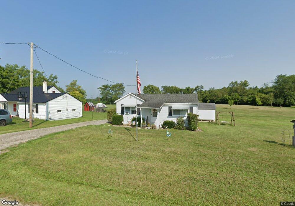
13196 Carson Rd Orient, OH 43146
Estimated Value: $177,000 - $239,000
1
Bed
1
Bath
640
Sq Ft
$318/Sq Ft
Est. Value
About This Home
This home is located at 13196 Carson Rd, Orient, OH 43146 and is currently estimated at $203,582, approximately $318 per square foot. 13196 Carson Rd is a home located in Pickaway County with nearby schools including Westfall Elementary School, Westfall Middle School, and Westfall High School.
Ownership History
Date
Name
Owned For
Owner Type
Purchase Details
Closed on
Jul 6, 2012
Sold by
Haag Ricky L
Bought by
Mcclain Douglas G
Current Estimated Value
Home Financials for this Owner
Home Financials are based on the most recent Mortgage that was taken out on this home.
Original Mortgage
$81,632
Outstanding Balance
$55,456
Interest Rate
3.64%
Mortgage Type
New Conventional
Estimated Equity
$148,126
Purchase Details
Closed on
Nov 17, 1998
Sold by
Haag Gary
Bought by
Haag Ricky L
Home Financials for this Owner
Home Financials are based on the most recent Mortgage that was taken out on this home.
Original Mortgage
$32,000
Interest Rate
6.68%
Mortgage Type
New Conventional
Purchase Details
Closed on
Aug 30, 1996
Sold by
Bowsher Ronald E
Bought by
Haag Gary and Haag Doris
Purchase Details
Closed on
Oct 1, 1990
Create a Home Valuation Report for This Property
The Home Valuation Report is an in-depth analysis detailing your home's value as well as a comparison with similar homes in the area
Purchase History
| Date | Buyer | Sale Price | Title Company |
|---|---|---|---|
| Mcclain Douglas G | $80,000 | Apex Title Agency Ltd | |
| Haag Ricky L | $32,000 | -- | |
| Haag Gary | $32,000 | -- | |
| -- | $14,900 | -- |
Source: Public Records
Mortgage History
| Date | Status | Borrower | Loan Amount |
|---|---|---|---|
| Open | Mcclain Douglas G | $81,632 | |
| Previous Owner | Haag Ricky L | $32,000 |
Source: Public Records
Tax History
| Year | Tax Paid | Tax Assessment Tax Assessment Total Assessment is a certain percentage of the fair market value that is determined by local assessors to be the total taxable value of land and additions on the property. | Land | Improvement |
|---|---|---|---|---|
| 2024 | -- | $50,590 | $26,280 | $24,310 |
| 2023 | $1,807 | $50,590 | $26,280 | $24,310 |
| 2022 | $1,424 | $36,010 | $17,530 | $18,480 |
| 2021 | $1,410 | $36,010 | $17,530 | $18,480 |
| 2020 | $1,413 | $36,010 | $17,530 | $18,480 |
| 2019 | $1,170 | $32,530 | $16,740 | $15,790 |
| 2018 | $1,266 | $32,530 | $16,740 | $15,790 |
| 2017 | $1,275 | $32,530 | $16,740 | $15,790 |
| 2016 | $1,075 | $28,140 | $14,760 | $13,380 |
| 2015 | $1,098 | $28,140 | $14,760 | $13,380 |
| 2014 | $965 | $24,980 | $14,760 | $10,220 |
| 2013 | $845 | $20,490 | $14,760 | $5,730 |
Source: Public Records
Map
Nearby Homes
- 6946 Harrisburg London Rd
- 1063 Springlawn Ave
- 6259 Cherokee Ln
- 6275 Cherokee Ln
- 8681 Larkspur Dr
- 8689 Larkspur Dr
- 6965 Gay Rd
- 8835 Iroquois Way
- 7879 Railroad St
- 12764 Cleo Rd
- 12635 Clark Dr
- 0 Opossum Run Rd Unit 5
- 7500 Opossum Run Rd Unit Lot 5
- 7500 Opossum Run Rd Unit Lot 1
- 0 Graessle Rd
- 6894 Biggert Rd
- 5653 Norton Rd
- 6616 London Groveport Rd
- 12500 London Rd
- 6106 London Groveport Rd Unit C9
- 13210 Carson Rd
- 13166 Carson Rd
- 13220 Carson Rd
- 13142 Carson Rd
- 13126 Carson Rd
- 13110 Carson Rd
- 13069 Carson Rd
- 13041 Carson Rd
- 12999 Carson Rd
- 13056 Carson Rd
- 13100 Carson Rd
- 13048 Carson Rd
- 12998 Carson Rd
- 9635 Us Highway 62
- 9635 U S 62 Unit 62
- 9621 U S 62 Unit 62
- 9621 Us Highway 62
- 9519 Us Highway 62
- 12946 Carson Rd
- 9628 Us Highway 62
