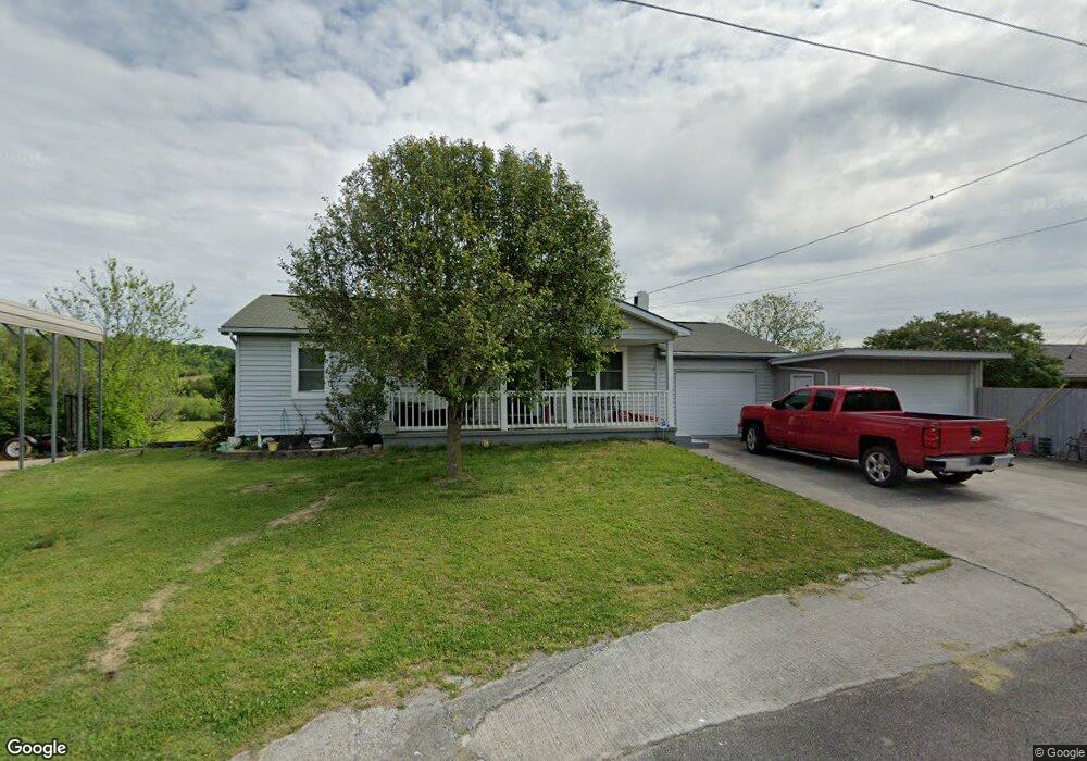
132 Brookfield Dr Newport, TN 37821
Estimated Value: $150,687 - $264,000
--
Bed
1
Bath
912
Sq Ft
$233/Sq Ft
Est. Value
About This Home
This home is located at 132 Brookfield Dr, Newport, TN 37821 and is currently estimated at $212,922, approximately $233 per square foot. 132 Brookfield Dr is a home located in Cocke County with nearby schools including Edgemont Elementary School, Cocke County High School, and Calvary Baptist Tabernacle School.
Ownership History
Date
Name
Owned For
Owner Type
Purchase Details
Closed on
Aug 25, 2016
Sold by
Shelton Jo Ann
Bought by
Smith Jack and Smith Ann
Current Estimated Value
Home Financials for this Owner
Home Financials are based on the most recent Mortgage that was taken out on this home.
Original Mortgage
$56,500
Outstanding Balance
$44,835
Interest Rate
3.48%
Mortgage Type
New Conventional
Estimated Equity
$168,087
Create a Home Valuation Report for This Property
The Home Valuation Report is an in-depth analysis detailing your home's value as well as a comparison with similar homes in the area
Home Values in the Area
Average Home Value in this Area
Purchase History
| Date | Buyer | Sale Price | Title Company |
|---|---|---|---|
| Smith Jack | $80,000 | -- |
Source: Public Records
Mortgage History
| Date | Status | Borrower | Loan Amount |
|---|---|---|---|
| Open | Smith Jack | $56,500 |
Source: Public Records
Tax History Compared to Growth
Tax History
| Year | Tax Paid | Tax Assessment Tax Assessment Total Assessment is a certain percentage of the fair market value that is determined by local assessors to be the total taxable value of land and additions on the property. | Land | Improvement |
|---|---|---|---|---|
| 2025 | $908 | $60,550 | $0 | $0 |
| 2024 | $596 | $23,300 | $2,500 | $20,800 |
| 2023 | $596 | $23,300 | $2,500 | $20,800 |
| 2022 | $598 | $23,300 | $2,500 | $20,800 |
| 2021 | $598 | $23,300 | $2,500 | $20,800 |
| 2020 | $598 | $23,300 | $2,500 | $20,800 |
| 2019 | $547 | $19,325 | $2,175 | $17,150 |
| 2018 | $547 | $19,325 | $2,175 | $17,150 |
| 2017 | $483 | $19,325 | $2,175 | $17,150 |
| 2016 | $431 | $16,650 | $2,175 | $14,475 |
| 2015 | $416 | $16,650 | $2,175 | $14,475 |
| 2014 | $416 | $16,650 | $2,175 | $14,475 |
| 2013 | $416 | $17,350 | $2,200 | $15,150 |
Source: Public Records
Map
Nearby Homes
- 140 Diamond Cir
- 205 Violet Dr
- 0 Industrial Rd Unit 256087
- 0 Industrial Rd Unit 256095
- 0 Industrial Rd Unit 256093
- 455 Highway 25e
- 105-109 Creek View Way
- 6acres Trentham Rd
- 6 acres Trentham Rd
- 535 Old Knoxville Hwy
- 152 Sulphur Springs Rd
- Par 152 Sulphur Springs Rd
- 364 Jasmine Dr
- 503 Long Cir
- 251 Huff Hollow Rd
- 1354 Splashaway Rd
- 127 Chipmunk Hollow Way
- 0 Overview Way Unit 307642
- Par 87.03 Overview Way
- Par 152 Sulpher Springs
- 130 Brookfield Dr
- 136 Brookfield Dr
- 137 Brookfield Dr
- 129 Brookfield Dr
- 133 Brookfield Dr
- 126 Brookfield Dr
- 142 Brookfield Dr
- 122 Brookfield Dr Unit 124
- 115 Brookfield Dr
- 146 Brookfield Dr
- 145 Brookfield Dr
- 140 Brookfield Dr
- 150 Brookfield Dr
- 149 Brookfield Dr
- 980 Thinwood Dr
- 154 Brookfield Dr
- 130 Diamond Cir
- 134 Diamond Cir
- 126 Diamond Cir
- 970 Thinwood Dr