Estimated Value: $297,000 - $373,000
2
Beds
3
Baths
1,500
Sq Ft
$229/Sq Ft
Est. Value
About This Home
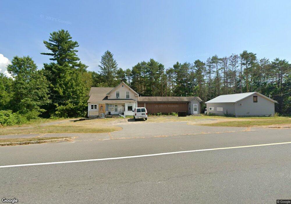
This home is located at 132 Brookside Rd, Athol, MA 01331 and is currently estimated at $342,966, approximately $228 per square foot. 132 Brookside Rd is a home located in Worcester County with nearby schools including Athol High School.
Ownership History
Date
Name
Owned For
Owner Type
Purchase Details
Closed on
Mar 24, 2000
Sold by
Richardson John E and Richardson Lois A
Bought by
Cormier A William
Current Estimated Value
Home Financials for this Owner
Home Financials are based on the most recent Mortgage that was taken out on this home.
Original Mortgage
$65,000
Outstanding Balance
$22,061
Interest Rate
8.31%
Mortgage Type
Purchase Money Mortgage
Estimated Equity
$320,905
Purchase Details
Closed on
Aug 12, 1991
Sold by
Richardson Realty Corp
Bought by
Todco Inc
Home Financials for this Owner
Home Financials are based on the most recent Mortgage that was taken out on this home.
Original Mortgage
$126,000
Interest Rate
9.58%
Mortgage Type
Purchase Money Mortgage
Purchase Details
Closed on
Jul 30, 1987
Sold by
Mr Moonlight Inc
Bought by
Richardson Realty Corp
Create a Home Valuation Report for This Property
The Home Valuation Report is an in-depth analysis detailing your home's value as well as a comparison with similar homes in the area
Home Values in the Area
Average Home Value in this Area
Purchase History
| Date | Buyer | Sale Price | Title Company |
|---|---|---|---|
| Cormier A William | $90,000 | -- | |
| Todco Inc | $140,000 | -- | |
| Richardson Realty Corp | $110,000 | -- |
Source: Public Records
Mortgage History
| Date | Status | Borrower | Loan Amount |
|---|---|---|---|
| Open | Richardson Realty Corp | $65,000 | |
| Previous Owner | Richardson Realty Corp | $126,000 |
Source: Public Records
Tax History
| Year | Tax Paid | Tax Assessment Tax Assessment Total Assessment is a certain percentage of the fair market value that is determined by local assessors to be the total taxable value of land and additions on the property. | Land | Improvement |
|---|---|---|---|---|
| 2025 | $3,554 | $279,600 | $51,900 | $227,700 |
| 2024 | $3,544 | $276,200 | $51,900 | $224,300 |
| 2023 | $3,542 | $252,300 | $37,600 | $214,700 |
| 2022 | $3,645 | $227,100 | $35,800 | $191,300 |
| 2021 | $2,986 | $169,100 | $32,600 | $136,500 |
| 2020 | $2,905 | $169,100 | $29,600 | $139,500 |
| 2019 | $2,698 | $154,600 | $28,000 | $126,600 |
| 2018 | $2,744 | $140,200 | $25,500 | $114,700 |
| 2017 | $2,785 | $136,500 | $25,500 | $111,000 |
| 2016 | $2,618 | $132,000 | $25,500 | $106,500 |
| 2015 | $2,512 | $132,000 | $25,500 | $106,500 |
| 2014 | $2,433 | $132,000 | $25,500 | $106,500 |
Source: Public Records
Map
Nearby Homes
- 1370 S Main St
- 1380 S Main St
- 245 Brookside Rd
- 277 Brookside Rd
- 1188 S Main St
- 1245 S Main St
- 289 Brookside Rd
- 0 Daniel Shays Hwy Unit 30668451
- 1 Brickyard Rd
- 2 Brickyard Rd
- 4 Brickyard Rd
- 3 Brickyard Rd
- 1187 S Main St
- 47 Daniel Shays Hwy
- 1146 S Main St
- 337 Brookside Rd
- 65 Fielding Way
- 46 Daniel Shays Hwy
- 67 Daniel Shays Hwy
- 191 Proctor Ave
Your Personal Tour Guide
Ask me questions while you tour the home.