Estimated Value: $802,771
--
Bed
2
Baths
13,322
Sq Ft
$60/Sq Ft
Est. Value
About This Home
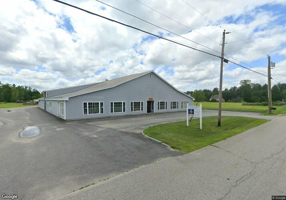
This home is located at 132 Cross Rd, Weare, NH 03281 and is currently estimated at $802,771, approximately $60 per square foot. 132 Cross Rd is a home located in Hillsborough County with nearby schools including Center Woods Elementary School, Weare Middle School, and John Stark Regional High School.
Ownership History
Date
Name
Owned For
Owner Type
Purchase Details
Closed on
Dec 28, 2020
Sold by
Knox R Jonh R and Knox Rodalyn
Bought by
Knox R Jonh R and Knox Rodalyn
Current Estimated Value
Purchase Details
Closed on
Jul 14, 2011
Sold by
Gmf Properties Llc
Bought by
Knox John and Knox Rodalyn
Purchase Details
Closed on
Mar 27, 2006
Sold by
Jones Allan Paul
Bought by
Gmf Props Llc
Create a Home Valuation Report for This Property
The Home Valuation Report is an in-depth analysis detailing your home's value as well as a comparison with similar homes in the area
Home Values in the Area
Average Home Value in this Area
Purchase History
| Date | Buyer | Sale Price | Title Company |
|---|---|---|---|
| Knox R Jonh R | -- | None Available | |
| Knox John | $350,000 | -- | |
| Gmf Props Llc | $350,000 | -- |
Source: Public Records
Mortgage History
| Date | Status | Borrower | Loan Amount |
|---|---|---|---|
| Previous Owner | Gmf Props Llc | $75,400 |
Source: Public Records
Tax History Compared to Growth
Tax History
| Year | Tax Paid | Tax Assessment Tax Assessment Total Assessment is a certain percentage of the fair market value that is determined by local assessors to be the total taxable value of land and additions on the property. | Land | Improvement |
|---|---|---|---|---|
| 2024 | $8,405 | $412,200 | $135,700 | $276,500 |
| 2023 | $7,766 | $412,200 | $135,700 | $276,500 |
| 2022 | $7,172 | $412,200 | $135,700 | $276,500 |
| 2021 | $7,090 | $412,200 | $135,700 | $276,500 |
| 2020 | $9,115 | $380,600 | $105,700 | $274,900 |
| 2019 | $10,454 | $440,900 | $105,700 | $335,200 |
| 2018 | $10,154 | $440,900 | $105,700 | $335,200 |
| 2016 | $10,174 | $454,800 | $119,600 | $335,200 |
| 2015 | $8,534 | $380,800 | $77,700 | $303,100 |
| 2014 | $8,458 | $380,800 | $77,700 | $303,100 |
| 2013 | $8,282 | $380,800 | $77,700 | $303,100 |
Source: Public Records
Map
Nearby Homes
- 0 Als Dr Unit 196
- 57 Lyndsey Ln
- 40 N Woods Rd
- 0 Huntington Hill Rd Unit 69
- 849 River Rd
- 92 Woodbury Rd
- 233 N Stark Hwy
- 464 Irish Hill Rd
- 49 Stark Hwy N
- 10 Sap House Rd
- 256 Irish Hill Rd
- 1003 School St
- 541 South Rd
- 256-0-17 Jewett Rd
- 15 Robert Rogers Rd
- I3-03-05 Clinton St
- 250 Grapevine Rd
- 0 Farrington Corner Rd Unit 14
- 3 Stephanie Rd
- 102 Fieldstone Rd
- 131 Cross Rd
- 111 Cross Rd
- 112 Cross Rd
- 175 Cross Rd
- 238 S Sugar Hill Rd
- 198 S Sugar Hill Rd
- 192 S Sugar Hill Rd
- 248 S Sugar Hill Rd
- 178 S Sugar Hill Rd
- 29 Als Dr
- 25 Als Dr
- 406-3 S Sugar Hill Rd
- 164 S Sugar Hill Rd
- 165 S Sugar Hill Rd
- 152 S Sugar Hill Rd
- 66 Dunbar Rd
- 22 Als Dr
- 31 Sewell Hoyt Rd
- 37 Als Dr
- 159 S Sugar Hill Rd