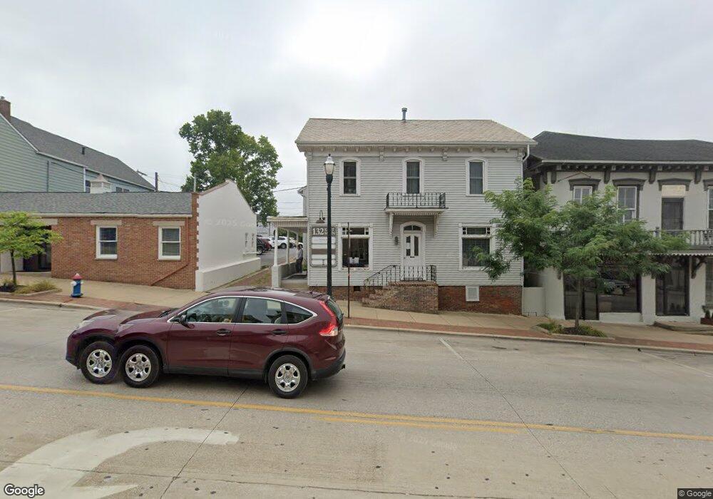
132 E Main St Unit Floor 1 Lancaster, OH 43130
Studio
--
Bath
4,227
Sq Ft
7,841
Sq Ft Lot
About This Home
This home is located at 132 E Main St Unit Floor 1, Lancaster, OH 43130. 132 E Main St Unit Floor 1 is a home located in Fairfield County with nearby schools including Thomas Ewing Junior High School, Lancaster High School, and St Mary Elementary School.
Ownership History
Date
Name
Owned For
Owner Type
Purchase Details
Closed on
Nov 16, 2017
Sold by
Square 13 Properties Ltd
Bought by
Skyhunt Holdings Llc
Home Financials for this Owner
Home Financials are based on the most recent Mortgage that was taken out on this home.
Original Mortgage
$169,470
Outstanding Balance
$118,844
Interest Rate
3.85%
Mortgage Type
Commercial
Purchase Details
Closed on
Feb 29, 1996
Sold by
132 East Main St Co
Bought by
Square 13 Properties Ltd
Home Financials for this Owner
Home Financials are based on the most recent Mortgage that was taken out on this home.
Original Mortgage
$200,000
Interest Rate
7.07%
Mortgage Type
Commercial
Create a Home Valuation Report for This Property
The Home Valuation Report is an in-depth analysis detailing your home's value as well as a comparison with similar homes in the area
Home Values in the Area
Average Home Value in this Area
Purchase History
| Date | Buyer | Sale Price | Title Company |
|---|---|---|---|
| Skyhunt Holdings Llc | $117,500 | Hocking Valley Title Agency | |
| Square 13 Properties Ltd | $176,000 | -- |
Source: Public Records
Mortgage History
| Date | Status | Borrower | Loan Amount |
|---|---|---|---|
| Open | Skyhunt Holdings Llc | $169,470 | |
| Previous Owner | Square 13 Properties Ltd | $200,000 |
Source: Public Records
Tax History
| Year | Tax Paid | Tax Assessment Tax Assessment Total Assessment is a certain percentage of the fair market value that is determined by local assessors to be the total taxable value of land and additions on the property. | Land | Improvement |
|---|---|---|---|---|
| 2025 | $5,235 | $81,580 | $31,700 | $49,880 |
| 2024 | $5,235 | $58,230 | $17,640 | $40,590 |
| 2023 | $3,508 | $58,230 | $17,640 | $40,590 |
| 2022 | $3,511 | $58,230 | $17,640 | $40,590 |
| 2021 | $3,563 | $58,230 | $17,640 | $40,590 |
| 2020 | $3,793 | $58,230 | $17,640 | $40,590 |
| 2019 | $3,669 | $58,230 | $17,640 | $40,590 |
| 2018 | $3,811 | $58,430 | $17,640 | $40,790 |
| 2017 | $4,014 | $67,270 | $17,640 | $49,630 |
| 2016 | $3,906 | $67,270 | $17,640 | $49,630 |
| 2015 | $3,130 | $67,270 | $17,640 | $49,630 |
| 2014 | $2,991 | $67,270 | $17,640 | $49,630 |
| 2013 | $2,991 | $67,270 | $17,640 | $49,630 |
Source: Public Records
Map
Nearby Homes
- 154 E Main St
- 0 N Columbus St
- 342 E Chestnut St
- 249 N Pearl Ave
- 414 E Walnut St
- 429 E Locust St
- 335 Whiley Ave
- 153 King St
- 515 E Chestnut St
- 0 Slocum Ave
- 534 E Wheeling St
- 233 Union St
- 233 Lewis Ave
- 515 N Columbus St
- 526 N Columbus St
- 547 E Mulberry St
- 600 N High St
- 517 N Maple St
- 621 E Mulberry St
- 627 N Columbus St
- 132 E Main St
- 132 E Main St Unit Floor 2
- 124 E Main St
- 118 E Main St
- 112 E Main St
- 112 E Main St
- 112 E Main St
- 112 E Main St Unit First Floor
- 112 E Main St Unit Second Floor
- 112 E Main St Unit 200
- 139 E Chestnut St
- 111 E Main St
- 143 E Chestnut St
- 125 S High St
- 125 S High St
- 129 E Chestnut St
- 149 E Chestnut St
- 129 E Main St
- 135 E Chestnut St
- 2370 NE 2370 Scenic Dr
Your Personal Tour Guide
Ask me questions while you tour the home.