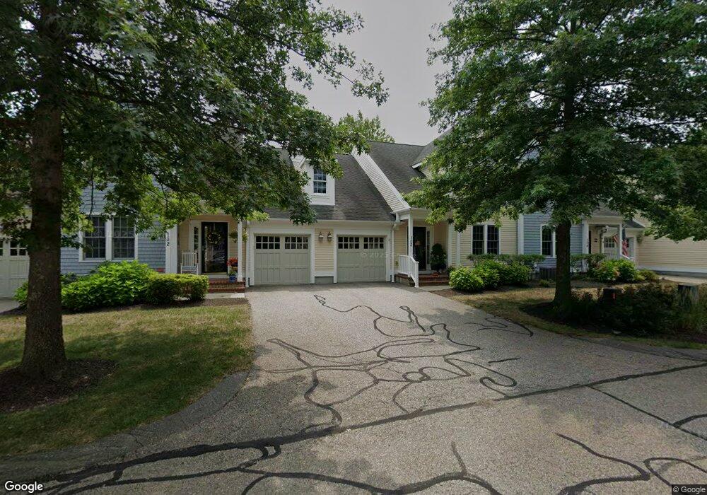
132 Godfrey Dr Norton, MA 02766
Estimated Value: $557,108 - $612,000
2
Beds
3
Baths
1,622
Sq Ft
$363/Sq Ft
Est. Value
About This Home
This home is located at 132 Godfrey Dr, Norton, MA 02766 and is currently estimated at $589,527, approximately $363 per square foot. 132 Godfrey Dr is a home located in Bristol County with nearby schools including J.C. Solmonese Elementary School, Henri A. Yelle Elementary School, and Norton Middle School.
Ownership History
Date
Name
Owned For
Owner Type
Purchase Details
Closed on
Sep 11, 2023
Sold by
Perry Carol
Bought by
Crowe Robyn R and Perry Christopher M
Current Estimated Value
Home Financials for this Owner
Home Financials are based on the most recent Mortgage that was taken out on this home.
Original Mortgage
$1
Outstanding Balance
$1
Interest Rate
6.96%
Mortgage Type
Stand Alone Refi Refinance Of Original Loan
Purchase Details
Closed on
Jun 27, 2005
Sold by
Barney Jacqueline J
Bought by
Perry Carol
Home Financials for this Owner
Home Financials are based on the most recent Mortgage that was taken out on this home.
Original Mortgage
$110,000
Interest Rate
5.82%
Mortgage Type
Purchase Money Mortgage
Purchase Details
Closed on
Apr 27, 2004
Sold by
Thorndike Prop Of Mass
Bought by
Barney Jacqueline J
Create a Home Valuation Report for This Property
The Home Valuation Report is an in-depth analysis detailing your home's value as well as a comparison with similar homes in the area
Home Values in the Area
Average Home Value in this Area
Purchase History
| Date | Buyer | Sale Price | Title Company |
|---|---|---|---|
| Crowe Robyn R | -- | None Available | |
| Perry Carol | $380,000 | -- | |
| Barney Jacqueline J | $365,255 | -- |
Source: Public Records
Mortgage History
| Date | Status | Borrower | Loan Amount |
|---|---|---|---|
| Open | Crowe Robyn R | $1 | |
| Previous Owner | Perry Carol | $110,000 |
Source: Public Records
Tax History Compared to Growth
Tax History
| Year | Tax Paid | Tax Assessment Tax Assessment Total Assessment is a certain percentage of the fair market value that is determined by local assessors to be the total taxable value of land and additions on the property. | Land | Improvement |
|---|---|---|---|---|
| 2025 | $61 | $473,900 | $0 | $473,900 |
| 2024 | $5,960 | $460,200 | $0 | $460,200 |
| 2023 | $5,623 | $432,900 | $0 | $432,900 |
| 2022 | $5,800 | $406,700 | $0 | $406,700 |
| 2021 | $5,632 | $377,200 | $0 | $377,200 |
| 2020 | $5,495 | $371,300 | $0 | $371,300 |
| 2019 | $5,354 | $359,300 | $0 | $359,300 |
| 2018 | $5,265 | $347,300 | $0 | $347,300 |
| 2017 | $5,040 | $327,900 | $0 | $327,900 |
| 2016 | $5,075 | $325,100 | $0 | $325,100 |
| 2015 | $4,682 | $304,200 | $0 | $304,200 |
| 2014 | $4,543 | $295,600 | $0 | $295,600 |
Source: Public Records
Map
Nearby Homes
- 157 Mansfield Ave Unit 14
- 93 Mansfield Ave
- 15 Reservoir St Unit 44
- 21 Juniper Rd
- 15 Patten Rd
- 18 Columbine Rd
- Lot 3 Birch Ln
- 15 Rock Ln
- 37 Oakleaf Dr
- 10 Ridge Rd
- 0 Brook Pkwy
- 14 Country Club Way
- 12 Sylvan Rd
- 23 Indian Rd
- 2 Oak St Unit 2D
- 2 Oak St Unit 2A
- 2 Oak St Unit 2B
- 176 Elm St
- 16 Park Ln
- 4 Village Way Unit F
- 135 Godfrey Dr
- 134 Godfrey Dr
- 133 Godfrey Dr
- 131 Godfrey Dr
- 156 Godfrey Dr
- 155 Godfrey Dr
- 154 Godfrey Dr
- 153 Godfrey Dr
- 152 Godfrey Dr
- 151 Godfrey Dr
- 151 Godfrey Dr Unit Wheaton:151
- 152 Godfrey Drive Barker Unit 2,15
- 76 Godfrey Dr
- 75 Godfrey Dr
- 74 Godfrey Dr
- 72 Godfrey Dr
- 71 Godfrey Dr
- 176 Godfrey Dr
- 175 Godfrey Dr
- 174 Godfrey Dr