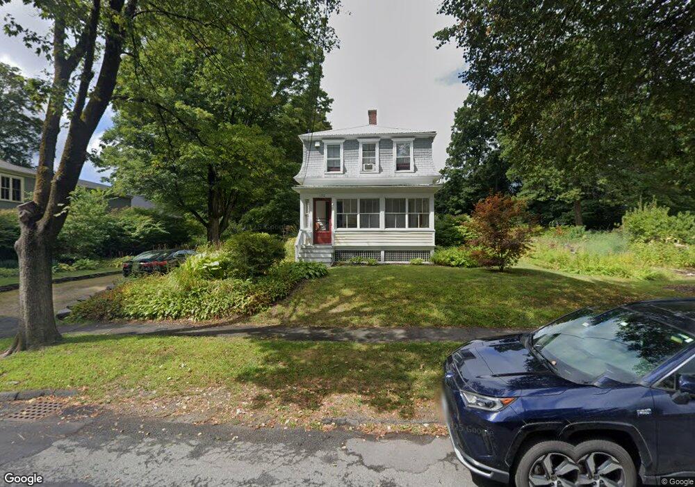
132 High St Amherst, MA 01002
Estimated Value: $570,000 - $700,000
3
Beds
2
Baths
2,210
Sq Ft
$292/Sq Ft
Est. Value
About This Home
This home is located at 132 High St, Amherst, MA 01002 and is currently estimated at $644,333, approximately $291 per square foot. 132 High St is a home located in Hampshire County with nearby schools including Wildwood Elementary School, Amherst Regional Middle School, and Amherst Regional High School.
Ownership History
Date
Name
Owned For
Owner Type
Purchase Details
Closed on
Dec 9, 2024
Sold by
Moll Robert N and Folsom Rachel A
Bought by
Moll-Folsom Ft and Moll
Current Estimated Value
Purchase Details
Closed on
Apr 30, 1984
Bought by
Moll Robert N and Folsom Rachel A
Create a Home Valuation Report for This Property
The Home Valuation Report is an in-depth analysis detailing your home's value as well as a comparison with similar homes in the area
Home Values in the Area
Average Home Value in this Area
Purchase History
| Date | Buyer | Sale Price | Title Company |
|---|---|---|---|
| Moll-Folsom Ft | -- | None Available | |
| Moll-Folsom Ft | -- | None Available | |
| Moll Robert N | $79,000 | -- |
Source: Public Records
Mortgage History
| Date | Status | Borrower | Loan Amount |
|---|---|---|---|
| Previous Owner | Moll Robert N | $100,000 |
Source: Public Records
Tax History
| Year | Tax Paid | Tax Assessment Tax Assessment Total Assessment is a certain percentage of the fair market value that is determined by local assessors to be the total taxable value of land and additions on the property. | Land | Improvement |
|---|---|---|---|---|
| 2025 | $101 | $562,300 | $204,100 | $358,200 |
| 2024 | $9,827 | $530,900 | $192,600 | $338,300 |
| 2023 | $9,425 | $468,900 | $175,200 | $293,700 |
| 2022 | $9,169 | $431,100 | $159,200 | $271,900 |
| 2021 | $8,763 | $401,600 | $147,600 | $254,000 |
| 2020 | $8,562 | $401,600 | $147,600 | $254,000 |
| 2019 | $8,264 | $379,100 | $147,600 | $231,500 |
| 2018 | $8,014 | $379,100 | $147,600 | $231,500 |
| 2017 | $7,876 | $360,800 | $140,600 | $220,200 |
| 2016 | $7,656 | $360,800 | $140,600 | $220,200 |
| 2015 | $7,411 | $360,800 | $140,600 | $220,200 |
Source: Public Records
Map
Nearby Homes
- 48 Gray St
- 0 Red Gate Ln Unit 73348273
- 60 Red Gate Ln
- 242 N East St Unit 24
- 0 Main St
- 50 Mount Pleasant
- 174 Lincoln Ave
- 75 Amity Place Unit 75
- 63 Amity Place Unit 63
- 310 Belchertown Rd
- 0 Heatherstone Rd
- 0 Amherst Rd
- 185 Cherry Ln
- 9 Harkness Rd
- 204 Aubinwood Rd
- 24 Greenleaves Dr Unit 418
- 26 Greenleaves Dr Unit 635
- 26 Greenleaves Dr Unit 624
- 30 Greenleaves Dr
- 27 Greenleaves Dr Unit 726
Your Personal Tour Guide
Ask me questions while you tour the home.