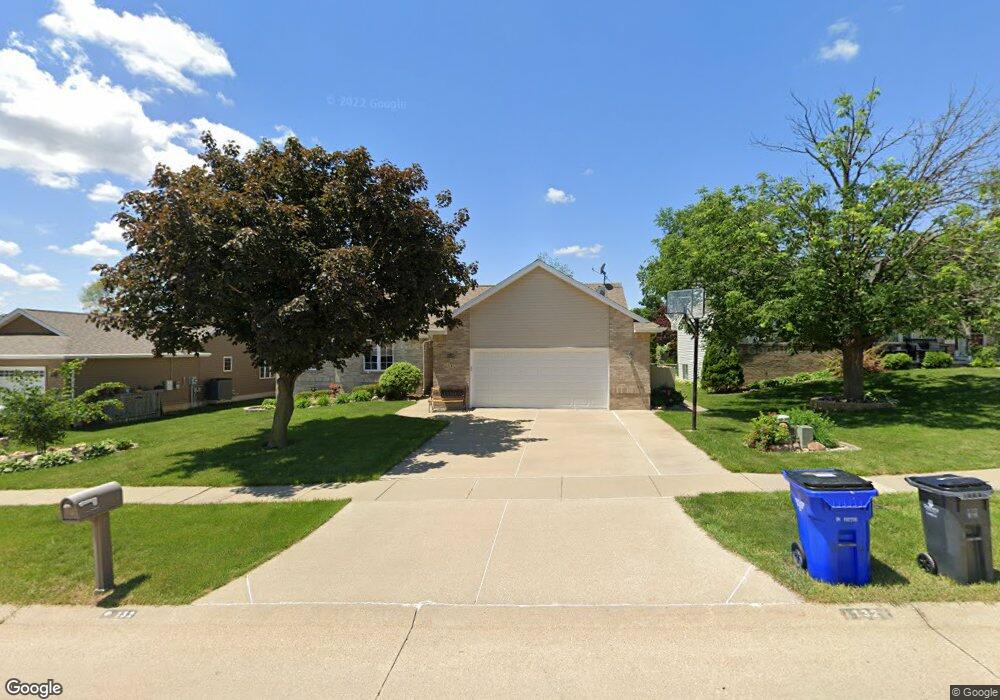
132 Jacob Ct NW Cedar Rapids, IA 52405
Estimated Value: $293,377 - $337,000
4
Beds
4
Baths
1,745
Sq Ft
$179/Sq Ft
Est. Value
About This Home
This home is located at 132 Jacob Ct NW, Cedar Rapids, IA 52405 and is currently estimated at $312,094, approximately $178 per square foot. 132 Jacob Ct NW is a home located in Linn County with nearby schools including Junction City Elementary School, Cleveland Elementary School, and Kentucky Tech - Ashland Reg Tech Center.
Ownership History
Date
Name
Owned For
Owner Type
Purchase Details
Closed on
May 28, 2008
Sold by
Wolff Jeffrey D and Wolff Penny A
Bought by
Tudor Leann R and Fite Peggy S
Current Estimated Value
Home Financials for this Owner
Home Financials are based on the most recent Mortgage that was taken out on this home.
Original Mortgage
$228,494
Outstanding Balance
$146,923
Interest Rate
6.09%
Mortgage Type
FHA
Estimated Equity
$165,171
Create a Home Valuation Report for This Property
The Home Valuation Report is an in-depth analysis detailing your home's value as well as a comparison with similar homes in the area
Home Values in the Area
Average Home Value in this Area
Purchase History
| Date | Buyer | Sale Price | Title Company |
|---|---|---|---|
| Tudor Leann R | $230,000 | None Available |
Source: Public Records
Mortgage History
| Date | Status | Borrower | Loan Amount |
|---|---|---|---|
| Open | Tudor Leann R | $228,494 |
Source: Public Records
Tax History Compared to Growth
Tax History
| Year | Tax Paid | Tax Assessment Tax Assessment Total Assessment is a certain percentage of the fair market value that is determined by local assessors to be the total taxable value of land and additions on the property. | Land | Improvement |
|---|---|---|---|---|
| 2025 | $4,254 | $299,500 | $45,700 | $253,800 |
| 2024 | $4,722 | $259,500 | $39,800 | $219,700 |
| 2023 | $4,722 | $259,500 | $39,800 | $219,700 |
| 2022 | $4,216 | $236,100 | $39,800 | $196,300 |
| 2021 | $4,392 | $215,900 | $35,800 | $180,100 |
| 2020 | $4,392 | $210,900 | $31,800 | $179,100 |
| 2019 | $4,012 | $197,900 | $31,800 | $166,100 |
| 2018 | $3,896 | $197,900 | $31,800 | $166,100 |
| 2017 | $3,922 | $191,900 | $31,800 | $160,100 |
| 2016 | $4,103 | $196,400 | $31,800 | $164,600 |
| 2015 | $4,157 | $198,656 | $31,800 | $166,856 |
| 2014 | $3,972 | $198,656 | $31,800 | $166,856 |
| 2013 | $3,880 | $198,656 | $31,800 | $166,856 |
Source: Public Records
Map
Nearby Homes
- 225 31st St NW
- 3013 Sue Ln NW
- 232 27th St NW
- 3107 Johnson Ave NW Unit 4
- 159 26th St NW
- 201 Edgewood Rd NW
- 312 24th Ave NW
- 3416 Sue Ln NW
- 327 NW Edgewood Rd Unit 324, 330, 336, 342 C
- 425 28th St NW
- 2433 8th Ave SW
- 2437 9th Ave SW
- 3403 1st Ave SW
- 1410 Adair Ct SW Unit Lot 2
- 3600 Midway Dr NW
- 3109 12th Ave SW
- 615 27th St NW
- 623 27th St NW
- 451 23rd St NW
- 3509 E Ave NW Unit D
- 138 Jacob Ct NW
- 126 Jacob Ct NW
- 3004 Dennis Dr NW
- 143 31st St NW
- 129 Jacob Ct NW
- 123 Jacob Ct NW
- 135 Jacob Ct NW
- 127 31st St NW
- 151 31st St NW
- 144 Jacob Ct NW
- 2923 Dennis Dr NW
- 2917 Dennis Dr NW
- 3007 Dennis Dr NW
- 159 31st St NW
- 2911 Dennis Dr NW
- 111 31st St NW
- 2814 Dennis Dr NW
- 223 31st St NW
- 2905 Dennis Dr NW
- 103 31st St NW