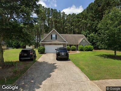
132 Laurel Ln Social Circle, GA 30025
Social Circle NeighborhoodEstimated Value: $349,399 - $429,000
4
Beds
3
Baths
2,060
Sq Ft
$189/Sq Ft
Est. Value
About This Home
This home is located at 132 Laurel Ln, Social Circle, GA 30025 and is currently estimated at $388,600, approximately $188 per square foot. 132 Laurel Ln is a home located in Walton County with nearby schools including Social Circle Primary School, Social Circle Elementary School, and Social Circle Middle School.
Ownership History
Date
Name
Owned For
Owner Type
Purchase Details
Closed on
Jul 21, 2010
Sold by
Glass Tracey
Bought by
Boyter Ginger B
Current Estimated Value
Home Financials for this Owner
Home Financials are based on the most recent Mortgage that was taken out on this home.
Original Mortgage
$152,071
Outstanding Balance
$104,407
Interest Rate
4.62%
Mortgage Type
FHA
Estimated Equity
$252,162
Purchase Details
Closed on
Jul 26, 2004
Sold by
Eastside Bldg Contractors Inc
Bought by
Fuchs Tracey G
Home Financials for this Owner
Home Financials are based on the most recent Mortgage that was taken out on this home.
Original Mortgage
$113,650
Interest Rate
6.22%
Mortgage Type
New Conventional
Purchase Details
Closed on
Feb 6, 2004
Sold by
Cps Ptnrs Unlimited Llc
Bought by
Eastside Bldg Contractors Inc
Create a Home Valuation Report for This Property
The Home Valuation Report is an in-depth analysis detailing your home's value as well as a comparison with similar homes in the area
Home Values in the Area
Average Home Value in this Area
Purchase History
| Date | Buyer | Sale Price | Title Company |
|---|---|---|---|
| Boyter Ginger B | $154,200 | -- | |
| Fuchs Tracey G | $142,100 | -- | |
| Eastside Bldg Contractors Inc | $124,000 | -- |
Source: Public Records
Mortgage History
| Date | Status | Borrower | Loan Amount |
|---|---|---|---|
| Open | Boyter Ginger B | $152,071 | |
| Previous Owner | Fughs Tracey G | $149,200 | |
| Previous Owner | Fughs Tracey G | $27,975 | |
| Previous Owner | Fuchs Tracey G | $30,000 | |
| Previous Owner | Fuchs Tracey G | $113,650 |
Source: Public Records
Tax History Compared to Growth
Tax History
| Year | Tax Paid | Tax Assessment Tax Assessment Total Assessment is a certain percentage of the fair market value that is determined by local assessors to be the total taxable value of land and additions on the property. | Land | Improvement |
|---|---|---|---|---|
| 2024 | $3,945 | $129,000 | $24,000 | $105,000 |
| 2023 | $3,781 | $119,680 | $22,000 | $97,680 |
| 2022 | $699 | $98,000 | $17,000 | $81,000 |
| 2021 | $699 | $85,240 | $15,200 | $70,040 |
| 2020 | $717 | $78,160 | $14,000 | $64,160 |
| 2019 | $732 | $70,040 | $12,000 | $58,040 |
| 2018 | $720 | $70,040 | $12,000 | $58,040 |
| 2017 | $2,840 | $67,960 | $12,000 | $55,960 |
| 2016 | $661 | $62,400 | $12,000 | $50,400 |
| 2015 | $538 | $51,800 | $8,000 | $43,800 |
| 2014 | $515 | $47,320 | $0 | $0 |
Source: Public Records
Map
Nearby Homes
- 116 Laurel Ln
- 100 St Andrew's
- 207 Tan Yard Rd
- 509 Cowpens Rd
- 531 Walton Dr
- 531 Lindsey Way
- 376 Lakewood Dr SW
- 159 S Forest Ave
- 237 Park Place Trail
- 453 Crossroads Dr
- 210 Park Place Trail
- 853 Crossroads Ct
- 843 Crossroads Ct
- 741 Jackson Ct
- 967 Park Place St
- 213 W Hightower Trail
- 815 Crossroads Ct
- 939 Park Place St
- 960 Park Place St
- 960 Park Place St Unit 120