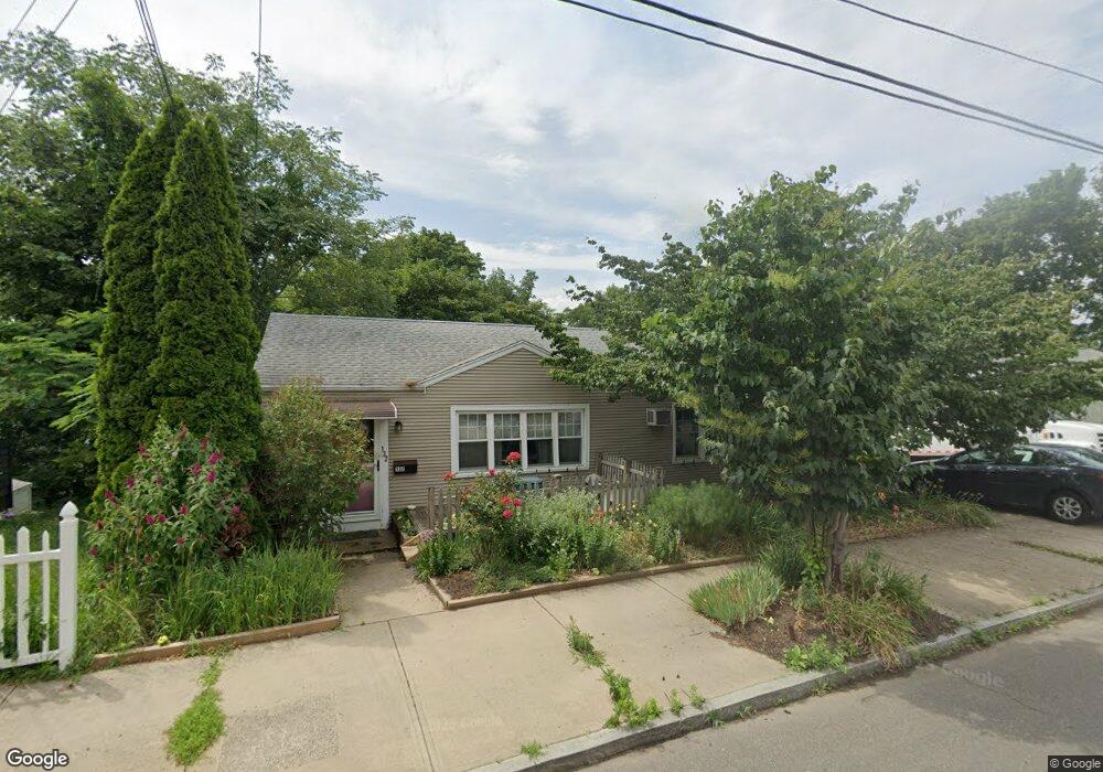
132 Lenox St New Haven, CT 06513
Fair Haven Heights NeighborhoodEstimated Value: $257,000 - $347,000
3
Beds
1
Bath
1,040
Sq Ft
$283/Sq Ft
Est. Value
About This Home
This home is located at 132 Lenox St, New Haven, CT 06513 and is currently estimated at $293,973, approximately $282 per square foot. 132 Lenox St is a home located in New Haven County with nearby schools including Ross Woodward, Cold Spring School, and All Nations Christian Academy.
Ownership History
Date
Name
Owned For
Owner Type
Purchase Details
Closed on
Sep 26, 2000
Sold by
Votto Richard E
Bought by
Hirshman Rhea
Current Estimated Value
Create a Home Valuation Report for This Property
The Home Valuation Report is an in-depth analysis detailing your home's value as well as a comparison with similar homes in the area
Home Values in the Area
Average Home Value in this Area
Purchase History
| Date | Buyer | Sale Price | Title Company |
|---|---|---|---|
| Hirshman Rhea | $85,000 | -- |
Source: Public Records
Mortgage History
| Date | Status | Borrower | Loan Amount |
|---|---|---|---|
| Open | Hirshman Rhea | $25,000 | |
| Previous Owner | Hirshman Rhea | $75,000 |
Source: Public Records
Tax History Compared to Growth
Tax History
| Year | Tax Paid | Tax Assessment Tax Assessment Total Assessment is a certain percentage of the fair market value that is determined by local assessors to be the total taxable value of land and additions on the property. | Land | Improvement |
|---|---|---|---|---|
| 2025 | $5,160 | $130,970 | $39,480 | $91,490 |
| 2024 | $5,042 | $130,970 | $39,480 | $91,490 |
| 2023 | $4,872 | $130,970 | $39,480 | $91,490 |
| 2022 | $5,206 | $130,970 | $39,480 | $91,490 |
| 2021 | $4,061 | $92,540 | $18,970 | $73,570 |
| 2020 | $4,061 | $92,540 | $18,970 | $73,570 |
| 2019 | $3,977 | $92,540 | $18,970 | $73,570 |
| 2018 | $3,977 | $92,540 | $18,970 | $73,570 |
| 2017 | $3,414 | $88,270 | $18,970 | $69,300 |
| 2016 | $3,784 | $91,070 | $28,420 | $62,650 |
| 2015 | $3,784 | $91,070 | $28,420 | $62,650 |
| 2014 | $3,784 | $91,070 | $28,420 | $62,650 |
Source: Public Records
Map
Nearby Homes
- 95 Lenox St Unit L
- 12 E Ferry St
- 265 Lexington Ave
- 1 Front St Unit 1 Kel
- 193 Farren Ave
- 190 Farren Ave
- 247 Fairmont Ave
- 39 Houston St
- 100 Front St Unit 100
- 314 Lenox St
- 191 Ferry St
- 674 Quinnipiac Ave
- 72 Pierpont St
- 673 Quinnipiac Ave Unit 673
- 111 Chapel St
- 172 Quinnipiac Ave
- 728 Quinnipiac Ave
- 22 Mountain Top Ln
- 28 Farren Ave
- 114 Blatchley Ave
- 126 Lenox St
- 140 Lenox St
- 120 Lenox St
- 453 Quinnipiac Ave
- 453 Quinnipiac Ave Unit 3
- 453 Quinnipiac Ave Unit 2
- 453 Quinnipiac Ave Unit 1
- 15 Oxford St
- 152 Lenox St
- 112 Lenox St Unit 2
- 112 Lenox St Unit 1
- 467 Quinnipiac Ave
- 467 Quinnipiac Ave Unit 4
- 467 Quinnipiac Ave Unit 1
- 135 Lenox St
- 127 Lenox St
- 139 Lenox St
- 1 Revere St
- 123 Lenox St
- 156 Lenox St