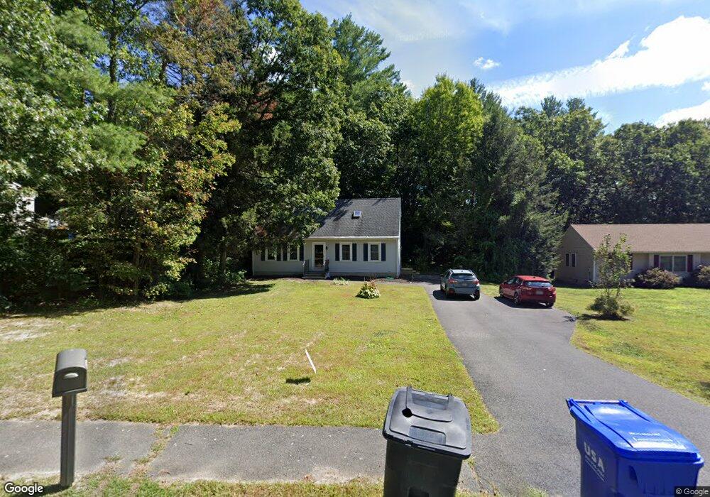
132 Logtown Rd Amherst, MA 01002
Estimated Value: $446,000 - $465,000
6
Beds
3
Baths
1,339
Sq Ft
$341/Sq Ft
Est. Value
About This Home
This home is located at 132 Logtown Rd, Amherst, MA 01002 and is currently estimated at $456,338, approximately $340 per square foot. 132 Logtown Rd is a home located in Hampshire County with nearby schools including Fort River Elementary School, Amherst Regional Middle School, and Amherst Regional High School.
Ownership History
Date
Name
Owned For
Owner Type
Purchase Details
Closed on
Jun 28, 1996
Sold by
Amick Terrence L and Cohen Nancy L
Bought by
Tracy Catherine A and Tracy Steven C
Current Estimated Value
Create a Home Valuation Report for This Property
The Home Valuation Report is an in-depth analysis detailing your home's value as well as a comparison with similar homes in the area
Home Values in the Area
Average Home Value in this Area
Purchase History
| Date | Buyer | Sale Price | Title Company |
|---|---|---|---|
| Tracy Catherine A | $132,000 | -- |
Source: Public Records
Mortgage History
| Date | Status | Borrower | Loan Amount |
|---|---|---|---|
| Open | Tracy Catherine A | $25,000 | |
| Open | Tracy Catherine A | $165,700 | |
| Closed | Tracy Catherine A | $33,600 |
Source: Public Records
Tax History Compared to Growth
Tax History
| Year | Tax Paid | Tax Assessment Tax Assessment Total Assessment is a certain percentage of the fair market value that is determined by local assessors to be the total taxable value of land and additions on the property. | Land | Improvement |
|---|---|---|---|---|
| 2025 | $67 | $370,800 | $160,100 | $210,700 |
| 2024 | $6,484 | $350,300 | $151,100 | $199,200 |
| 2023 | $6,219 | $309,400 | $137,500 | $171,900 |
| 2022 | $6,051 | $284,500 | $125,000 | $159,500 |
| 2021 | $5,754 | $263,700 | $115,800 | $147,900 |
| 2020 | $5,622 | $263,700 | $115,800 | $147,900 |
| 2019 | $5,463 | $250,600 | $115,800 | $134,800 |
| 2018 | $5,298 | $250,600 | $115,800 | $134,800 |
| 2017 | $5,067 | $232,100 | $110,400 | $121,700 |
| 2016 | $4,925 | $232,100 | $110,400 | $121,700 |
| 2015 | $4,767 | $232,100 | $110,400 | $121,700 |
Source: Public Records
Map
Nearby Homes
- 96 Logtown Rd
- 57 Tanglewood Rd
- 53 Pine Grove Unit 53
- 14 Pebble Ridge Rd
- 130 Linden Ridge Rd
- 265 Stanley St
- 61 S Valley Rd
- 100 Larkspur Dr
- 0 Heatherstone Rd
- 9 Harkness Rd
- 41 Arnold Rd
- 324 Pomeroy Ln
- 112 North St
- 121 Amherst Rd
- 48 Gray St
- Lot B-2 N Gulf Rd
- 0 Red Gate Ln Unit 73348273
- 305 Strong St
- 161 Chestnut St
- 170 E Hadley Rd Unit 123