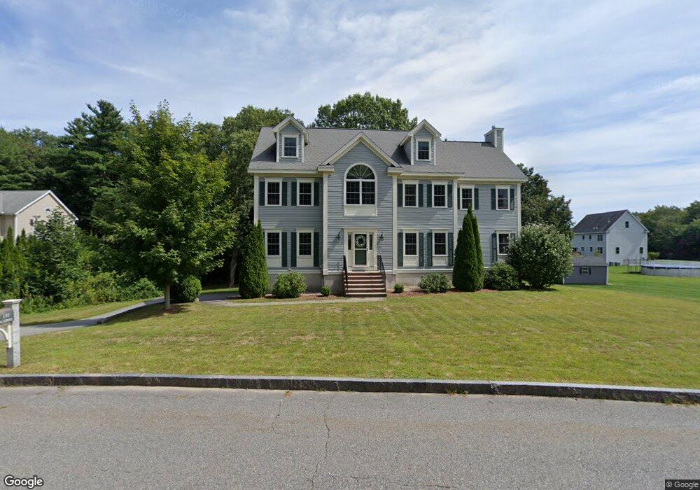
132 Marion St Unit Lot 1 Wilmington, MA 01887
Estimated Value: $1,345,886 - $1,632,000
4
Beds
3
Baths
3,346
Sq Ft
$445/Sq Ft
Est. Value
About This Home
This home is located at 132 Marion St Unit Lot 1, Wilmington, MA 01887 and is currently estimated at $1,489,972, approximately $445 per square foot. 132 Marion St Unit Lot 1 is a home located in Middlesex County with nearby schools including Wilmington Middle School, Wilmington High School, and Abundant Life Christian School and Childcare.
Ownership History
Date
Name
Owned For
Owner Type
Purchase Details
Closed on
Oct 20, 2022
Sold by
Campbell William J and Campbell Karen E
Bought by
Fonseca John C and Fonseca Juliann M
Current Estimated Value
Home Financials for this Owner
Home Financials are based on the most recent Mortgage that was taken out on this home.
Original Mortgage
$642,000
Outstanding Balance
$615,590
Interest Rate
5.89%
Mortgage Type
Purchase Money Mortgage
Estimated Equity
$874,382
Purchase Details
Closed on
May 16, 2008
Sold by
Northeastern Dev Corp
Bought by
Campbell Karen E and Campbell William J
Home Financials for this Owner
Home Financials are based on the most recent Mortgage that was taken out on this home.
Original Mortgage
$180,000
Interest Rate
5.91%
Mortgage Type
Purchase Money Mortgage
Create a Home Valuation Report for This Property
The Home Valuation Report is an in-depth analysis detailing your home's value as well as a comparison with similar homes in the area
Home Values in the Area
Average Home Value in this Area
Purchase History
| Date | Buyer | Sale Price | Title Company |
|---|---|---|---|
| Fonseca John C | $1,230,000 | None Available | |
| Campbell Karen E | $725,000 | -- | |
| Northern Dev Corp | -- | -- | |
| Campbell Karen E | $725,000 | -- | |
| Northern Dev Corp | -- | -- |
Source: Public Records
Mortgage History
| Date | Status | Borrower | Loan Amount |
|---|---|---|---|
| Open | Fonseca John C | $642,000 | |
| Previous Owner | Northern Dev Corp | $325,000 | |
| Previous Owner | Northern Dev Corp | $180,000 | |
| Previous Owner | Campbell Karen E | $400,000 |
Source: Public Records
Tax History Compared to Growth
Tax History
| Year | Tax Paid | Tax Assessment Tax Assessment Total Assessment is a certain percentage of the fair market value that is determined by local assessors to be the total taxable value of land and additions on the property. | Land | Improvement |
|---|---|---|---|---|
| 2025 | $13,506 | $1,179,600 | $319,800 | $859,800 |
| 2024 | $12,950 | $1,133,000 | $319,800 | $813,200 |
| 2023 | $12,051 | $1,009,300 | $290,900 | $718,400 |
| 2022 | $11,155 | $856,100 | $242,400 | $613,700 |
| 2021 | $11,401 | $823,800 | $220,300 | $603,500 |
| 2020 | $11,151 | $821,100 | $220,300 | $600,800 |
| 2019 | $11,455 | $833,100 | $209,600 | $623,500 |
| 2018 | $11,677 | $815,100 | $199,600 | $615,500 |
| 2017 | $11,677 | $808,100 | $199,600 | $608,500 |
| 2016 | $10,893 | $744,600 | $190,000 | $554,600 |
| 2015 | $10,517 | $731,900 | $190,000 | $541,900 |
| 2014 | $9,836 | $690,700 | $181,000 | $509,700 |
Source: Public Records
Map
Nearby Homes
- 11 Patchs Pond Ln
- 14 Roberts Rd
- 142 Burlington Ave
- 7 Cross St (Units 201 & 202)
- 61 Lowell St
- 7 Cross St Unit 306
- 7 Cross St Unit 304
- 7 Cross St Unit 205
- 414-418 Main St
- 9 Parker St
- 17 Molloy Rd
- 21 Spring Valley Rd
- 25 Sarah St
- 29 Beaverbrook Rd
- 27 Fairview Ave
- 9 Upland Rd
- 38 Freeport Dr
- 5 Morse Ave
- 2 Winston Ave
- 3 Cochrane Rd
- 132 Marion St
- 130 Marion St
- 134 Marion St
- 134 Marion St Unit Lot 2
- 136 Marion St Unit Lot 3
- 136 Marion St
- 135 Marion St
- 133 Marion St
- 138 Marion St Unit Lot #4
- 137 Marion St
- 137 Marion St
- 137 Marion St Unit 137
- 140 Marion St Unit Lot 5
- 140 Marion St Unit Lot 5
- 140 Marion St Unit 5
- 140 Marion St
- 1 Emery Way
- 131 Marion St
- 126 Marion St
- 11 Fernbanks Rd