Estimated Value: $300,000 - $383,000
2
Beds
1
Bath
842
Sq Ft
$391/Sq Ft
Est. Value
About This Home
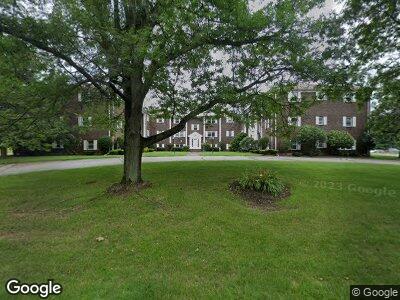
This home is located at 132 Parker St Unit I3, Acton, MA 01720 and is currently estimated at $329,075, approximately $390 per square foot. 132 Parker St Unit I3 is a home located in Middlesex County with nearby schools including Acton-Boxborough Regional High School, Maynard Knowledge Beginnings, and The Imago School.
Ownership History
Date
Name
Owned For
Owner Type
Purchase Details
Closed on
Jul 19, 2004
Sold by
Crosby John R
Bought by
Loh Ryong A
Current Estimated Value
Home Financials for this Owner
Home Financials are based on the most recent Mortgage that was taken out on this home.
Original Mortgage
$129,750
Outstanding Balance
$67,216
Interest Rate
6.25%
Mortgage Type
Purchase Money Mortgage
Estimated Equity
$259,118
Purchase Details
Closed on
Nov 2, 1995
Sold by
Bankers Trust Co Ca
Bought by
Testa Joseph F
Home Financials for this Owner
Home Financials are based on the most recent Mortgage that was taken out on this home.
Original Mortgage
$40,500
Interest Rate
7.58%
Mortgage Type
Purchase Money Mortgage
Purchase Details
Closed on
Feb 14, 1995
Sold by
Zarrella Angela M
Bought by
Bankers Trust Co
Create a Home Valuation Report for This Property
The Home Valuation Report is an in-depth analysis detailing your home's value as well as a comparison with similar homes in the area
Home Values in the Area
Average Home Value in this Area
Purchase History
| Date | Buyer | Sale Price | Title Company |
|---|---|---|---|
| Loh Ryong A | $173,000 | -- | |
| Testa Joseph F | $45,000 | -- | |
| Bankers Trust Co | $51,744 | -- |
Source: Public Records
Mortgage History
| Date | Status | Borrower | Loan Amount |
|---|---|---|---|
| Open | Loh Ryong A | $129,750 | |
| Previous Owner | Bankers Trust Co | $13,000 | |
| Previous Owner | Bankers Trust Co | $40,500 |
Source: Public Records
Tax History Compared to Growth
Tax History
| Year | Tax Paid | Tax Assessment Tax Assessment Total Assessment is a certain percentage of the fair market value that is determined by local assessors to be the total taxable value of land and additions on the property. | Land | Improvement |
|---|---|---|---|---|
| 2025 | $4,696 | $273,800 | $0 | $273,800 |
| 2024 | $4,061 | $243,600 | $0 | $243,600 |
| 2023 | $4,158 | $236,800 | $0 | $236,800 |
| 2022 | $3,960 | $203,600 | $0 | $203,600 |
| 2021 | $4,032 | $199,300 | $0 | $199,300 |
| 2020 | $3,496 | $181,700 | $0 | $181,700 |
| 2019 | $3,357 | $173,300 | $0 | $173,300 |
| 2018 | $3,219 | $166,100 | $0 | $166,100 |
| 2017 | $2,991 | $156,900 | $0 | $156,900 |
| 2016 | $2,738 | $142,400 | $0 | $142,400 |
| 2015 | $2,522 | $132,400 | $0 | $132,400 |
| 2014 | $2,227 | $114,500 | $0 | $114,500 |
Source: Public Records
Map
Nearby Homes
- 132 Parker St Unit I6
- 132 Parker St Unit I5
- 132 Parker St Unit I4
- 132 Parker St Unit I3
- 132 Parker St Unit I2
- 132 Parker St Unit I1
- 132 Parker St Unit H6
- 132 Parker St Unit H5
- 132 Parker St Unit H3
- 132 Parker St Unit H2
- 132 Parker St Unit H1
- 132 Parker St Unit G6
- 132 Parker St Unit G5
- 132 Parker St Unit G3
- 132 Parker St Unit G2
- 132 Parker St Unit G1
- 132 Parker St Unit I-2
- 132 Parker St Unit I-6
- 132 Parker St Unit H-3
- 132 Parker St Unit G5