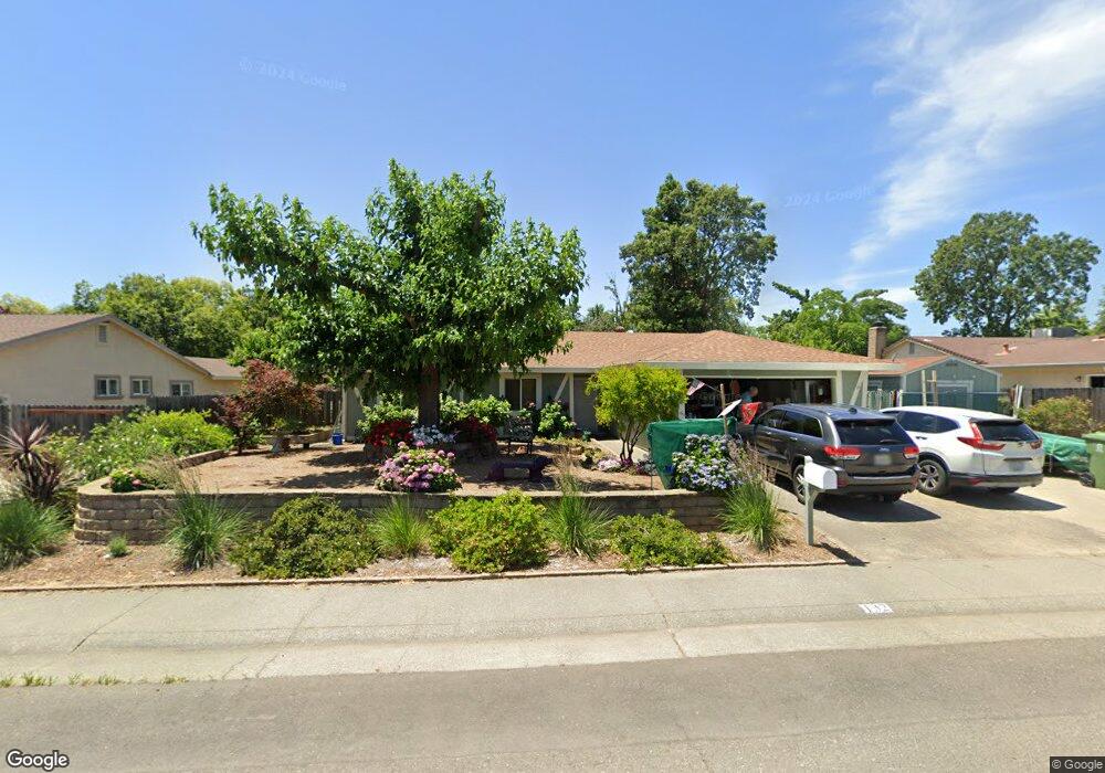
132 Perraud Dr Folsom, CA 95630
Estimated Value: $422,000 - $592,000
4
Beds
2
Baths
1,342
Sq Ft
$395/Sq Ft
Est. Value
About This Home
This home is located at 132 Perraud Dr, Folsom, CA 95630 and is currently estimated at $529,889, approximately $394 per square foot. 132 Perraud Dr is a home located in Sacramento County with nearby schools including Blanche Sprentz Elementary School, Sutter Middle School, and St. John Notre Dame.
Ownership History
Date
Name
Owned For
Owner Type
Purchase Details
Closed on
Nov 29, 2022
Sold by
Mauch Heather Janice
Bought by
Peterson Robert and Mauck Heather Janice
Current Estimated Value
Purchase Details
Closed on
May 14, 1997
Sold by
Barnard Hage N and Barnard Gloria
Bought by
Mauck Heather Janice
Home Financials for this Owner
Home Financials are based on the most recent Mortgage that was taken out on this home.
Original Mortgage
$5,100
Interest Rate
7.57%
Mortgage Type
Purchase Money Mortgage
Create a Home Valuation Report for This Property
The Home Valuation Report is an in-depth analysis detailing your home's value as well as a comparison with similar homes in the area
Purchase History
| Date | Buyer | Sale Price | Title Company |
|---|---|---|---|
| Peterson Robert | -- | Landwood Title | |
| Mauck Heather Janice | $5,500 | Stewart Title |
Source: Public Records
Mortgage History
| Date | Status | Borrower | Loan Amount |
|---|---|---|---|
| Previous Owner | Mauck Heather Janice | $5,100 |
Source: Public Records
Tax History
| Year | Tax Paid | Tax Assessment Tax Assessment Total Assessment is a certain percentage of the fair market value that is determined by local assessors to be the total taxable value of land and additions on the property. | Land | Improvement |
|---|---|---|---|---|
| 2025 | $1,445 | $142,444 | $41,251 | $101,193 |
| 2024 | $1,445 | $139,652 | $40,443 | $99,209 |
| 2023 | $1,418 | $136,914 | $39,650 | $97,264 |
| 2022 | $1,396 | $134,230 | $38,873 | $95,357 |
| 2021 | $1,376 | $131,599 | $38,111 | $93,488 |
| 2020 | $1,358 | $130,251 | $37,721 | $92,530 |
| 2019 | $1,334 | $127,698 | $36,982 | $90,716 |
| 2018 | $1,300 | $125,195 | $36,257 | $88,938 |
| 2017 | $1,211 | $122,742 | $35,547 | $87,195 |
| 2016 | $1,263 | $120,336 | $34,850 | $85,486 |
| 2015 | $1,220 | $118,529 | $34,327 | $84,202 |
| 2014 | $1,156 | $116,208 | $33,655 | $82,553 |
Source: Public Records
Map
Nearby Homes
- 260 Flower Dr
- 101 Kerr Ct
- 110 Fargo Way
- 205 Briarcliff Dr
- 409 Wales Dr
- 617 Wales Dr
- 167 Price Way
- 182 Price Way
- 98-98 1/2 Dean Way
- 100 Boxler Ct
- 115 Winchester Ct
- 219 Needles Way
- 510 Stafford St
- 306 Dean Way
- 124 Windstar Cir
- 0 Figueroa St Unit 225034113
- 293 Leidesdorff St
- 692 Humbert St
- 102 Black Gold Ln
- 603 Figueroa St
- 130 Perraud Dr
- 134 Perraud Dr
- 126 Sierra Woods Cir
- 128 Sierra Woods Cir
- 128 Perraud Dr
- 124 Sierra Woods Cir
- 138 Perraud Dr
- 135 Perraud Dr
- 133 Perraud Dr
- 130 Sierra Woods Cir
- 137 Perraud Dr
- 131 Perraud Dr
- 122 Sierra Woods Cir
- 126 Perraud Dr
- 139 Perraud Dr
- 129 Perraud Dr
- 134 Sierra Woods Cir
- 132 Sierra Woods Cir
- 136 Sierra Woods Cir
- 250 Montrose Dr
Your Personal Tour Guide
Ask me questions while you tour the home.