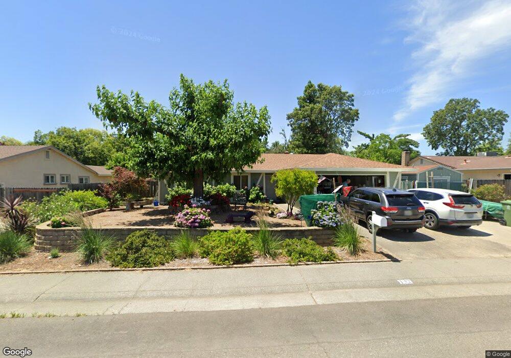
132 Perraud Dr Folsom, CA 95630
Estimated Value: $559,501 - $597,000
About This Home
This home is located at 132 Perraud Dr, Folsom, CA 95630 and is currently estimated at $575,375, approximately $428 per square foot. 132 Perraud Dr is a home located in Sacramento County with nearby schools including Blanche Sprentz Elementary School, Sutter Middle School, and St. John Notre Dame.
Ownership History
We collect this data history from publicly available records. To have your information removed, we recommend requesting removal directly through your county’s website.
Purchase Details
Purchase Details
Home Financials for this Owner
Home Financials are based on the most recent Mortgage that was taken out on this home.Purchase History
We collect this data history from publicly available records. To have your information removed, we recommend requesting removal directly through your county’s website.
| Date | Buyer | Sale Price | Title Company |
|---|---|---|---|
| -- | Landwood Title | ||
| $5,500 | Stewart Title |
Mortgage History
We collect this data history from publicly available records. To have your information removed, we recommend requesting removal directly through your county’s website.
| Date | Status | Borrower | Loan Amount |
|---|---|---|---|
| Previous Owner | $5,100 |
Tax History
We collect this data history from publicly available records. To have your information removed, we recommend requesting removal directly through your county’s website.
| Year | Tax Paid | Tax Assessment Tax Assessment Total Assessment is a certain percentage of the fair market value that is determined by local assessors to be the total taxable value of land and additions on the property. | Land | Improvement |
|---|---|---|---|---|
| 2025 | $1,477 | $142,444 | $41,251 | $101,193 |
| 2024 | $1,445 | $139,652 | $40,443 | $99,209 |
| 2023 | $1,418 | $136,914 | $39,650 | $97,264 |
| 2022 | $1,396 | $134,230 | $38,873 | $95,357 |
| 2021 | $1,376 | $131,599 | $38,111 | $93,488 |
| 2020 | $1,358 | $130,251 | $37,721 | $92,530 |
| 2019 | $1,334 | $127,698 | $36,982 | $90,716 |
| 2018 | $1,300 | $125,195 | $36,257 | $88,938 |
| 2017 | $1,211 | $122,742 | $35,547 | $87,195 |
| 2016 | $1,263 | $120,336 | $34,850 | $85,486 |
| 2015 | $1,220 | $118,529 | $34,327 | $84,202 |
| 2014 | $1,156 | $116,208 | $33,655 | $82,553 |
Map
- 141 Sierra Woods Cir
- 106 Perraud Dr
- 132 McKiernan Dr
- 118 Henderson Way
- 29 Dean Way
- 606 Wales Dr
- 614 Wales Dr
- 619 Wales Dr
- 199 Briarcliff Dr
- 212 Wales Dr
- 179 Price Way
- 100 May Ct
- 98-98 1/2 Dean Way
- 112 Cradle Bar Ct
- 951 Duchow Way
- 105 Snow Bar Ct
- 219 Persifer St
- 100 Winchester Ct
- 306 Dean Way
- 109 Crossing Way
- 130 Perraud Dr
- 134 Perraud Dr
- 126 Sierra Woods Cir
- 128 Sierra Woods Cir
- 128 Perraud Dr
- 124 Sierra Woods Cir
- 138 Perraud Dr
- 135 Perraud Dr
- 133 Perraud Dr
- 130 Sierra Woods Cir
- 137 Perraud Dr
- 131 Perraud Dr
- 122 Sierra Woods Cir
- 126 Perraud Dr
- 139 Perraud Dr
- 129 Perraud Dr
- 134 Sierra Woods Cir
- 132 Sierra Woods Cir
- 136 Sierra Woods Cir
- 250 Montrose Dr
Ask me questions while you tour the home.