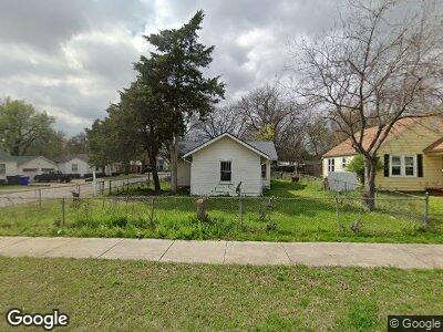
132 S Flood Ave Norman, OK 73069
Southwest Norman NeighborhoodEstimated Value: $180,126 - $294,000
2
Beds
2
Baths
1,230
Sq Ft
$196/Sq Ft
Est. Value
About This Home
This home is located at 132 S Flood Ave, Norman, OK 73069 and is currently estimated at $240,782, approximately $195 per square foot. 132 S Flood Ave is a home located in Cleveland County with nearby schools including McKinley Elementary School, Alcott Middle School, and Norman High School.
Ownership History
Date
Name
Owned For
Owner Type
Purchase Details
Closed on
Feb 8, 2023
Sold by
Mendros Harry George
Bought by
Harry George Mendros Family Trust
Current Estimated Value
Purchase Details
Closed on
Dec 20, 2010
Sold by
Wallace Lester F
Bought by
Mendros Harry G
Purchase Details
Closed on
May 19, 2005
Sold by
Wallace Lester F and Wallace Pamela S
Bought by
Wallace Lester F and Wallace Pamela S
Purchase Details
Closed on
Oct 11, 2004
Sold by
Walker Frances E
Bought by
Wallace Lester and Wallace Pamela S
Create a Home Valuation Report for This Property
The Home Valuation Report is an in-depth analysis detailing your home's value as well as a comparison with similar homes in the area
Home Values in the Area
Average Home Value in this Area
Purchase History
| Date | Buyer | Sale Price | Title Company |
|---|---|---|---|
| Harry George Mendros Family Trust | -- | -- | |
| Mendros Harry G | $80,000 | None Available | |
| Wallace Lester F | -- | None Available | |
| Wallace Lester | $66,000 | -- |
Source: Public Records
Tax History Compared to Growth
Tax History
| Year | Tax Paid | Tax Assessment Tax Assessment Total Assessment is a certain percentage of the fair market value that is determined by local assessors to be the total taxable value of land and additions on the property. | Land | Improvement |
|---|---|---|---|---|
| 2024 | $1,337 | $11,163 | $3,758 | $7,405 |
| 2023 | $1,276 | $10,632 | $2,400 | $8,232 |
| 2022 | $1,224 | $10,632 | $2,400 | $8,232 |
| 2021 | $1,291 | $10,632 | $2,400 | $8,232 |
| 2020 | $1,304 | $10,980 | $2,400 | $8,580 |
| 2019 | $1,326 | $10,980 | $2,400 | $8,580 |
| 2018 | $1,286 | $10,980 | $2,400 | $8,580 |
| 2017 | $1,300 | $10,980 | $0 | $0 |
| 2016 | $1,323 | $10,980 | $2,400 | $8,580 |
| 2015 | $1,272 | $10,893 | $2,381 | $8,512 |
| 2014 | $1,224 | $10,374 | $1,134 | $9,240 |
Source: Public Records
Map
Nearby Homes
- 629 W Comanche St
- 1002 Garver St
- 1118 Zara St
- 1021 W Apache St
- 1106 W Symmes St
- 1115 W Eufaula St
- 318 College Ave
- 430 Kansas St
- 436 Elm Ave
- 1202 Barbour St
- 413 Park Dr
- 818 W Boyd St
- 830 Nebraska St
- 701 Iowa St
- 1308 Glenwood St
- 2913 Zara St
- 207 W Apache St
- 1037 Piper St
- 802 Dakota St
- 705 Chautauqua Ave
- 132 S Flood Ave
- 130 S Flood Ave
- 128 S Flood Ave
- 202 S Flood Ave
- 809 W Comanche St
- 206 S Flood Ave
- 811 W Comanche St
- 810 W Comanche St
- 212 S Flood Ave
- 812 W Comanche St
- 813 W Comanche St
- 214 S Flood Ave
- 814 W Comanche St
- 827 W Comanche St
- 828 W Comanche St
- 828 W Comanche St Unit 1/2
- 205 S Flood Ave
- 201 S Flood Ave
- 218 S Flood Ave
- 125 S Pickard Ave