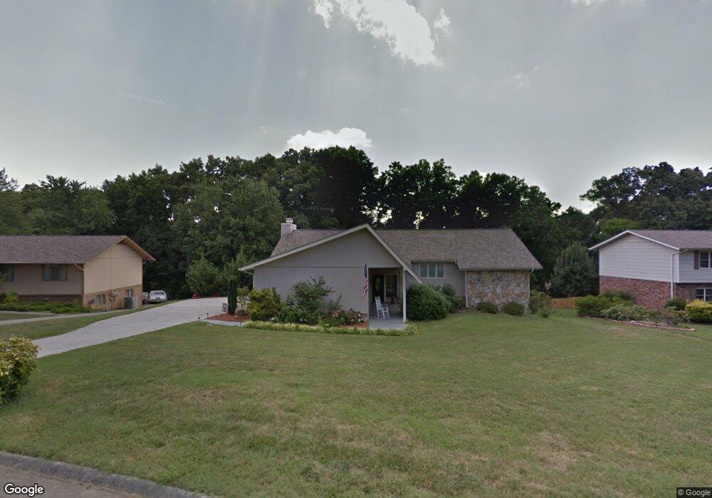
132 Saint Andrews Dr Knoxville, TN 37934
Estimated Value: $618,000 - $683,000
4
Beds
3
Baths
3,300
Sq Ft
$198/Sq Ft
Est. Value
About This Home
This home is located at 132 Saint Andrews Dr, Knoxville, TN 37934 and is currently estimated at $653,765, approximately $198 per square foot. 132 Saint Andrews Dr is a home located in Knox County with nearby schools including Farragut Primary School, Farragut Intermediate School, and Farragut Middle School.
Ownership History
Date
Name
Owned For
Owner Type
Purchase Details
Closed on
Jun 15, 2020
Sold by
Peebles Thomas
Bought by
Peebles Thomas W and Thomas W Peebles Living Trust
Current Estimated Value
Purchase Details
Closed on
Jul 13, 2011
Sold by
Gaztambide Mario and Parker Hilary
Bought by
Peebles Thomas W and Peebles Cammie C
Purchase Details
Closed on
Jul 19, 2007
Sold by
Meade Michael R
Bought by
Gaztambide Mario and Parker Hilary
Home Financials for this Owner
Home Financials are based on the most recent Mortgage that was taken out on this home.
Original Mortgage
$277,875
Interest Rate
6.52%
Mortgage Type
Purchase Money Mortgage
Purchase Details
Closed on
Feb 22, 2005
Sold by
Meade Debra
Bought by
Meade Michael
Create a Home Valuation Report for This Property
The Home Valuation Report is an in-depth analysis detailing your home's value as well as a comparison with similar homes in the area
Home Values in the Area
Average Home Value in this Area
Purchase History
| Date | Buyer | Sale Price | Title Company |
|---|---|---|---|
| Peebles Thomas W | -- | None Available | |
| Peebles Thomas W | $235,000 | Title Assoc Of Knoxville | |
| Gaztambide Mario | $292,500 | None Available | |
| Meade Michael | -- | None Available |
Source: Public Records
Mortgage History
| Date | Status | Borrower | Loan Amount |
|---|---|---|---|
| Previous Owner | Gaztambide Mario | $277,875 |
Source: Public Records
Tax History Compared to Growth
Tax History
| Year | Tax Paid | Tax Assessment Tax Assessment Total Assessment is a certain percentage of the fair market value that is determined by local assessors to be the total taxable value of land and additions on the property. | Land | Improvement |
|---|---|---|---|---|
| 2024 | $1,759 | $113,200 | $0 | $0 |
| 2023 | $1,759 | $113,200 | $0 | $0 |
| 2022 | $1,759 | $113,200 | $0 | $0 |
| 2021 | $1,548 | $73,000 | $0 | $0 |
| 2020 | $1,548 | $73,000 | $0 | $0 |
| 2019 | $1,548 | $73,000 | $0 | $0 |
| 2018 | $1,548 | $73,000 | $0 | $0 |
| 2017 | $1,548 | $73,000 | $0 | $0 |
| 2016 | $1,621 | $0 | $0 | $0 |
| 2015 | $1,621 | $0 | $0 | $0 |
| 2014 | $1,621 | $0 | $0 | $0 |
Source: Public Records
Map
Nearby Homes
- 12427 Willow Ridge Ln
- 216 Saint Andrews Dr
- 12359 N Fox Den Dr
- 224 Baltusrol Rd Unit 1
- 312 Windham Hill Rd Unit 1
- 12628 Needlepoint Dr
- 12309 N Fox Den Dr
- 12715 Union Rd
- 12218 Torrey Pines Point
- 623 Augusta National Way
- 12636 Pony Express Dr
- 12201 S Fox Den Dr
- 317 Everett Rd
- 12710 Duckfoot Ln
- 12722 Duckfoot Ln
- 12713 Duckfoot Ln
- 12212 Oakmont Cir
- 12121 S Fox Den Dr
- 12501 Willow Hill Ct
- 12906 Siena Ln
- 136 Saint Andrews Dr
- 108 Doral Point
- 140 Saint Andrews Dr
- 133 Saint Andrews Dr
- 105 Doral Point
- 137 Saint Andrews Dr
- 12501 Kingston Pike
- 144 Saint Andrews Dr
- 144 St Andrews Dr
- 129 Saint Andrews Dr
- 141 Saint Andrews Dr
- 101 Doral Point
- 145 Saint Andrews Dr
- 120 Saint Andrews Dr
- 125 St Andrews Dr
- 125 Saint Andrews Dr
- 104 Carnoustie Point
- 152 Saint Andrews Dr
- 12428 Hound Ears Point
- 102 Carnoustie Point