Estimated Value: $85,000 - $157,000
4
Beds
2
Baths
1,478
Sq Ft
$82/Sq Ft
Est. Value
About This Home
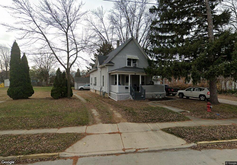
This home is located at 132 W Mcpherson Hwy, Clyde, OH 43410 and is currently estimated at $121,333, approximately $82 per square foot. 132 W Mcpherson Hwy is a home located in Sandusky County with nearby schools including Clyde High School, Harvest Temple Christian Academy, and St. Mary's School.
Ownership History
Date
Name
Owned For
Owner Type
Purchase Details
Closed on
Apr 2, 2015
Sold by
Dearsman Roger A and Dearsman Christine R
Bought by
Rcd Investments Llc
Current Estimated Value
Home Financials for this Owner
Home Financials are based on the most recent Mortgage that was taken out on this home.
Original Mortgage
$160,800
Outstanding Balance
$123,742
Interest Rate
3.73%
Mortgage Type
Future Advance Clause Open End Mortgage
Estimated Equity
-$2,409
Purchase Details
Closed on
Feb 27, 2006
Sold by
Zinkand Margaret L and Zinkand John L
Bought by
Dearsman Roger A and Dearsman Christine R
Home Financials for this Owner
Home Financials are based on the most recent Mortgage that was taken out on this home.
Original Mortgage
$50,850
Interest Rate
6.2%
Mortgage Type
Fannie Mae Freddie Mac
Create a Home Valuation Report for This Property
The Home Valuation Report is an in-depth analysis detailing your home's value as well as a comparison with similar homes in the area
Home Values in the Area
Average Home Value in this Area
Purchase History
| Date | Buyer | Sale Price | Title Company |
|---|---|---|---|
| Rcd Investments Llc | -- | First American | |
| Dearsman Roger A | $42,250 | First American |
Source: Public Records
Mortgage History
| Date | Status | Borrower | Loan Amount |
|---|---|---|---|
| Open | Rcd Investments Llc | $160,800 | |
| Previous Owner | Dearsman Roger A | $50,850 |
Source: Public Records
Tax History Compared to Growth
Tax History
| Year | Tax Paid | Tax Assessment Tax Assessment Total Assessment is a certain percentage of the fair market value that is determined by local assessors to be the total taxable value of land and additions on the property. | Land | Improvement |
|---|---|---|---|---|
| 2024 | $911 | $24,300 | $5,220 | $19,080 |
| 2023 | $911 | $23,140 | $4,970 | $18,170 |
| 2022 | $944 | $23,140 | $4,970 | $18,170 |
| 2021 | $955 | $23,140 | $4,970 | $18,170 |
| 2020 | $827 | $19,390 | $4,970 | $14,420 |
| 2019 | $817 | $19,390 | $4,970 | $14,420 |
| 2018 | $817 | $19,390 | $4,970 | $14,420 |
| 2017 | $839 | $19,390 | $4,970 | $14,420 |
| 2016 | $1,028 | $19,390 | $4,970 | $14,420 |
| 2015 | $871 | $19,390 | $4,970 | $14,420 |
| 2014 | $788 | $17,850 | $4,830 | $13,020 |
| 2013 | $770 | $17,850 | $4,830 | $13,020 |
Source: Public Records
Map
Nearby Homes
- 0 W Mcpherson Hwy
- 117 Nelson St
- 0 Ohio 101
- 118 E Buckeye St
- 167 Excalibur Dr
- 1337 E Sr 20
- 235 W Buckeye St
- 322 Vine St
- 0 Ames St
- 315 E Grant St
- 761 N Woodland Ave
- 625 Ames St
- 209 Fair St
- 741 May St
- 222 Bertha Ave
- 628 W Maple St
- 1270 W Mcpherson Hwy
- 153 Zimmerman Dr
- 0 Merlin Ln Unit 20253762
- 0 Merlin Ln Unit 20253639
- 128 W Mcpherson Hwy
- 1018 Vine St
- 1012 Vine St
- 139 Washington Ave
- 148 W Mcpherson Hwy
- 127 Washington Ave
- 143 Washington Ave
- 1026 Vine St
- 147 Washington Ave
- 123 Washington Ave
- 151 Washington Ave
- 129 W Mcpherson Hwy
- 131 W Mcpherson Hwy
- 117 Washington Ave
- 136 Washington Ave Unit 136
- 136 Washington Ave Unit 13
- 1023 Vine St
- 1019 Vine St
- 1011 Vine St
- 1029 Vine St