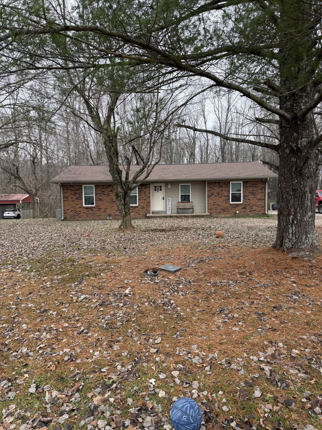
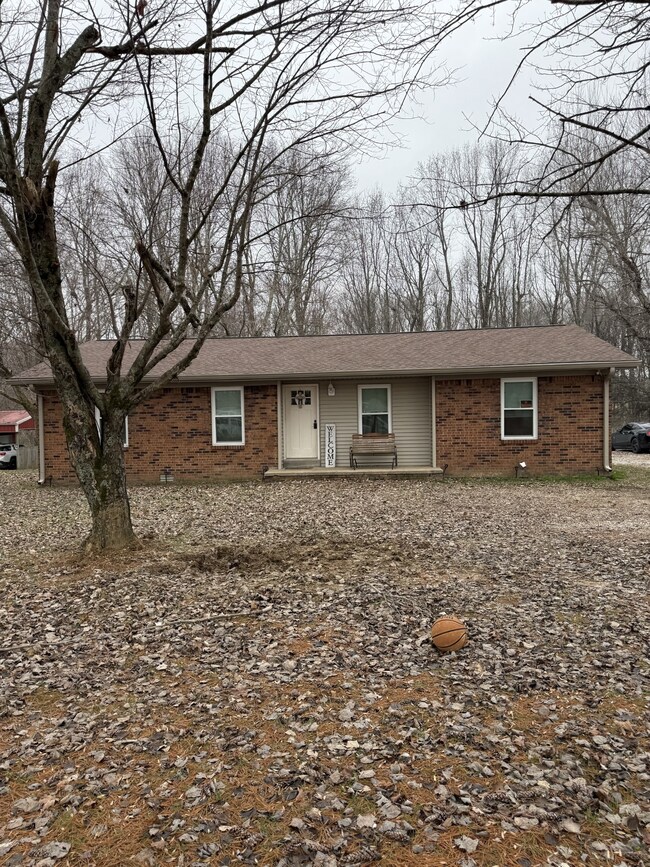
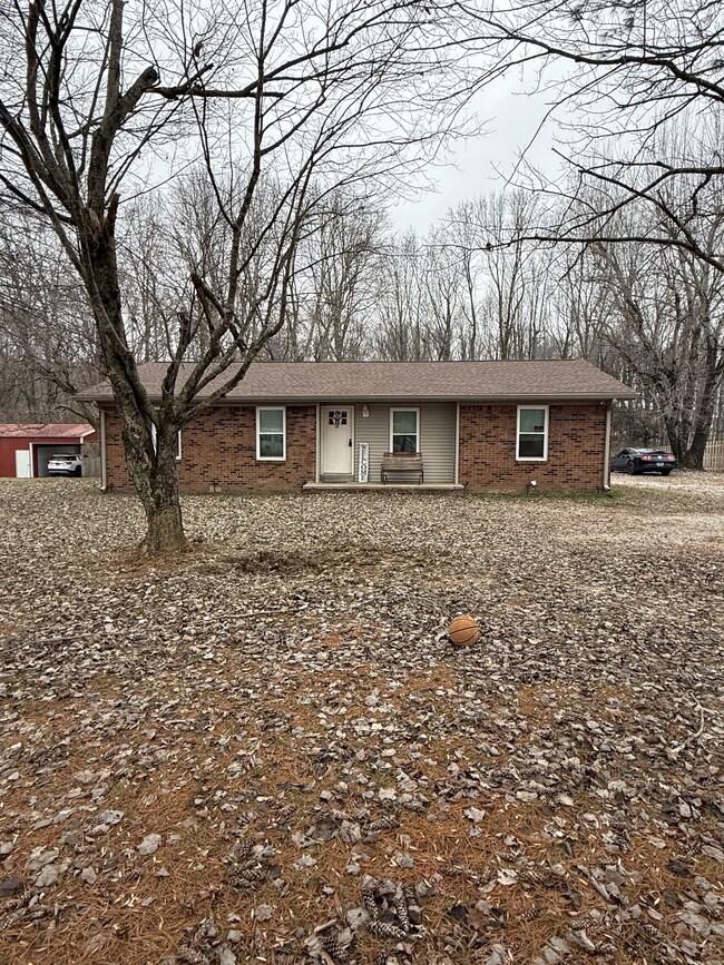
132 Wind Curve Cir Lafayette, TN 37083
Estimated payment $1,364/month
Highlights
- No HOA
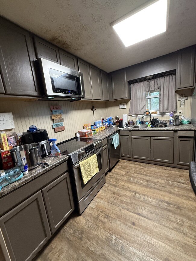
- Stainless Steel Appliances
- 1 Car Garage
- Covered Patio or Porch
- Central Heating and Cooling System
- Utility Room
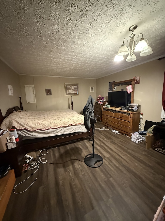
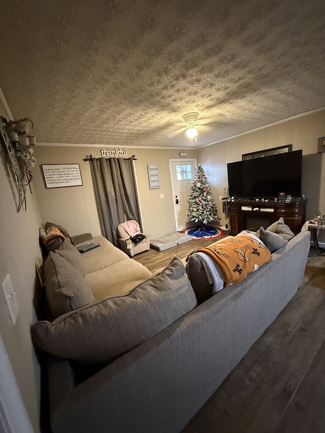
About This Home
Super Cute 4 Bedroom 1 Bath home in a Great Location! Home Features and Large open Living Room and Kitchen with alot of pretty cabinets - Windows, Cabinets, & Roof are only 2 years old. This is alot of house for the money.... And all this sitting on a beautiful lot with beautiful mature trees.
Listing Agent
Gene Carman Real Estate & Auctions Brokerage Phone: 6156336000 License #281545 Listed on: 12/05/2025
Home Details
Home Type
- Single Family
Est. Annual Taxes
- $647
Year Built
- Built in 1979
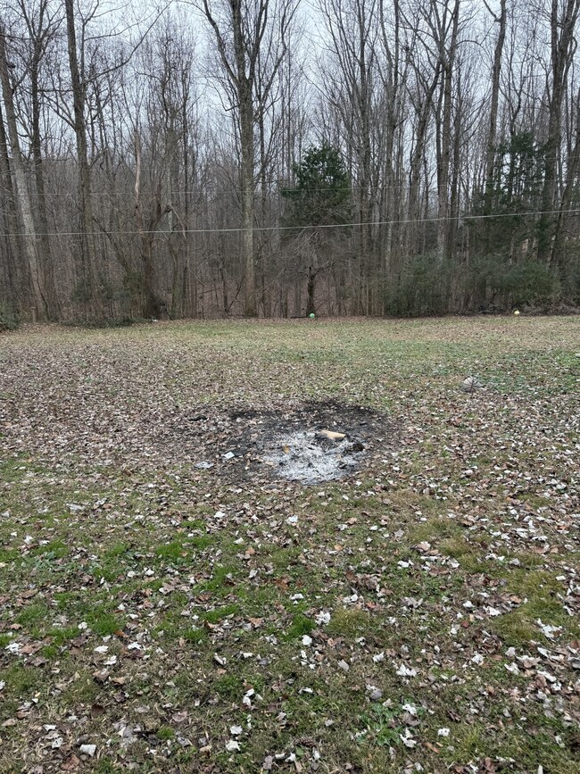
Lot Details
- 0.57 Acre Lot
- Level Lot
Parking
- 1 Car Garage
Home Design
- Brick Exterior Construction
Interior Spaces
- 1,372 Sq Ft Home
- Property has 1 Level
- Utility Room
- Washer and Electric Dryer Hookup
- Laminate Flooring
Kitchen
- Microwave
- Dishwasher
- Stainless Steel Appliances
Bedrooms and Bathrooms
- 4 Main Level Bedrooms
- 1 Full Bathroom
Outdoor Features
- Covered Patio or Porch
Schools
- Fairlane Elementary School
- Macon County Junior High School
- Macon County High School
Utilities
- Central Heating and Cooling System
- Septic Tank
- High Speed Internet
Community Details
- No Home Owners Association
- Spring Creek Estates Subdivision
Listing and Financial Details
- Assessor Parcel Number 030P A 03400 000
Map
Home Values in the Area
Average Home Value in this Area
Tax History
| Year | Tax Paid | Tax Assessment Tax Assessment Total Assessment is a certain percentage of the fair market value that is determined by local assessors to be the total taxable value of land and additions on the property. | Land | Improvement |
|---|---|---|---|---|
| 2024 | $634 | $39,850 | $4,250 | $35,600 |
| 2023 | $563 | $39,850 | $0 | $0 |
| 2022 | $496 | $20,650 | $2,500 | $18,150 |
| 2021 | $496 | $20,650 | $2,500 | $18,150 |
| 2020 | $496 | $20,650 | $2,500 | $18,150 |
| 2019 | $496 | $20,650 | $2,500 | $18,150 |
| 2018 | $426 | $19,250 | $2,500 | $16,750 |
| 2017 | $447 | $17,725 | $2,500 | $15,225 |
| 2016 | $425 | $17,725 | $2,500 | $15,225 |
| 2015 | $425 | $17,725 | $2,500 | $15,225 |
| 2014 | $426 | $17,730 | $0 | $0 |
Property History
| Date | Event | Price | List to Sale | Price per Sq Ft |
|---|---|---|---|---|
| 12/05/2025 12/05/25 | For Sale | $249,900 | -- | $182 / Sq Ft |
Purchase History
| Date | Type | Sale Price | Title Company |
|---|---|---|---|
| Deed | $72,500 | -- | |
| Deed | $115,000 | -- | |
| Deed | $55,000 | -- | |
| Deed | $55,000 | -- | |
| Deed | -- | -- | |
| Deed | -- | -- |
Mortgage History
| Date | Status | Loan Amount | Loan Type |
|---|---|---|---|
| Open | $61,625 | Cash |
Source: Realtracs
MLS Number: 3058904
APN: 030P-A-034.00
Disclaimer: Certain information contained herein is derived from information provided by parties other than Homes.com. All information provided is deemed reliable, but is not guaranteed to be accurate and should be independently verified.
![]() Based on information submitted to the MLS GRID. All data is obtained from various sources and may not have been verified by broker or MLS GRID. Supplied Open House Information is subject to change without notice. All information should be independently reviewed and verified for accuracy. Properties may or may not be listed by the office/agent presenting the information. Some IDX listings have been excluded from this website.
Based on information submitted to the MLS GRID. All data is obtained from various sources and may not have been verified by broker or MLS GRID. Supplied Open House Information is subject to change without notice. All information should be independently reviewed and verified for accuracy. Properties may or may not be listed by the office/agent presenting the information. Some IDX listings have been excluded from this website.
The Digital Millennium Copyright Act of 1998, 17 U.S.C. § 512 (the “DMCA”) provides recourse for copyright owners who believe that material appearing on the Internet infringes their rights under U.S. copyright law. If you believe in good faith that any content or material made available in connection with our website or services infringes your copyright, you (or your agent) may send us a notice requesting that the content or material be removed, or access to it blocked.
Notices must be sent in writing by email to DMCAnotice@MLSGrid.com.
The DMCA requires that your notice of alleged copyright infringement include the following information:
(1) description of the copyrighted work that is the subject of claimed infringement;
(2) description of the alleged infringing content and information sufficient to permit us to locate the content;
(3) contact information for you, including your address, telephone number and email address;
(4) a statement by you that you have a good faith belief that the content in the manner complained of is not authorized by the copyright owner, or its agent, or by the operation of any law;
(5) a statement by you, signed under penalty of perjury, that the information in the notification is accurate and that you have the authority to enforce the copyrights that are claimed to be infringed; and
(6) a physical or electronic signature of the copyright owner or a person authorized to act on the copyright owner’s behalf. Failure to include all of the above information may result in the delay of the processing of your complaint.
- 354 Spring Creek Rd
- 3716 Scottsville Rd
- 317 Jack Porter Rd
- 251 Walton Chapel Rd
- 0 Johns Creek Rd
- 165 Pleasant Hill Rd
- 341 Trent Rd
- 4574 Long Creek Rd
- 79 Taylor Ln
- 0 White Springs Ln
- 5212 White Springs Ln
- 5190 White Springs Ln
- 0 White Springs Rd Unit RTC2907895
- 2 White Springs Rd
- 114 White Springs Rd
- 400 White Springs Rd
- 5110 White Springs Ln
- 1021 Maple Grove Rd
- 881 White Springs Rd
- 889 White Springs Rd
- 150 Apache Ln
- 2165 Union Chapel Rd
- 108 Hayes St
- 70 Epoch Ct
- 378 River St Unit 4D
- 16 Cartertown Rd Unit B
- 73 Willow Tree Cir
- 1020 Harness Cir
- 131 Dixon Dr
- 129 Dixon Dr
- 111 Dixon Dr
- 1001 Rio Dr
- 211 Carmack Ave Unit 211 Carmack Ave Unit 2
- 69 Louise Ln
- 1546 Winding Way Cir
- 5755 Hartsville Pike
- 138 Lester Ave
- 339 Bayhill Dr
- 130 S Main St Unit 2
- 586 Hollerman Ln
