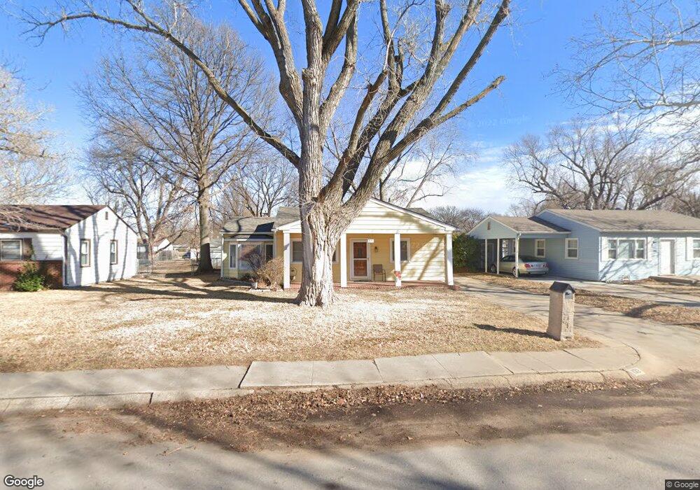
132 Wire Ave Haysville, KS 67060
Estimated Value: $158,000 - $169,734
2
Beds
1
Bath
1,190
Sq Ft
$138/Sq Ft
Est. Value
About This Home
This home is located at 132 Wire Ave, Haysville, KS 67060 and is currently estimated at $163,867, approximately $137 per square foot. 132 Wire Ave is a home located in Sedgwick County with nearby schools including Rex Elementary School, Haysville Middle School, and Campus High School.
Ownership History
Date
Name
Owned For
Owner Type
Purchase Details
Closed on
Dec 31, 2019
Sold by
Sampson Kelly J and Sampson Larry
Bought by
Heinz Catherine M
Current Estimated Value
Home Financials for this Owner
Home Financials are based on the most recent Mortgage that was taken out on this home.
Original Mortgage
$92,450
Outstanding Balance
$81,840
Interest Rate
3.7%
Mortgage Type
New Conventional
Estimated Equity
$82,027
Create a Home Valuation Report for This Property
The Home Valuation Report is an in-depth analysis detailing your home's value as well as a comparison with similar homes in the area
Home Values in the Area
Average Home Value in this Area
Purchase History
| Date | Buyer | Sale Price | Title Company |
|---|---|---|---|
| Heinz Catherine M | -- | Security 1St Title |
Source: Public Records
Mortgage History
| Date | Status | Borrower | Loan Amount |
|---|---|---|---|
| Open | Heinz Catherine M | $92,450 |
Source: Public Records
Tax History Compared to Growth
Tax History
| Year | Tax Paid | Tax Assessment Tax Assessment Total Assessment is a certain percentage of the fair market value that is determined by local assessors to be the total taxable value of land and additions on the property. | Land | Improvement |
|---|---|---|---|---|
| 2025 | $2,085 | $16,503 | $3,117 | $13,386 |
| 2023 | $2,085 | $14,134 | $1,967 | $12,167 |
| 2022 | $1,743 | $12,076 | $1,852 | $10,224 |
| 2021 | $1,710 | $11,558 | $1,852 | $9,706 |
| 2020 | $1,685 | $11,202 | $1,852 | $9,350 |
| 2019 | $1,595 | $10,569 | $1,852 | $8,717 |
| 2018 | $1,506 | $10,063 | $1,449 | $8,614 |
| 2017 | $1,510 | $0 | $0 | $0 |
| 2016 | $1,465 | $0 | $0 | $0 |
| 2015 | $1,465 | $0 | $0 | $0 |
| 2014 | $1,379 | $0 | $0 | $0 |
Source: Public Records
Map
Nearby Homes
- 115 Hungerford Ave
- 214 Stearns Ave
- 242 Wire Ave
- 150 Sunset Ave
- 200 Sunset Ave
- 181 Sunset Ave
- 238 Western Ave
- 415 Spring Dr
- 213 Timberlane Ct
- 449 W 4th St
- 1204 W Leonard St
- 523 Alexander Dr
- 400 Alexander Dr
- 988 Alexander Dr
- 504 S Shira Cir
- 201 E Karla Ave
- 156 W Alexander Ct
- 224 N Maynard Ave
- 1307 W Hannah Ln
- 221 River Birch St