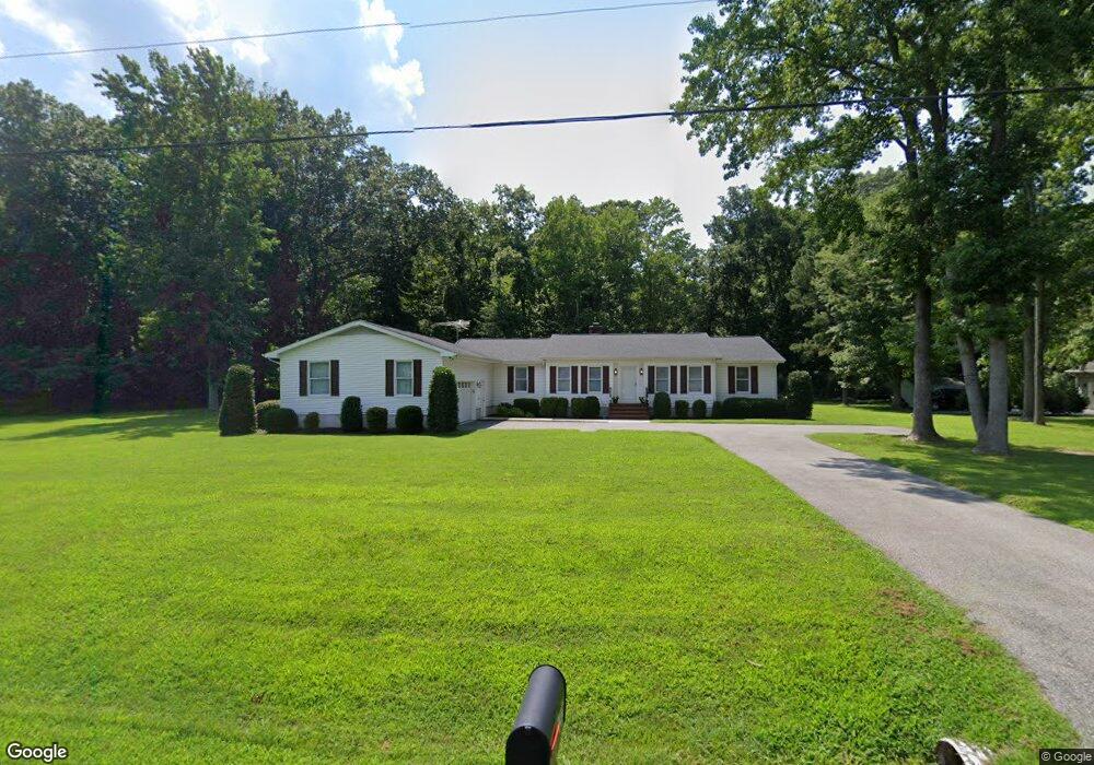
132 Wye River Dr Queenstown, MD 21658
Estimated Value: $502,000 - $704,000
--
Bed
--
Bath
2,251
Sq Ft
$264/Sq Ft
Est. Value
About This Home
This home is located at 132 Wye River Dr, Queenstown, MD 21658 and is currently estimated at $595,106, approximately $264 per square foot. 132 Wye River Dr is a home located in Queen Anne's County with nearby schools including Grasonville Elementary School, Stevensville Middle School, and Kent Island High School.
Ownership History
Date
Name
Owned For
Owner Type
Purchase Details
Closed on
Jun 22, 2005
Sold by
Scarpa Frank S
Bought by
Smith Bruce A and Smith Bonnie S
Current Estimated Value
Purchase Details
Closed on
Dec 24, 1986
Sold by
Pitt Vincent C and Pitt Bridgett J
Bought by
Scarpa Frank S
Home Financials for this Owner
Home Financials are based on the most recent Mortgage that was taken out on this home.
Original Mortgage
$37,800
Interest Rate
9.3%
Purchase Details
Closed on
Apr 8, 1983
Sold by
Wye River Enterprises, Inc
Bought by
Pitt Vincent C and Pitt Bridgett J
Create a Home Valuation Report for This Property
The Home Valuation Report is an in-depth analysis detailing your home's value as well as a comparison with similar homes in the area
Home Values in the Area
Average Home Value in this Area
Purchase History
| Date | Buyer | Sale Price | Title Company |
|---|---|---|---|
| Smith Bruce A | $120,000 | -- | |
| Scarpa Frank S | $42,000 | -- | |
| Pitt Vincent C | $30,000 | -- |
Source: Public Records
Mortgage History
| Date | Status | Borrower | Loan Amount |
|---|---|---|---|
| Previous Owner | Scarpa Frank S | $37,800 |
Source: Public Records
Tax History Compared to Growth
Tax History
| Year | Tax Paid | Tax Assessment Tax Assessment Total Assessment is a certain percentage of the fair market value that is determined by local assessors to be the total taxable value of land and additions on the property. | Land | Improvement |
|---|---|---|---|---|
| 2025 | $4,086 | $427,367 | $0 | $0 |
| 2024 | $3,807 | $397,800 | $183,900 | $213,900 |
| 2023 | $3,658 | $381,933 | $0 | $0 |
| 2022 | $3,508 | $366,067 | $0 | $0 |
| 2021 | $3,419 | $350,200 | $143,900 | $206,300 |
| 2020 | $3,419 | $350,200 | $143,900 | $206,300 |
| 2019 | $3,419 | $350,200 | $143,900 | $206,300 |
| 2018 | $3,842 | $394,300 | $153,900 | $240,400 |
| 2017 | $1,372 | $143,100 | $0 | $0 |
| 2016 | -- | $142,300 | $0 | $0 |
| 2015 | $1,752 | $141,500 | $0 | $0 |
| 2014 | $1,752 | $141,500 | $0 | $0 |
Source: Public Records
Map
Nearby Homes
- 100 Marlborough Rd
- 2006 Bennett Point Rd
- 1150 Cheston Ln
- 405 Cove Rd
- 618 Pigpen Point Rd
- 4 Fairway Island
- 115 Masters Way
- 16 Fairway Island
- 4 Bunker Ct
- 29 Fairway Island
- 20 Prospect Bay Dr W
- 1326 Perrys Corner Rd
- 205 Piney Point Landing
- 144 River Run
- 317 Caspian Dr
- 0 Grasonville Cemetery Rd
- 113 Aslan Ct
- The Chester Plan at Whitetail Crossing
- The Cordova Plan at Whitetail Crossing
- The Miles Plan at Whitetail Crossing
- 128 Wye River Dr
- 125 Wye River Dr
- 121 Wye River Dr
- 129 Wye River Dr
- 124 Wye River Dr
- 119 Wye River Dr
- 0 Wye House Ln
- 1751 Perrys Corner Rd
- 133 Wye River Dr
- 121 Gloucester Rd
- 107 Somerset Ct
- 115 Wye River Dr
- 125 Gloucester Rd
- 120 Wye River Dr
- 137 Wye River Dr
- 103 Somerset Ct
- 117 Gloucester Rd
- 120 Woods Rd
- 111 Somerset Ct
- 111 Wye House Ln
