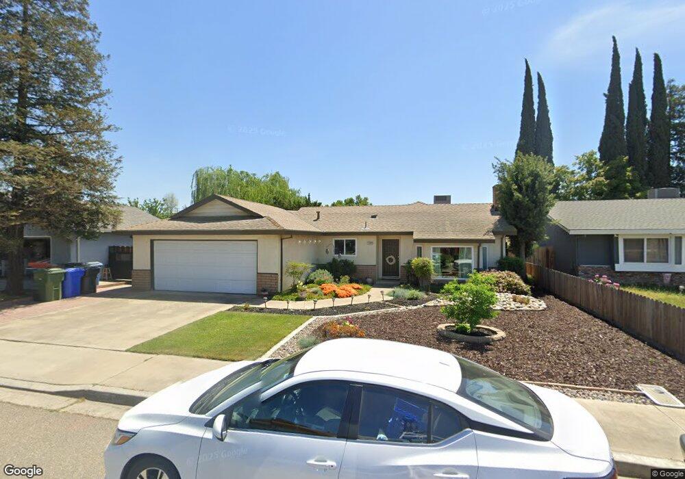
1320 Berry Dr Turlock, CA 95382
Estimated Value: $303,000 - $441,000
3
Beds
2
Baths
1,377
Sq Ft
$289/Sq Ft
Est. Value
About This Home
This home is located at 1320 Berry Dr, Turlock, CA 95382 and is currently estimated at $397,948, approximately $288 per square foot. 1320 Berry Dr is a home located in Stanislaus County with nearby schools including Walter M. Brown Elementary School, Turlock Junior High School, and Marvin A. Dutcher Middle School.
Ownership History
Date
Name
Owned For
Owner Type
Purchase Details
Closed on
Mar 4, 2014
Sold by
Lefler Michael A
Bought by
Lefler Janet and The Janet M Lefler & Michael A
Current Estimated Value
Purchase Details
Closed on
Dec 16, 2013
Sold by
Department Of Veterans Affairs Of The St
Bought by
Lefler Michael A and Lefler Janet
Purchase Details
Closed on
Mar 7, 2009
Sold by
Lefler Michael A
Bought by
The Janet M Lefler & Michael A Lefler Li
Purchase Details
Closed on
Nov 21, 1994
Sold by
Lamps Frederick W and Lamps Antoinette M
Bought by
Va
Create a Home Valuation Report for This Property
The Home Valuation Report is an in-depth analysis detailing your home's value as well as a comparison with similar homes in the area
Home Values in the Area
Average Home Value in this Area
Purchase History
| Date | Buyer | Sale Price | Title Company |
|---|---|---|---|
| Lefler Janet | -- | None Available | |
| Lefler Michael A | -- | None Available | |
| The Janet M Lefler & Michael A Lefler Li | -- | None Available | |
| Va | $100,000 | Chicago Title Company |
Source: Public Records
Tax History Compared to Growth
Tax History
| Year | Tax Paid | Tax Assessment Tax Assessment Total Assessment is a certain percentage of the fair market value that is determined by local assessors to be the total taxable value of land and additions on the property. | Land | Improvement |
|---|---|---|---|---|
| 2025 | $1,729 | $167,951 | $67,180 | $100,771 |
| 2024 | $1,696 | $164,659 | $65,863 | $98,796 |
| 2023 | $1,692 | $161,431 | $64,572 | $96,859 |
| 2022 | $1,669 | $158,266 | $63,306 | $94,960 |
| 2021 | $1,643 | $155,164 | $62,065 | $93,099 |
| 2020 | $1,631 | $153,574 | $61,429 | $92,145 |
| 2019 | $1,602 | $150,564 | $60,225 | $90,339 |
| 2018 | $1,599 | $147,613 | $59,045 | $88,568 |
| 2017 | $1,560 | $144,720 | $57,888 | $86,832 |
| 2016 | $1,456 | $141,883 | $56,753 | $85,130 |
| 2015 | $1,442 | $139,753 | $55,901 | $83,852 |
| 2014 | $1,426 | $137,016 | $54,806 | $82,210 |
Source: Public Records
Map
Nearby Homes
- 2700 Oxford Ave
- 2213 Dels Ln
- 2985 Radford Way
- 2300 Dels Ln
- 2821 Messenger Ct
- 3076 Radford Way
- 517 W Tuolumne Rd
- 1321 Trinity Way
- 2101 State St
- 2417 Andre Ln
- 401 W Tuolumne Rd
- 2226 Typhoon Ct
- 2620 Bird Rock Place
- 1883 Ethan Allen Ct
- 3117 Andre Ln
- 2391 Typhoon Dr
- 2900 Andre Ln Unit 241
- 2900 Andre Ln Unit 237
- 330 Wiley Ct
- 2905 Niagra St Unit 168