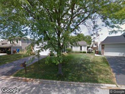
1320 Bristol Ct Roselle, IL 60172
Estimated Value: $372,422 - $397,000
3
Beds
1
Bath
1,429
Sq Ft
$273/Sq Ft
Est. Value
About This Home
This home is located at 1320 Bristol Ct, Roselle, IL 60172 and is currently estimated at $390,356, approximately $273 per square foot. 1320 Bristol Ct is a home located in DuPage County with nearby schools including Waterbury Elementary School, Spring Wood Middle School, and Lake Park High School.
Ownership History
Date
Name
Owned For
Owner Type
Purchase Details
Closed on
Apr 9, 2003
Sold by
Andis Fiddick Debra L
Bought by
Fiddick Michael and Andis Fiddick Debra L
Current Estimated Value
Home Financials for this Owner
Home Financials are based on the most recent Mortgage that was taken out on this home.
Original Mortgage
$95,000
Interest Rate
5.71%
Mortgage Type
Purchase Money Mortgage
Purchase Details
Closed on
Aug 25, 1993
Sold by
Fiddick Michael J
Bought by
Fiddick Debra L Andis
Create a Home Valuation Report for This Property
The Home Valuation Report is an in-depth analysis detailing your home's value as well as a comparison with similar homes in the area
Home Values in the Area
Average Home Value in this Area
Purchase History
| Date | Buyer | Sale Price | Title Company |
|---|---|---|---|
| Fiddick Michael | -- | Amerititle Inc | |
| Fiddick Debra L Andis | -- | -- |
Source: Public Records
Mortgage History
| Date | Status | Borrower | Loan Amount |
|---|---|---|---|
| Open | Andis Debra L | $104,500 | |
| Closed | Fiddick Michael | $95,000 | |
| Closed | Fiddick Debra L Andis | $112,000 |
Source: Public Records
Tax History Compared to Growth
Tax History
| Year | Tax Paid | Tax Assessment Tax Assessment Total Assessment is a certain percentage of the fair market value that is determined by local assessors to be the total taxable value of land and additions on the property. | Land | Improvement |
|---|---|---|---|---|
| 2023 | $6,254 | $97,540 | $37,880 | $59,660 |
| 2022 | $6,555 | $96,310 | $32,980 | $63,330 |
| 2021 | $6,242 | $91,500 | $31,330 | $60,170 |
| 2020 | $6,262 | $89,270 | $30,570 | $58,700 |
| 2019 | $6,050 | $85,790 | $29,380 | $56,410 |
| 2018 | $5,830 | $81,090 | $28,610 | $52,480 |
| 2017 | $5,530 | $75,160 | $26,520 | $48,640 |
| 2016 | $5,724 | $69,560 | $24,540 | $45,020 |
| 2015 | $5,645 | $64,910 | $22,900 | $42,010 |
| 2014 | $5,541 | $63,390 | $22,900 | $40,490 |
| 2013 | $5,495 | $65,560 | $23,680 | $41,880 |
Source: Public Records
Map
Nearby Homes
- 134 Andover Dr
- 1210 Churchill Dr
- 200 Rodenburg Rd
- 1170 Singleton Dr
- 1500 Brittania Way Unit 13614
- 165 Avalon Ct Unit 13043
- 1355 Hampshire Ct Unit 15511
- 263 Birmingham Ct Unit 15432
- 1621 Thornfield Ct Unit 160801
- 665 Briarwood Ln
- 810 Case Dr
- 5508 Cloverdale Rd
- 885 Edenwood Dr
- 5588 Cambridge Way
- 125 Leawood Dr
- 1118 Prescott Dr Unit 2C
- Lot Foster Ave
- 765 Woodside Dr
- 811 Rosebud Ct
- 1183 Hialeah Ln
- 1320 Bristol Ct
- 1310 Bristol Ct
- 1330 Bristol Ct
- 135 Chatham Ln
- 1300 Bristol Ct
- 1325 Pembrook Cir
- 1315 Pembrook Cir
- 125 Chatham Ln
- 1305 Pembrook Cir
- 175 Chatham Ln
- 1295 Pembrook Cir
- 1315 Bristol Ct
- 1311 Bristol Ct
- 1307 Bristol Ct
- 140 Chatham Ln
- 150 Chatham Ln
- 185 Chatham Ln
- 160 Chatham Ln
- 130 Chatham Ln
- 1320 Pembrook Cir