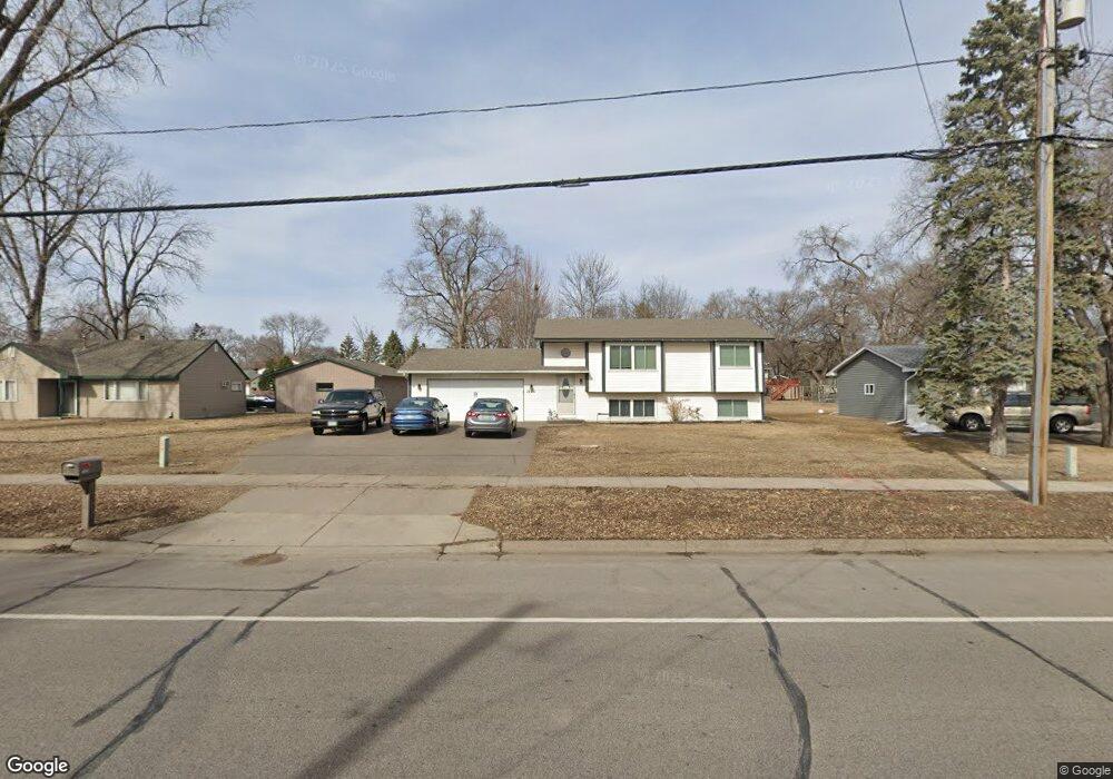
1320 Brookdale Dr Brooklyn Park, MN 55444
Monroe NeighborhoodEstimated Value: $294,000 - $341,582
4
Beds
2
Baths
881
Sq Ft
$354/Sq Ft
Est. Value
About This Home
This home is located at 1320 Brookdale Dr, Brooklyn Park, MN 55444 and is currently estimated at $311,646, approximately $353 per square foot. 1320 Brookdale Dr is a home located in Hennepin County with nearby schools including Monroe Elementary School, Jackson Middle School, and Champlin Park High School.
Ownership History
Date
Name
Owned For
Owner Type
Purchase Details
Closed on
Mar 11, 2008
Sold by
Wells Fargo Bank Na
Bought by
Baremor Terry Alan and Baremor Mary Suzanne
Current Estimated Value
Purchase Details
Closed on
Jan 25, 2002
Sold by
Hildebrand Renee Susan
Bought by
Barto Sarah D
Purchase Details
Closed on
Nov 7, 2000
Sold by
Geisinger Jim
Bought by
Hildebrand Lark and Stack Renee
Create a Home Valuation Report for This Property
The Home Valuation Report is an in-depth analysis detailing your home's value as well as a comparison with similar homes in the area
Home Values in the Area
Average Home Value in this Area
Purchase History
| Date | Buyer | Sale Price | Title Company |
|---|---|---|---|
| Baremor Terry Alan | $143,000 | -- | |
| Barto Sarah D | $164,900 | -- | |
| Hildebrand Lark | $84,500 | -- |
Source: Public Records
Mortgage History
| Date | Status | Borrower | Loan Amount |
|---|---|---|---|
| Closed | Hildebrand Lark | -- |
Source: Public Records
Tax History Compared to Growth
Tax History
| Year | Tax Paid | Tax Assessment Tax Assessment Total Assessment is a certain percentage of the fair market value that is determined by local assessors to be the total taxable value of land and additions on the property. | Land | Improvement |
|---|---|---|---|---|
| 2024 | $3,522 | $284,500 | $120,000 | $164,500 |
| 2023 | $3,512 | $291,700 | $120,000 | $171,700 |
| 2022 | $2,481 | $285,900 | $120,000 | $165,900 |
| 2021 | $2,275 | $198,000 | $55,000 | $143,000 |
| 2020 | $2,264 | $185,600 | $55,000 | $130,600 |
| 2019 | $2,234 | $177,100 | $55,000 | $122,100 |
| 2018 | $2,127 | $170,200 | $49,600 | $120,600 |
| 2017 | $1,708 | $134,000 | $49,600 | $84,400 |
| 2016 | $1,929 | $143,400 | $49,600 | $93,800 |
| 2015 | $1,612 | $123,000 | $39,700 | $83,300 |
| 2014 | -- | $110,200 | $39,700 | $70,500 |
Source: Public Records
Map
Nearby Homes
- 7701 Girard Ave N
- 7557 Dupont Ave N
- 1501 80th Ave N
- 7440 Fremont Ct N
- 8031 Dupont Ct N
- 1908 Sugarloaf Trail
- 2016 Teton Trail
- 1222 81st Ct N
- 924 81st Ave N
- 2008 Yellowstone Trail
- 8125 James Ave N
- 609 82nd Ave N
- 322 74th Ave N
- 2531 Brookdale Ln Unit 2531
- 7801 Mississippi Ln
- 2547 Brookdale Ln Unit 2547
- 2537 Brookdale Ln
- 8232 Morgan Ave N
- 1701 83rd Ave N
- 2536 Brookdale Ln Unit 2536
- 1310 Brookdale Dr
- 7748 Fremont Ave N
- 1344 Brookdale Dr
- 7708 Girard Ave N
- 1317 77th Way
- 1216 Brookdale Dr
- 1309 77th Way
- 1301 77th Way
- 7716 Girard Ave N
- 7609 Fremont Ave N
- 1341 Brookdale Dr
- 1204 Brookdale Dr
- 7709 Emerson Ave N
- 7717 Emerson Ave N
- 7724 Girard Ave N
- 7709 Girard Ave N
- 7616 Fremont Ave N
- 1316 77th Way
- 7717 Girard Ave N
- 1436 Brookdale Dr