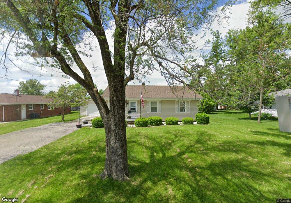
1320 Douglas St Charleston, IL 61920
Estimated Value: $102,051 - $154,000
3
Beds
1
Bath
990
Sq Ft
$132/Sq Ft
Est. Value
About This Home
This home is located at 1320 Douglas St, Charleston, IL 61920 and is currently estimated at $130,263, approximately $131 per square foot. 1320 Douglas St is a home located in Coles County with nearby schools including Charleston High School, Charleston Christian Academy, and Charleston Christian Academy High School.
Ownership History
Date
Name
Owned For
Owner Type
Purchase Details
Closed on
Aug 20, 2025
Sold by
Elam Sandy and Elam Emily J
Bought by
Elam Yvonne E
Current Estimated Value
Purchase Details
Closed on
Oct 9, 2020
Sold by
Jones Willetta M and Willetta M Jones Revocable Tru
Bought by
Elam Emily J and Elam Sandy
Purchase Details
Closed on
Nov 6, 2014
Sold by
Jones Philip R and Jones Willetta M
Bought by
Jones Philip R and Jones Willetta M
Purchase Details
Closed on
Oct 21, 2010
Sold by
Hayward John H
Bought by
Jones Philip R
Create a Home Valuation Report for This Property
The Home Valuation Report is an in-depth analysis detailing your home's value as well as a comparison with similar homes in the area
Home Values in the Area
Average Home Value in this Area
Purchase History
| Date | Buyer | Sale Price | Title Company |
|---|---|---|---|
| Elam Yvonne E | $45,000 | None Listed On Document | |
| Elam Emily J | $82,000 | Accommodation | |
| Jones Philip R | -- | -- | |
| Jones Philip R | $69,000 | None Available |
Source: Public Records
Tax History Compared to Growth
Tax History
| Year | Tax Paid | Tax Assessment Tax Assessment Total Assessment is a certain percentage of the fair market value that is determined by local assessors to be the total taxable value of land and additions on the property. | Land | Improvement |
|---|---|---|---|---|
| 2024 | $2,452 | $31,604 | $5,743 | $25,861 |
| 2023 | $2,415 | $28,862 | $5,245 | $23,617 |
| 2022 | $2,165 | $28,385 | $5,158 | $23,227 |
| 2021 | $2,165 | $27,241 | $4,950 | $22,291 |
| 2020 | $2,165 | $24,093 | $6,488 | $17,605 |
| 2019 | $2,130 | $23,254 | $6,262 | $16,992 |
| 2018 | $2,080 | $23,254 | $6,262 | $16,992 |
| 2017 | $2,080 | $23,254 | $6,262 | $16,992 |
| 2016 | $1,827 | $20,605 | $6,262 | $14,343 |
| 2015 | $1,886 | $20,605 | $6,262 | $14,343 |
| 2014 | $1,886 | $20,605 | $6,262 | $14,343 |
| 2013 | $1,886 | $20,605 | $6,262 | $14,343 |
Source: Public Records
Map
Nearby Homes
- 711 Kenton Dr
- 0 Timberlake Lot 17 Estates
- 929 Reynolds Dr
- 911 W Hayes Ave
- 926 Westgate Dr
- 921 Reynolds Dr
- 942 E St
- W Hayes Ave Lot Unit WP001
- 1035 Woodberry Ln
- 9 Orchard Dr
- 1071 Woodberry Ln
- 1528 Division St
- 926 Division St
- 124 Polk Ave
- 934 2nd St
- 943 2nd St
- 715 W Coolidge Ave
- 27 Heather Dr
- 1103 & 1105 6th St
- 1011 6th St
- 1316 Douglas St
- 29 Buchanan Ct
- 1312 Douglas St
- 28 Buchanan Ct
- 1313 Audrey Ln
- 1314 Audrey Ln
- 27 Buchanan Ct
- 825 W Lincoln Ave
- 26 Buchanan Ct
- 1308 Douglas St
- 2 Buchanan Ct
- 1315 Audrey Ln
- 4 Buchanan Ct
- 25 Buchanan Ct
- 1312 Audrey Ln
- 24 Buchanan Ct
- 3 Buchanan Ct
- 6 Buchanan Ct
- 1309 Audrey Ln
- 23 Buchanan Ct