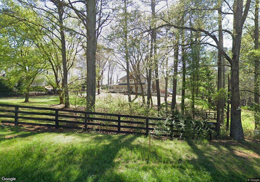
13200 Freemanville Rd Alpharetta, GA 30004
Estimated Value: $1,093,000 - $1,871,000
4
Beds
4
Baths
2,840
Sq Ft
$533/Sq Ft
Est. Value
About This Home
This home is located at 13200 Freemanville Rd, Alpharetta, GA 30004 and is currently estimated at $1,513,159, approximately $532 per square foot. 13200 Freemanville Rd is a home located in Fulton County with nearby schools including Summit Hill Elementary School, Northwestern Middle School, and Milton High School.
Ownership History
Date
Name
Owned For
Owner Type
Purchase Details
Closed on
May 25, 2017
Bought by
Suid Richard E and Suid Rebecca M
Current Estimated Value
Home Financials for this Owner
Home Financials are based on the most recent Mortgage that was taken out on this home.
Original Mortgage
$460,000
Outstanding Balance
$381,810
Interest Rate
4.03%
Mortgage Type
New Conventional
Estimated Equity
$1,131,349
Create a Home Valuation Report for This Property
The Home Valuation Report is an in-depth analysis detailing your home's value as well as a comparison with similar homes in the area
Home Values in the Area
Average Home Value in this Area
Purchase History
| Date | Buyer | Sale Price | Title Company |
|---|---|---|---|
| Suid Richard E | $575,000 | -- |
Source: Public Records
Mortgage History
| Date | Status | Borrower | Loan Amount |
|---|---|---|---|
| Open | Suid Richard E | $460,000 |
Source: Public Records
Tax History Compared to Growth
Tax History
| Year | Tax Paid | Tax Assessment Tax Assessment Total Assessment is a certain percentage of the fair market value that is determined by local assessors to be the total taxable value of land and additions on the property. | Land | Improvement |
|---|---|---|---|---|
| 2025 | $937 | $432,920 | $145,640 | $287,280 |
| 2023 | $9,385 | $332,480 | $145,640 | $186,840 |
| 2022 | $4,494 | $332,480 | $145,640 | $186,840 |
| 2021 | $4,467 | $235,200 | $136,520 | $98,680 |
| 2020 | $4,502 | $192,560 | $61,280 | $131,280 |
| 2019 | $853 | $189,160 | $60,200 | $128,960 |
| 2018 | $4,668 | $184,720 | $58,800 | $125,920 |
| 2017 | $4,361 | $164,720 | $38,040 | $126,680 |
| 2016 | $4,339 | $164,720 | $38,040 | $126,680 |
| 2015 | $5,063 | $164,720 | $38,040 | $126,680 |
| 2014 | $4,496 | $164,720 | $38,040 | $126,680 |
Source: Public Records
Map
Nearby Homes
- 13095 Freemanville Rd
- 900 Crabapple Hill
- 13039 Freemanville Rd
- 13440 Hipworth Rd
- 13250 Birmingham Hwy
- 175 Heatherton Ln
- 380 Creek Point
- 275 Heatherton Way
- 245 Heatherton Way
- 2098 Cortland Rd Unit 31
- 601 Dorris Rd
- 13630 Birmingham Hwy
- 14040 Providence Rd
- 1355 Sherry Dr
- 1360 Bethany Ct
- 0 Providence Way Rear
- 14300 Providence Rd
- 1580 Mayfield Rd
- 1050 Little River Ln
- 1950 Heritage Walk
- 13180 Freemanville Rd
- 13152 Freemanville Rd
- 13235 Freemanville Rd
- 13250 Freemanville Rd
- 13215 Freemanville Rd
- 13170 Freemanville Rd
- 13255 Freemanville Rd
- 13220 Freemanville Rd
- 13160 Freemanville Rd
- 13301 Freemanville Rd
- 13148 Freemanville Rd
- 13140 Freemanville Rd
- 13309 Freemanville Rd
- 13144 Freemanville Rd
- 13268 Freemanville Rd
- 13115 Freemanville Rd
- 13125 Freemanville Rd
- 13264 Freemanville Rd
- 13105 Freemanville Rd
- 622 Congaree Ct