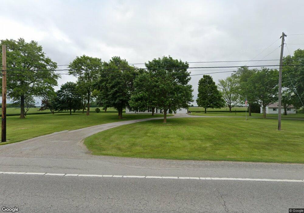
13200 Us Route 127 Paulding, OH 45879
Estimated Value: $185,000 - $197,000
3
Beds
1
Bath
1,424
Sq Ft
$133/Sq Ft
Est. Value
About This Home
This home is located at 13200 Us Route 127, Paulding, OH 45879 and is currently estimated at $188,913, approximately $132 per square foot. 13200 Us Route 127 is a home located in Paulding County with nearby schools including Paulding High School.
Ownership History
Date
Name
Owned For
Owner Type
Purchase Details
Closed on
May 2, 2011
Sold by
Coe Paula S and Messman Patricia Ann
Bought by
Myers Valerie E
Current Estimated Value
Purchase Details
Closed on
Apr 1, 2009
Sold by
Holtsberry Paul D and The Holtsberry Family Trust
Bought by
Gress James L and Gress Elaine E
Purchase Details
Closed on
Feb 3, 2009
Sold by
Gress James L and Gress Elaine E
Bought by
Gress James L and Gress Elaine E
Purchase Details
Closed on
Oct 17, 2003
Sold by
Holtsberry Paul D
Bought by
Myers Valerie E
Purchase Details
Closed on
Jun 6, 2003
Sold by
Holtsberry Paul D
Bought by
Myers Valerie E
Purchase Details
Closed on
Mar 26, 1993
Bought by
Myers Valerie E
Create a Home Valuation Report for This Property
The Home Valuation Report is an in-depth analysis detailing your home's value as well as a comparison with similar homes in the area
Home Values in the Area
Average Home Value in this Area
Purchase History
| Date | Buyer | Sale Price | Title Company |
|---|---|---|---|
| Myers Valerie E | $73,000 | None Available | |
| Gress James L | $1,600 | None Available | |
| Gress James L | -- | None Available | |
| Myers Valerie E | -- | -- | |
| Myers Valerie E | -- | -- | |
| Myers Valerie E | $74,900 | -- |
Source: Public Records
Tax History Compared to Growth
Tax History
| Year | Tax Paid | Tax Assessment Tax Assessment Total Assessment is a certain percentage of the fair market value that is determined by local assessors to be the total taxable value of land and additions on the property. | Land | Improvement |
|---|---|---|---|---|
| 2024 | $1,871 | $47,150 | $6,930 | $40,220 |
| 2023 | $1,871 | $47,150 | $6,930 | $40,220 |
| 2022 | $1,862 | $47,150 | $6,930 | $40,220 |
| 2021 | $1,559 | $36,410 | $6,760 | $29,650 |
| 2020 | $1,605 | $36,410 | $6,760 | $29,650 |
| 2019 | $1,619 | $33,430 | $6,760 | $26,670 |
| 2018 | $1,363 | $33,430 | $6,760 | $26,670 |
| 2017 | $1,365 | $33,430 | $6,760 | $26,670 |
| 2016 | $1,365 | $33,430 | $6,760 | $26,670 |
| 2015 | $1,374 | $33,990 | $6,440 | $27,550 |
| 2014 | $1,367 | $33,990 | $6,440 | $27,550 |
| 2013 | $1,400 | $33,990 | $6,440 | $27,550 |
Source: Public Records
Map
Nearby Homes
- 629 Airport Rd
- 825 Johnson Rd
- 1065 Emerald Rd
- 13120 Helen St
- 13688 Kay St
- 1051 Emerald Rd
- 1045 Emerald Rd
- 907 Country View Dr
- 775 N Walnut St
- Tract 2 - 0000 Ohio 111
- 0000 Ohio 111
- 829 Greenbriar Ave
- 726 N Main St
- 741 Tom Tim Dr
- 516 N Williams St
- 15010 U S 127
- 301 N Main St
- 215 N Dewitt St
- 720 W Perry St
- 717 W Harrison St
- 13174 Us Route 127
- 12470 Road 162
- 13522 Us Route 127
- 12705 Road 162
- 13507 Us Route 127
- 12737 Road 162
- 12152 Road 162
- 601 Airport Rd
- 609 Airport Rd
- 13803 Us Route 127
- 12571 Us Route 127
- 611 Airport Rd
- 617 Airport Rd
- 623 Airport Rd
- 11902 Road 162
- 635 Airport Rd
- 1288 Emerald Rd
- 15142 Road 105
- 15112 Road 105
- 1280 Emerald Rd