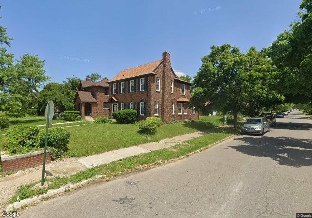
13204 Broadstreet Ave Detroit, MI 48238
Russell Woods NeighborhoodEstimated Value: $174,428 - $275,000
3
Beds
3
Baths
1,792
Sq Ft
$121/Sq Ft
Est. Value
About This Home
This home is located at 13204 Broadstreet Ave, Detroit, MI 48238 and is currently estimated at $216,607, approximately $120 per square foot. 13204 Broadstreet Ave is a home located in Wayne County with nearby schools including Durfee Elementary-Middle School, Charles L. Spain Elementary-Middle School, and Edward 'Duke' Ellington Conservatory of Music and Art.
Ownership History
Date
Name
Owned For
Owner Type
Purchase Details
Closed on
Jul 27, 2015
Sold by
The Detroit Land Bank Authority
Bought by
King Anthony
Current Estimated Value
Purchase Details
Closed on
Oct 17, 2011
Sold by
Fannie Mae
Bought by
Floyd Saku and Floyd Gregory
Purchase Details
Closed on
May 26, 2011
Sold by
Wells Fargo Bank N A
Bought by
Federal National Mortgage Association
Purchase Details
Closed on
Mar 9, 2011
Sold by
Lewis Aaron and Lewis Wilma
Bought by
Wells Fargo Bank Na
Create a Home Valuation Report for This Property
The Home Valuation Report is an in-depth analysis detailing your home's value as well as a comparison with similar homes in the area
Home Values in the Area
Average Home Value in this Area
Purchase History
| Date | Buyer | Sale Price | Title Company |
|---|---|---|---|
| King Anthony | $10,100 | None Available | |
| Floyd Saku | $10,001 | Attorneys Title Agency Llc | |
| Federal National Mortgage Association | -- | None Available | |
| Wells Fargo Bank Na | $65,642 | None Available |
Source: Public Records
Tax History Compared to Growth
Tax History
| Year | Tax Paid | Tax Assessment Tax Assessment Total Assessment is a certain percentage of the fair market value that is determined by local assessors to be the total taxable value of land and additions on the property. | Land | Improvement |
|---|---|---|---|---|
| 2025 | $2,523 | $66,200 | $0 | $0 |
| 2024 | $2,523 | $50,600 | $0 | $0 |
| 2023 | $2,453 | $41,300 | $0 | $0 |
| 2022 | $2,633 | $36,000 | $0 | $0 |
| 2021 | $2,554 | $26,500 | $0 | $0 |
| 2020 | $1,944 | $24,600 | $0 | $0 |
| 2019 | $1,913 | $18,900 | $0 | $0 |
| 2018 | $1,772 | $19,900 | $0 | $0 |
| 2017 | $372 | $19,600 | $0 | $0 |
| 2016 | $2,019 | $39,100 | $0 | $0 |
| 2015 | $2,100 | $21,000 | $0 | $0 |
| 2013 | $2,918 | $29,177 | $0 | $0 |
| 2010 | -- | $41,806 | $1,571 | $40,235 |
Source: Public Records
Map
Nearby Homes
- 4370 Tyler St
- 4266 Waverly St
- 13202 Stoepel St
- 13566 Stoepel St
- 4234 W Davison
- 4224 W Davison
- 13145 Livernois Ave
- 13559 Stoepel St
- 12805 Broadstreet Ave
- 13620 Santa Rosa Dr
- 13523 Santa Rosa Dr
- 4053 Tyler St
- 13194 Monica St
- 4060 W Buena Vista St
- 4052 W Buena Vista St
- 13592 Monica St
- 2685 Oakman Blvd
- 4053 W Grand St
- 12722 Stoepel St
- 4025 Clements St
- 13212 Broadstreet Ave
- 13220 Broadstreet Ave
- 13144 Broadstreet Ave
- 13232 Broadstreet Ave
- 4364 Tyler St
- 13134 Broadstreet Ave
- 4373 Tyler St
- 4360 Tyler St
- 13240 Broadstreet Ave
- 4365 Tyler St
- 4373 Waverly St
- 13120 Broadstreet Ave
- 4350 Tyler St
- 4365 Waverly St
- 4357 Tyler St
- 13213 Broadstreet Ave
- 13205 Broadstreet Ave
- 4357 Waverly St
- 4351 Tyler St
- 13114 Broadstreet Ave