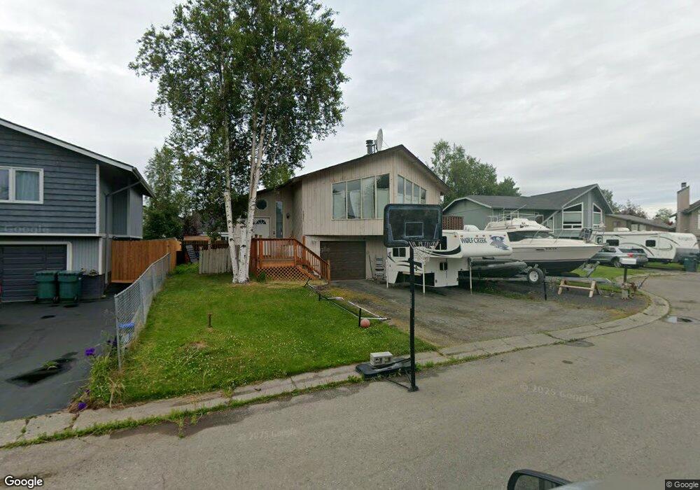
1321 Heidi Cir Anchorage, AK 99518
Taku-Campbell NeighborhoodEstimated Value: $245,000 - $405,000
3
Beds
2
Baths
1,660
Sq Ft
$212/Sq Ft
Est. Value
About This Home
This home is located at 1321 Heidi Cir, Anchorage, AK 99518 and is currently estimated at $351,634, approximately $211 per square foot. 1321 Heidi Cir is a home located in Anchorage Municipality with nearby schools including Campbell Elementary School, Romig Middle School, and West High School.
Ownership History
Date
Name
Owned For
Owner Type
Purchase Details
Closed on
Nov 22, 2013
Sold by
Peters Joseph I
Bought by
Peters Scott T
Current Estimated Value
Home Financials for this Owner
Home Financials are based on the most recent Mortgage that was taken out on this home.
Original Mortgage
$226,359
Outstanding Balance
$165,010
Interest Rate
3.75%
Mortgage Type
FHA
Estimated Equity
$186,624
Purchase Details
Closed on
Apr 10, 2008
Sold by
Lasalle Bank Na
Bought by
Peters Joseph I and Peters Scott T
Home Financials for this Owner
Home Financials are based on the most recent Mortgage that was taken out on this home.
Original Mortgage
$245,063
Interest Rate
5.88%
Mortgage Type
FHA
Purchase Details
Closed on
Jan 31, 2008
Sold by
Fronteras Nemia
Bought by
Lasalle Bank Na and Certificateholders Of Bear Stearns Asset
Purchase Details
Closed on
Jul 22, 2005
Sold by
Olivero Richard A
Bought by
Fronteras Nemia
Home Financials for this Owner
Home Financials are based on the most recent Mortgage that was taken out on this home.
Original Mortgage
$205,520
Interest Rate
7.3%
Mortgage Type
Purchase Money Mortgage
Purchase Details
Closed on
Oct 6, 2003
Sold by
Yoon Il No and Yoon Keum Duk
Bought by
Olivero Richard A
Home Financials for this Owner
Home Financials are based on the most recent Mortgage that was taken out on this home.
Original Mortgage
$163,200
Interest Rate
3.75%
Mortgage Type
Purchase Money Mortgage
Purchase Details
Closed on
Dec 27, 1996
Sold by
Bossingham Lawrence Wayne and Pilgrim Linda Diane
Bought by
Yoon Il No and Yoon Keum Duk
Home Financials for this Owner
Home Financials are based on the most recent Mortgage that was taken out on this home.
Original Mortgage
$139,828
Interest Rate
7.59%
Mortgage Type
FHA
Purchase Details
Closed on
Oct 24, 1989
Sold by
Kemp Jack and Secretary/Housing & Urban Dev
Bought by
Bossingham Lawrence Wayne and Pilgrim Linda Diane
Home Financials for this Owner
Home Financials are based on the most recent Mortgage that was taken out on this home.
Original Mortgage
$128,379
Interest Rate
10.15%
Mortgage Type
FHA
Create a Home Valuation Report for This Property
The Home Valuation Report is an in-depth analysis detailing your home's value as well as a comparison with similar homes in the area
Home Values in the Area
Average Home Value in this Area
Purchase History
| Date | Buyer | Sale Price | Title Company |
|---|---|---|---|
| Peters Scott T | -- | Auta | |
| Peters Joseph I | -- | None Available | |
| Lasalle Bank Na | $197,467 | None Available | |
| Fronteras Nemia | -- | -- | |
| Olivero Richard A | -- | Alyeska Title Guaranty Agenc | |
| Yoon Il No | -- | -- | |
| Bossingham Lawrence Wayne | -- | -- | |
| Bossingham Lawrence Wayne | -- | -- |
Source: Public Records
Mortgage History
| Date | Status | Borrower | Loan Amount |
|---|---|---|---|
| Open | Peters Scott T | $226,359 | |
| Closed | Peters Joseph I | $245,063 | |
| Previous Owner | Fronteras Nemia | $205,520 | |
| Previous Owner | Olivero Richard A | $163,200 | |
| Previous Owner | Yoon Il No | $139,828 | |
| Previous Owner | Bossingham Lawrence Wayne | $128,379 |
Source: Public Records
Tax History Compared to Growth
Tax History
| Year | Tax Paid | Tax Assessment Tax Assessment Total Assessment is a certain percentage of the fair market value that is determined by local assessors to be the total taxable value of land and additions on the property. | Land | Improvement |
|---|---|---|---|---|
| 2025 | $4,364 | $366,600 | $88,500 | $278,100 |
| 2024 | $4,364 | $345,300 | $88,500 | $256,800 |
| 2023 | $5,404 | $317,300 | $88,500 | $228,800 |
| 2022 | $4,533 | $319,200 | $88,500 | $230,700 |
| 2021 | $5,119 | $284,100 | $88,500 | $195,600 |
| 2020 | $3,975 | $284,100 | $88,500 | $195,600 |
| 2019 | $3,823 | $283,700 | $88,500 | $195,200 |
| 2018 | $3,708 | $276,100 | $88,500 | $187,600 |
| 2017 | $4,101 | $281,900 | $88,500 | $193,400 |
| 2016 | $3,802 | $284,700 | $85,500 | $199,200 |
| 2015 | $3,802 | $268,700 | $76,900 | $191,800 |
| 2014 | $3,802 | $262,900 | $76,900 | $186,000 |
Source: Public Records
Map
Nearby Homes
- 1310 Heidi Cir
- 981 Oakridge Dr
- 7520 Papa Cir
- 1121 W 77th Ave
- 1025 W 77th Ave
- 7740 Lars Cir
- 638 W 74th Ave
- 639 W 75th Ave
- 6243 Eula St
- 1028 W 80th Ave
- 400 W 76th Ave Unit 111
- 7330 Huntsmen Cir Unit 13F
- 8020 Fairwood Cir
- 2131 Sundew Cir
- 7510 Foxridge Way Unit 2A
- 7232 Foxridge Cir Unit 9A
- 7222 Foxridge Cir Unit 14B
- 7242 Foxridge Cir Unit 10D
- 7311 Huntsmen Cir Unit 22F
- 1957 Terrebonne Loop